Hudi Kot
| Hudi Kot | |
|---|---|
 | |
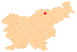
 Hudi Kot Location in Slovenia | |
| Coordinates: 46°31′28.1″N 15°14′9.84″E / 46.524472°N 15.2360667°ECoordinates: 46°31′28.1″N 15°14′9.84″E / 46.524472°N 15.2360667°E | |
| Country |
|
| Traditional region | Styria |
| Statistical region | Carinthia |
| Municipality | Ribnica na Pohorju |
| Area | |
| • Total | 35.46 km2 (13.69 sq mi) |
| Elevation | 726.9 m (2,384.8 ft) |
| Population (2002) | |
| • Total | 268 |
| [1] | |
Hudi Kot (pronounced [ˈxuːdi ˈkoːt]) is a dispersed settlement in the Pohorje Hills in the Municipality of Ribnica na Pohorju in northeastern Slovenia. The area was part of the traditional region of Styria. It is now included in the Carinthia Statistical Region.[2]
The local church is dedicated to Saint Wolfgang (Slovene: sveti Bolfenk) and belongs to the parish of Ribnica na Pohorju. It dates to the early 16th century.[3]
References
External links
 Media related to Hudi Kot at Wikimedia Commons
- Hudi Kot on Geopedia (map, aerial view)
- Hudi Kot on Google Maps (map, photographs, street view)
| Settlements | Administrative centre: Ribnica na Pohorju
|  |
|---|---|---|
| Landmarks |
| |
This article is issued from Wikipedia - version of the 7/12/2016. The text is available under the Creative Commons Attribution/Share Alike but additional terms may apply for the media files.