Hunsecker's Mill Covered Bridge
| Hunsecker's Mill Covered Bridge | |
|---|---|
 | |
| Coordinates | 40°05′14″N 76°14′51″W / 40.0872°N 76.2475°WCoordinates: 40°05′14″N 76°14′51″W / 40.0872°N 76.2475°W |
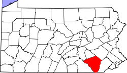
| Locale | Lancaster County, Pennsylvania, United States |
| Characteristics | |
| Design | single span, double Burr arch truss |
| Total length | 180 feet (54.9 m) |
| History | |
| Constructed by | John Russell |
| Construction begin | 1843 |
 | |
 | |
The Hunsecker's Mill Covered Bridge is a covered bridge located in Lancaster County, Pennsylvania, United States.[1] The bridge has a single span, wooden, double Burr arch trusses design. The bridge, which spans the Conestoga River, is 180 feet (55 m) long, making it the longest single span covered bridge in the county.[2]
The bridge's WGCB Number is 38-36-06.[3] Unlike most historic covered bridges in the county, it is not listed on the National Register of Historic Places. It is located at 40°5′13.8″N 76°14′51″W / 40.087167°N 76.24750°W (40.08717, -76.24750). The bridge is approximately one mile southeast of Pennsylvania Route 272 and is 0.5 miles (0.80 km) north of Pennsylvania Route 23 off Mondale Road on Hunsecker Road, just west of the community of Hunsecker.[4] The bridge divides the road on which it is upon into Hunsecker Road (East) in Upper Leacock Township and Hunsicker Road (West) in Manheim Township.
History
The original bridge was built in 1843[3] by John Russell at a cost of $1,988. It was and is a double Burr Arch truss system. It has been swept away in flooding numerous times, most recently in 1972 after Hurricane Agnes.[5] Waters lifted the original structure off its abutments and carried it downstream. In 1973, following destruction from the hurricane, it was rebuilt at a cost of $321,302.[2]Note:[6] Its length of 180 feet makes it the longest single-span covered bridge of Lancaster County's 29 covered bridges. While Schenck's covered bridge (Big Chiques #4) is one of 3 bridges with horizontal siding boards, the Hunsecker's Mill bridge may be the only one in Lancaster County with horizontal floor boards which give a unique vibration upon crossing, it is a little bumpy for cyclists at speed, proceed with some caution. A detailed scale model (~7' long), complete with stone abutments, was donated to the Lancaster Mennonite Historical Society and may be available for viewing.
Dimensions
- Length: 180 feet (55 m) total length[2][3][5]
- Width: 15 feet (4.6 m) total width[3][5]
- Overhead clearance: 13 feet 10 inches (4.22 m)[3]
Gallery
 A three-quarters view of the bridge
 Another view from a different angle
 A side view
 The approach to the bridge from the east
 The inside of the bridge showing the Burr arch truss
 A closer look of the Burr arch bridge
 A closeup of spot where the floor meets the wall
 The center of the bridge highlighting the Burr arch truss
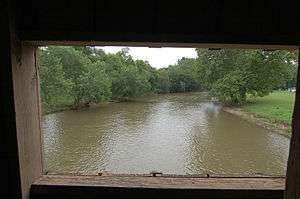 A view out of the bridge's window
See also
References
- ↑ "Hunsecker's Mill Covered Bridge". Lancaster County, PA Government Portal. County of Lancaster, Pennsylvania. 2001-10-30. Retrieved 2006-07-07.
- 1 2 3 "Hunsecker's Mill Covered Bridge". Lancaster County Pennsylvania Dutch Country Official Visitors Center. Pennsylvania Dutch Convention & Visitors Bureau. 2006. Retrieved 2006-07-07.
- 1 2 3 4 5 Bickel, Hank (2005-06-23). "Hunsecker's Mill Bridge". Covered Bridges of the Northeast USA. Retrieved 2006-08-04.
- ↑ Travis, Dale. "38-36-06". Round Barns & Covered Bridges. Retrieved 2006-08-08.
- 1 2 3 Dr. Roger A. McCain. "Hunsecker's Mill Bridge". A Guide to Old Covered Bridges of Southeastern Pennsylvania and nearby areas. Retrieved 2006-08-03.
- ↑ Bickel lists 1948 as another reconstruction date, but fails to mention the significant and more recent 1972 flooding and subsequent reconstruction.
| Bridges of the Conestoga River | ||||
|---|---|---|---|---|
| ||||