Hwanggang Dam
| Hwanggang Dam | |
|---|---|
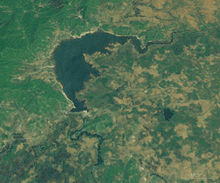 Landsat view of the dam. Center of the image, at the bottom end of the lake. | |
| Coordinates | 38°23′42″N 127°10′59″E / 38.395°N 127.183°ECoordinates: 38°23′42″N 127°10′59″E / 38.395°N 127.183°E |
| Construction began | 2002[1] |
| Opening date | 2007[2] |
| Dam and spillways | |
| Impounds | Imjin River |
Hwanggang Dam is a dam on the Imjin River in North Korea. Located approximately 26 miles (42 km) north of the Korean Demilitarized Zone, the dam has an estimated capacity of 400,000,000 short tons (360,000,000 t).[2] Construction began in 2002 and was completed in 2007.[1] The stated aims of the project are to generate hydropower and provide water for crop irrigation.[2][3]
In September 2009, without warning, North Korea released a massive amount of water from the dam, causing large floods in South Korea that killed six persons.[2] An estimated 40,000,000 short tons (36,000,000 t) of water was dumped during the flood, causing the water level at the border of Gyeonggi-do to leap from 7.5 feet (2.3 m) to 15.1 feet (4.6 m).[2][3]
To protect itself against the perceived threat, South Korea built two dams in the area in the early 2010s.[3]
References
- 1 2 Hyung-Jin Kim (2008-04-22). "NK Dam Could Threaten S. Korean Regions". The Korea Times. Retrieved 2009-09-08.
- 1 2 3 4 5 Choe Sang-hun (2009-09-07). "South Korea Rejects North's Explanation of Dam Release". The New York Times. Retrieved 2009-09-08.
- 1 2 3 Hyung-Jin Kim (2009-09-07). "SKorea demands NKorea explanation for deadly flood". Associated Press. Retrieved 2009-09-08.