Ichic Jeulla
| Ichic Jeulla | |
|---|---|
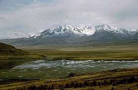 Caullaraju and Ichic Jeulla as seen from Lake Conococha | |
| Highest point | |
| Elevation | 5,091 m (16,703 ft) |
| Coordinates | 9°58′50″S 77°14′31″W / 9.98056°S 77.24194°WCoordinates: 9°58′50″S 77°14′31″W / 9.98056°S 77.24194°W |
| Geography | |
 Ichic Jeulla Peru | |
| Location | Peru, Ancash Region |
| Parent range | Andes, Cordillera Blanca |
Ichic Jeulla[1][2] (possibly from Ancash Quechua ichik small, little, few, qiwlla, qillwa, qiwiña gull)[3][4] is a 5,091-metre-high (16,703 ft)[1] mountain in the southern part of the Cordillera Blanca in the Andes of Peru. It is located in the Ancash Region, Recuay Province, Catac District.[2] Ichic Jeulla lies southeast of Caullaraju.[1][2]
See also
References
- 1 2 3 Peru 1:100 000, Recuay (20-i). IGN (Instituto Geográfico Nacional - Perú).
- 1 2 3 escale.minedu.gob.pe - UGEL map of the Recuay Province (Ancash Region)
- ↑ Vocabulario comparativo quechua ecuatoriano - quechua ancashino -- castellano - English (pdf)
- ↑ Teofilo Laime Ajacopa, Diccionario Bilingüe Iskay simipi yuyayk'ancha, La Paz, 2007 (Quechua-Spanish dictionary)
This article is issued from Wikipedia - version of the 8/20/2016. The text is available under the Creative Commons Attribution/Share Alike but additional terms may apply for the media files.