Idaho State Highway 38
| ||||
|---|---|---|---|---|
| Route information | ||||
| Maintained by ITD | ||||
| Length: | 23.438 mi[1] (37.720 km) | |||
| Major junctions | ||||
| West end: | North Holbrook Road / Stone Road in Holbrook | |||
| East end: |
| |||
| Location | ||||
| Counties: | Oneida | |||
| Highway system | ||||
| ||||

Idaho State Highway 38 is a 23.438-mile (37.72 km) east-west state highway located entirely within Oneida County in the southeast part of the U.S. state of Idaho. SH-38 runs from Holbrook east to Interstate 15 in Malad City. The highway is maintained by the Idaho Transportation Department.
Route description
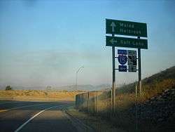
SH-38 begins at an intersection with North Holbrook Road and Stone Road in Holbrook. The highway continues as an unsigned road northwest of the terminus, connecting to Idaho State Highway 37 in Power County; this section of road is closed in the winter.[2] From its terminus, SH-38 heads east through a rural area within the Curlew National Grassland. It takes a more crooked route east outside of Holbrook, intersecting Arbon Valley Road. From here, the highway enters mountainous terrain, passing Holbrook Summit at an elevation of 6,104 feet (1,860 m). After passing through the mountains, SH-38 enters a rural area and passes through the community of Pleasantview. The highway turns northeast toward Malad City, passing the Malad City Airport. After entering Malad City, the route turns eastward, passing through a mixed residential and business district. SH-38 leaves the Malad City limits before terminating at Exit 13 of Interstate 15.[1][3]
History
The route which is now SH-38 was marked as part of SH-33 by 1927.[4] Between 1927 and 1937, SH-33 was changed to SH-37, and SH-38 was first designated on a route between Roy and Portneuf.[5] By 1956, the southern terminus of SH-38 had changed to SH-37 east of Holbrook; the route continued north to Arbon via Buist, where it resumed its original route.[6]
Major intersections
The entire route is in Oneida County.
| Location | mi[1] | km | Destinations | Notes | |
|---|---|---|---|---|---|
| Holbrook | 0.000 | 0.000 | North Holbrook Road / Stone Road | Western terminus of SH-38 | |
| Malad City | 23.438 | 37.720 | |||
| 1.000 mi = 1.609 km; 1.000 km = 0.621 mi | |||||
References
- 1 2 3 "State Highway 38 Milepoint Log" (PDF). Idaho Transportation Department. Retrieved 21 May 2011.
- ↑ Idaho Official State Highway Map (Map). Idaho Transportation Department. 2009.
- ↑ "Overview map of State Highway 38". Google Maps. Google, Inc. Retrieved 21 May 2011.
- ↑ Rand McNally Junior Auto Road Map: Idaho (Map). Rand Mcnally Company. 1927. Retrieved 2011-05-21.
- ↑ Texaco Road Map: Idaho, Montana, Wyoming (Map). Rand McNally Company and Texas Company. 1937. Retrieved 2011-05-21.
- ↑ Shell Map of Idaho and Wyoming (Map). Shell Oil Company. 1956. Retrieved 2011-05-21.