Indian Battle Park
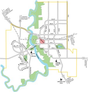
Location of Indian Battle Park in Lethbridge
Indian Battle Park is a park located in the Oldman River valley urban park system of Lethbridge, Alberta. The 150-acre (0.61 km2) park was developed in 1960 and commemorates the Battle of the Belly River held in the area on 24 October 1870 between the Blackfoot and the Cree. A formal peace treaty between the two nations was reached in 1871.
In 2005, a city council bid to rename the park Valley Of Peace (to remove negative references to First Nations) was rejected.
The park is home to Fort Whoop-Up, Helen Schuler Coulee Centre and the High Level Bridge.
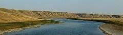
Oldman River close to the mouth, seen from Veteran Memorial Highway, Alberta, Canada
External links
Coordinates: 49°41′38″N 112°51′40″W / 49.69391°N 112.86105°W
This article is issued from Wikipedia - version of the 9/8/2016. The text is available under the Creative Commons Attribution/Share Alike but additional terms may apply for the media files.