Indian Cave State Park
| Indian Cave State Park | |
| Nebraska State Park | |
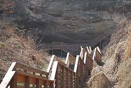 The stairs leading up to the Indian Cave rock shelter | |
| Country | United States |
|---|---|
| State | Nebraska |
| Counties | Nemaha, Richardson |
| Location | Shubert |
| - elevation | 1,102 ft (336 m) [1] |
| - coordinates | 40°15′10″N 95°33′16″W / 40.25278°N 95.55444°WCoordinates: 40°15′10″N 95°33′16″W / 40.25278°N 95.55444°W |
| Area | 3,052 acres (1,235 ha) |
| Founded | 1962 [2] |
| Management | Nebraska Game and Parks Commission |
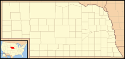 Location of Indian Cave State Park in Nebraska | |
Indian Cave State Park is a state park of Nebraska, USA, preserving a cave with prehistoric petroglyphs and the partially reconstructed village of St. Deroin established in 1853. The 3,052-acre (1,235 ha) park is along the Missouri River on the county line between Nemaha and Richardson counties.[3] It is 10 miles (16 km) south of Brownville, Nebraska.[4]
Some of the carvings within Indian Cave are believed to be several thousand years old, but their exact period and cultural affiliations are undetermined.[2] The park offers horseback riding, hiking trails, camping and picnic facilities, fishing areas and winter skiing.[3][4] The park contains part of the former Nemaha Half-Breed Reservation.
References
- ↑ "Indian Cave State Park". Geographic Names Information System. United States Geological Survey. 2000-10-10. Retrieved 2011-04-29.
- 1 2 "Indian Cave State Park" (PDF). Nebraska Game and Parks Commission. May 2008. Retrieved 2011-04-30.
- 1 2 "Indian Cave State Park".
- 1 2 "Indian Cave State Park". Nebraska Game and Parks Commission.
External links
| Historic and present tribes | |
|---|---|
| Present languages | |
| Present reservations | |
| Present tribal colleges and universities | |
| Historic figures | |
| Historic events | |
| Historic reservations | |
| Historic communities |
|
| Historic sacred places | |
| Other historic places |
|
| Prehistoric peoples | |
| Prehistoric communities |
|
| Other prehistoric places |
|
| Other topics | |
This article is issued from Wikipedia - version of the 11/15/2016. The text is available under the Creative Commons Attribution/Share Alike but additional terms may apply for the media files.