Ini, Nigeria
| Ini | |
|---|---|
| LGA | |
 Ini Location in Nigeria | |
| Coordinates: 5°24′0″N 7°44′0″E / 5.40000°N 7.73333°E | |
| Country |
|
| State | Akwa Ibom State |
| Capital | Uyo |
| Time zone | WAT (UTC+1) |
Ini is located in the south south of Nigeria and is a Local Government Area of Akwa Ibom State.
Location: Ini Local Government Area was carved out of the former Ikono Local Government Area and is bounded by Ikono, Obot Akara Local Government Areas of the State, and Abia State. It has a landmass of 320,451 square kilometres.
Representative: Hon.
State capital: Uyo | ||
| LGAs | 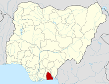 | |
People The people of Ini Local Government Area are of the Ibibio stock, and Ibibio, Itu, Nkari languages are spoken.
Population
Males 52,644 and Females=46, 552 and TOTAL: 99,196
- Source: 2006 National Census
PROFILE:
Natural Resorces Limestones, clay, gravel, fine sand, crude oil and iron ore. The forest region provides timber and firewood.
Commerce
Because of the land expanse of the area, the people are predominantly farmers, producing such food items as rice, palm produce, cassava, cocoa, plantain, banana, etc.
As the nickname indicates - food basket of Akwa Ibom State - there are good potential for agricultural expansion. Activities by hunters are appreciably noticed. Ini Local Government are made up of mostly Itu and Nkari community. The Nkari community consist of 10 Villages. TRADITIONAL RULERS
- Paramount Ruler: His Royal Majesty, Edidem Apostle Nteong Udo Effiong Akpan (Who is also the Clan Head of Itu Mbon Uso
- Obong Obio of Mbente Village and Clan Head of Nkari: Chief Udoette Elong
- Obong Obio of Obbrong or Ete Idung(Village Head): Chief Willness Akpan Ise
- Obong Obio of Ikot Uko Chief: Marcus Akpan Nja
- Obong Obio of Ibono Usuk: Chief Obuaya
- Cultural Society or groups: Obon, Mkpon imo,etc And for female exclusive:Ipo
Youth groups:Nkan Imbarawa, Obbrong groups,etc