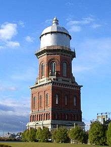
Invercargill
| Invercargill Waihōpai (Māori) | |
|---|---|
|
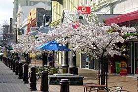
Spring in Esk Street, Invercargill | |
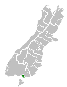 Invercargill City's location within the South Island | |
| Country |
|
| Island | South Island |
| Region | Southland |
| Territorial authority | Invercargill City |
| Settled by Europeans | 1853 |
| Government | |
| • Mayor | Tim Shadbolt |
| • Deputy Mayor | Darren Ludlow |
| Area | |
| • Territorial | 389 km2 (150 sq mi) |
| • Urban | 115 km2 (44 sq mi) |
| Population (June 2016)[1] | |
| • Territorial | 54,700 |
| • Density | 140/km2 (360/sq mi) |
| • Urban | 50,700 |
| • Urban density | 440/km2 (1,100/sq mi) |
| Demonym(s) | Invercargillite |
| Time zone | NZST (UTC+12) |
| • Summer (DST) | NZDT (UTC+13) |
| Postcode(s) | 9810, 9812 |
| Area code(s) | 03 |
| Website |
icc |
Invercargill (Māori: Waihōpai)[2] is the southernmost and westernmost city in New Zealand, and one of the southernmost cities in the world. It is the commercial centre of the Southland region. It lies in the heart of the wide expanse of the Southland Plains on the Oreti or New River some 18 km north of Bluff, which is the southernmost town in the South Island. It sits amid rich farmland that is bordered by large areas of conservation land and marine reserves, including Fiordland National Park covering the south-west corner of the South Island and the Catlins coastal region.
Many streets in the city, especially in the centre and main shopping district, are named after rivers in Great Britain, mainly Scotland. These include the main streets Dee and Tay, as well as those named after the Forth, Tyne, Esk, Don, Thames, Mersey, Ness, Yarrow, Spey and Eye rivers.
The 2013 Census showed the population was 51,696, up 2.7% on the 2006 census number.[3]
History
Southland was a scene of early extended contact between Europeans and Maori, notably whalers and missionaries – Wohlers at Ruapuke.[4] In 1853, Walter Mantell purchased Murihiku from local Maori iwi, claiming the land for European settlement.[5] Otago, of which Southland was itself part, was the subject of planned settlement by the Free Church, an offshoot of the Presbyterian Church of Scotland.[6] Settlement broadened with the discovery of gold in Central Otago in the 1860s. Today, traces of Scottish speech persist in Southland voices, with R often pronounced with a rolling burr. This is more noticeable among country people.
In 1856, a petition was put forward to Thomas Gore Browne, the Governor of New Zealand, for a port at Bluff. Due to the Otago gold rush, the region's population grew during the 1860s with the settlement of Bluff.[7] Browne agreed to the petition and gave the name Invercargill to the settlement north of the port. Inver comes from the Scottish Gaelic word inbhir meaning a river's mouth and Cargill is in honour of Captain William Cargill, who was at the time the Superintendent of Otago, of which Southland was then a part.[8] The settlement's chief surveyor was John Turnbull Thomson, a British civil engineer.[9]
Under the influence of James Menzies, Southland Province (a small part of the present Region, centred on Invercargill) seceded from Otago in 1861 following the escalation of political tensions. However, rising debt forced Southland to rejoin Otago in 1870 and the provincial system, and with it the province of Otago, was abolished entirely in 1876.[10] This debt was caused by a population decline stemming from poor returns from pastoral farming. In 1874, Invercargill's population was less than 2,500 which reflected the drift north to large centres.[10] In the 1880s, the development of an export industry based on butter and cheese encouraged the growth of dairy farming in Southland.[11] In December 1905, Invercargill voted in local prohibition of alcohol sales. This lasted for 40 years until voted out by returning servicemen in the Second World War. Drinking continued meanwhile, thanks to hotels and liquor merchants in outlying districts, huge volumes of beer, often in kegs, brought to private homes, or sold by the glass by keggers at hiding spots round the City. When prohibition ended, a committee of citizens persuaded the Government to give the monopoly on liquor sales in Invercargill to the specially formed Invercargill Licensing Trust. Based on a scheme in Carlisle, England, it returns profits to city amenities. Even today, alcohol is not sold in supermarkets.
In recent years, publicity has been brought to the southern city by the election of Tim Shadbolt, a colourful and outspoken former student activist and former mayor of Waitemata City, as mayor. He once appeared on a cheese advertisement stating "I don't mind where, as long as I'm Mayor". His supporters like the colour he brings to the city. His opponents refer to his controversial mayoral career in the Auckland suburbs and to his attitude to veterans during his opposition to the Vietnam War. Publicity and students have also come to the city by the Southern Institute of Technology's "Zero Fees" scheme, which allows New Zealand citizens and permanent residents to study while only paying for material costs of their study, and not tuition fees.
Geography
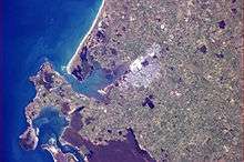
Invercargill is the southernmost city in the Commonwealth of Nations. Invercargill is situated on the fertile and alluvial Southland Plains, which is amongst some of New Zealand's most fertile farmland. Southern Invercargill lies on the shore of the New River Estuary, while the northern parts lie on the banks of the Waihopai River. 10 kilometres west of the city centre lies Oreti Beach, a long expanse of sand stretching from the Sandy Point area to nearby Riverton.
 |
Te Anau and Fiordland National Park | Winton and Queenstown | Gore and Dunedin | |
| Riverton and Fiordland National Park | |
The Catlins | ||
| ||||
| | ||||
| Bluff |
Climate
Invercargill has a temperate oceanic climate with summer temperatures similar to those of the northern British Isles and winter temperatures comparable to those of the southern Atlantic coast of France. The mean daily temperature ranges from 5.2 °C (41.4 °F) in July to 14 °C (57 °F) in January. The yearly mean temperature is 9.8 °C (49.6 °F). Rainfall averages 1,112 millimetres (43.8 in) annually, and measurable snowfall is occasionally seen during the winter months of June to September. It is the cloudiest city in New Zealand with only 1,580 hours of sunshine per annum. Despite its cloudiness, and a relatively high frequency of rainy days, Invercargill receives less rain than either Auckland or Wellington. Invercargill is also New Zealand's second windiest city, after Wellington.
The average temperature high ranges from 18.7 °C (65.7 °F) in January to 9.5 °C (49.1 °F) in July, but temperatures do occasionally exceed 25 °C (77 °F) in summer with a recorded extreme of 32.2 °C (90.0 °F).[12] Owing to its relatively high latitude (46° 42′), the city enjoys nearly 16 hours of daylight at the summer solstice in late December. Conversely, the city receives only around 8 hours of daylight at the winter solstice in late June.
Invercargill is the "City of Water and Light". The "light" refers to the long summer twilights and the aurora australis (southern lights). The "water" reference, humorists suggest, comes from notorious horizontal, driving rain in high wind at the corner of the two main streets, Dee and Tay. A recent sign also states "Invercargill, where dreams can come true" with an image from the 2005 film The World's Fastest Indian.
In September 2010, Invercargill's heaviest snowfall in living memory heralded a run of unseasonably cold weather. A few buildings were damaged, notably Stadium Southland, the roof of which collapsed under the weight of the snow; and a decorating store. Many other stores were shut, and Invercargill Airport was closed for a day.[13]
| Climate data for Invercargill (1981–2010) | |||||||||||||
|---|---|---|---|---|---|---|---|---|---|---|---|---|---|
| Month | Jan | Feb | Mar | Apr | May | Jun | Jul | Aug | Sep | Oct | Nov | Dec | Year |
| Average high °C (°F) | 18.7 (65.7) |
18.6 (65.5) |
17.1 (62.8) |
14.9 (58.8) |
12.3 (54.1) |
10.0 (50) |
9.5 (49.1) |
11.1 (52) |
13.1 (55.6) |
14.4 (57.9) |
15.8 (60.4) |
17.5 (63.5) |
14.4 (57.9) |
| Daily mean °C (°F) | 14.2 (57.6) |
13.9 (57) |
12.5 (54.5) |
10.4 (50.7) |
8.0 (46.4) |
5.9 (42.6) |
5.3 (41.5) |
6.6 (43.9) |
8.5 (47.3) |
9.9 (49.8) |
11.4 (52.5) |
13.0 (55.4) |
10.0 (50) |
| Average low °C (°F) | 9.6 (49.3) |
9.3 (48.7) |
7.9 (46.2) |
5.8 (42.4) |
3.8 (38.8) |
1.9 (35.4) |
1.0 (33.8) |
2.2 (36) |
4.0 (39.2) |
5.4 (41.7) |
7.0 (44.6) |
8.6 (47.5) |
5.5 (41.9) |
| Average precipitation mm (inches) | 115.0 (4.528) |
87.1 (3.429) |
97.4 (3.835) |
95.9 (3.776) |
114.4 (4.504) |
104.0 (4.094) |
85.2 (3.354) |
75.6 (2.976) |
84.2 (3.315) |
95.0 (3.74) |
90.4 (3.559) |
105.0 (4.134) |
1,149.3 (45.248) |
| Average precipitation days (≥ 1.0 mm) | 13.0 | 10.3 | 12.3 | 12.3 | 15.3 | 15.6 | 14.2 | 12.8 | 13.1 | 13.8 | 13.3 | 14.3 | 160.4 |
| Average relative humidity (%) | 80.6 | 83.3 | 84.2 | 85.3 | 87.0 | 87.7 | 88.1 | 85.8 | 81.3 | 80.0 | 78.2 | 78.6 | 83.3 |
| Mean monthly sunshine hours | 185.9 | 167.2 | 142.6 | 117.2 | 87.5 | 78.7 | 97.9 | 123.0 | 139.8 | 173.0 | 181.3 | 188.2 | 1,682.2 |
| Source: NIWA Climate Data[14] | |||||||||||||

Government
Local
The Invercargill City Council governs the territorial authority of Invercargill. It is made up of an elected mayor and 12 additional councillors.[15] They are elected under the First Past the Post system in triennial elections, with the last election being held in 2013. The current mayor is the incumbent Tim Shadbolt who has held the position for seven consecutive mayoral terms.[16]
As of 2016, the current council members are:
| Mayor | Tim Shadbolt |
| Councillors – Invercargill City Council | Lindsay Abbott Rebecca Amundsen Allan Arnold Karen Arnold Toni Biddle Alex Crackett Lloyd Esler Graham Lewis Darren Ludlow (Deputy Mayor) Ian Pottinger Lesley Soper Lindsay Thomas |
Coat of Arms
The city of Invercargill has a Coat of Arms emblazoned; Or, on three Bars Wavy Gules a Ram's Head Horned Affrontee proper, on a Chief Wavy Azure a Lymphad Argent, Flagged Gules between two Garbs Or. Crest: A Mural Crown Argent. Supporters: On either side a Takahe proper. Motto: Pro Communi Utilitate.
Translation of the blazon. Firstly the shield is described. "Or" means gold so the base colour of the shield is gold. "Three Bars Wavy" are three thick bars in the base of the shield and these are shaped like waves. "Gules" means red so these bars are red. On these bars is placed a Ram’s Head that has horns and is facing to the front ("affrontee".) The word "proper" means that the head is depicted in its natural colours. A "chief" is a broad stripe at the top of the shield but its base is "wavy" the same way as the bars are. "Azure" means blue so the chief is coloured blue. On the chief is sailing ship ("Lymphad") coloured silver or "argent." The ship has flags ("flagged") on its masts and these are red ("gules".) The ship is placed between two "garbs" or wheat-sheaves and these are coloured "Or" which is gold.
The crest is a "Mural Crown" which is a crown made from masonry or bricks and represents city walls or towers. This crown is often found on city coats of arms. The Supporters are the creatures on either side of the shield and in this case are Takahe birds depicted in their natural colours ("proper.") The motto may be given in English as "For the use of the community." The compartment which is what the supporters stand on and to what the motto is attached is not normally part of the blazon but is left to the heraldic artist to decide.
National
The electorate of Invercargill in the Parliament of New Zealand is held by Sarah Dowie, an MP from the incumbent National Party. Under the Maori electorates system, Invercargill is part of the large Te Tai Tonga electorate, which covers the entire South Island and the surrounding islands, and is currently held by the Labour Party MP Rino Tirikatene.
Economy
Invercargill is home to the Southern Institute of Technology,[17] which has introduced a zero-fees scheme.[18] The scheme was partly responsible for rejuvenating the city when it was in a steady state of population decline. However the major factor in Invercargill's regrowth is the dairy industrial boom of the 2000s (decade) due to an increased demand for New Zealand milk, cheese and butter. New dairy factories have opened around the Southland Region, as well as more efficient meat processing works and research and development facilities.[19]
Invercargill is on the Southern Scenic Route (tourist road), allowing day trips to Queenstown, Stewart Island/Rakiura, Dunedin, Te Anau and Fiordland.[20]
As of 2008, there have been plans to develop wind power and hydroelectric schemes and plans to survey the Great South Basin for oil extraction.[20]
Liquor licensing trusts
The Invercargill Licensing Trust is one of several trusts in the city of Invercargill. The Invercargill Licensing Trust and the ILT Foundation are major funders of community projects in Invercargill. The ILT Foundation provides donations and grants totalling around $10 million a year to over 500 organisations. The trust has also been influential in the development of city facilities such as the ILT Stadium Southland and Invercargill Velodrome. The trust are also big-time backers of local sporting franchises the Southern Steel, Southland Sharks and Southland Stags.
The Community Trust of Southland was established after Westpac bought out the Trust Bank Southland in the late 1990s. It was sold for approximately $150 million, with those funds now being set aside for the people of the Southland regions, including Queenstown, Arrowtown and Tapanui. It is widely recognised as one of New Zealand's leading community trusts, with the benefit of a large capital base for a relatively small population. Consequently, the Trust provides significant funding to a wide range of projects and programmes. Each year, it distributes between $7 and $10 million in the region, not including the large sums given to sports franchises and building projects and since its inception has distributed close to $140 million in grants.
Transport
Road
Invercargill is the southernmost city on New Zealand's state highway network and is linked to Fiordland and the Catlins by the Southern Scenic Route and Dunedin and Gore by SH 1. It is also the southern end of SH6 coming from Queenstown and the West Coast. The main streets of Invercargill: Dee (SH 6) and Tay (SH 1) measure over 40 metres wide. Numerous roads in the city are dual-carriageway but there are no expressways/motorways proposed for the city.
Rail links
Invercargill is at the southern end of the Main South Line railway, which extends up the east coast to Christchurch and Lyttelton via Dunedin. It was the first town in New Zealand to have a steam locomotive and had the first railway in the country . Though once the centre of a much larger rail network, over the years, this has diminished. Passenger trains no longer call at Invercargill, except for occasional excursions. Until the cancellation of The Southerner in 2002, Invercargill had the southernmost passenger railway station in the world. The Bluff Branch extends south from Invercargill and has been freight-only since 1967. The Wairio Branch extends northwest from Invercargill to the Solid Energy coalfields near Ohai and continues to carry freight even after the closing of the Ohai coal mine.
Airport
During the mid-1950s, Invercargill Airport was used for fuel top-up and final take off by Operation Deep Freeze. Twin-engine propeller-driven planes destined for McMurdo Sound in the Antarctic used the airport, assisted in takeoff by JATO rockets. Larger aircraft flew from Christchurch when a permanent Deep Freeze base was established there.
Air New Zealand operates eight daily flights to Christchurch and two to Wellington. Stewart Island Flights make regular flights to and from Stewart Island/Rakiura. Mount Cook Airline and Air Nelson, wholly owned subsidiaries of Air New Zealand, also operate out of the airport flying ATR 72's and Bombardier Dash 8's. Mainland Air of Dunedin operate a Piper Navajo which are contracted to fly doctors to Southland Hospital several times per week from Dunedin Hospital.
Southern Wings is the only aeroclub based at the airport and runs charter flights as well as running a flight school.
Invercargill Airport has the fourth longest runway in New Zealand, following Auckland, Christchurch and Ohakea, at 2210 metres.
Sport
The Southern Sting (Netball- Now Southern Steel) won seven National titles from 1999–2004, 2007, while the local rugby team the Southland Stags held the Ranfurly Shield from 22 October 2009 to 9 October 2010 and have made the NPC Semi-finals for the past three years. Southland also has one of the highest percentages of sports participants in the country, with codes such as rugby union, netball, basketball, cricket and hockey being popular. Many professional sportsmen too, have come out of Southland as well. Invercargill also has some high quality sporting facilities, including an indoor velodrome (the only one in New Zealand), an Olympic sized swimming centre, a 20,000 capacity rugby stadium and also international playing arenas for both hockey and cricket. The city's 4500 capacity indoor stadium was severely damaged in 2010, its roof collapsing following a heavy snowfall.[21] Southland also has four professional sporting sides that are based in Invercargill:
- Southland Stags (Rugby)
- Spirit FC (Association Football)
- Southern Steel (Netball)
- Southland Sharks (Basketball)
Invercargill is home to the only indoor cycling velodrome in the South Island. The indoor 250 metres wooden velodrome is home to Track Cycling in Southland. The Invercargill Licensing Trust supports the velodrome which is situated at Stadium Southland, a large indoor sports complex located at Surrey Park. The stadium itself was badly damaged after its roof collapsed in 2010 following a heavy snowfall.[21] The cost of rebuilding the stadium is likely to run into millions of dollars.[22]
Music
The "Invercargill March" is an internationally famous tune was written by Alex Lithgow who attended Invercargill Grammar School (now Middle School). In his book Invercargill – 150 Years, Lloyd Esler's opening sentence reads, "Invercargill was done a fine favour by Alex Lithgow who named his famous march after his boyhood home. The Invercargill March is possibly the best advertisement the town has ever had as the work is a brass-band favourite and the word 'Invercargill' is whispered amongst audiences worldwide. There is only one Invercargill in the world – this one".
When Invercargill hosted the national brass band contest in 1909, Alex's brother Tom asked for a test piece for the contest and Alex offered this piece to the city. On the music he wrote,
"To Invercargill, the Southernmost City in New Zealand (End of the World), and its Citizens, I dedicate this March as a memento of the many pleasant years spent there in my boyhood."— Alex Lithgow
Education
Colleges
- Invercargill is home to the Southern Institute of Technology, a polytechnic whom provides under-graduate and post-graduate qualifications.
- The Southern Wings Aviation College whom operates out of Invercargill airport; provides aviation licence training and also the New Zealand Diploma in Aviation.[23]
High schools
All High Schools in Invercargill are Year 7–13, following a Ministry of Education review in 2004 that made most of Invercargill's primary schools Year 1–6 and closed the Year 7–8 schools Rosedale Intermediate and Collingwood Intermediate and Tweedsmuir Junior High
- James Hargest College is in northern Invercargill with about 1,800 pupils. Current Principal is Andy Wood.[24]
- Aurora College was established in 2005, after Mount Anglem College was closed in 2004. Current Principal is Robyn Hickman.
- Southland Girls' High School In 2005 became the first state Year 7–13 single-sex female school in New Zealand. Current Principal is Yvonne Browning.
- Southland Boys' High School In 2005 became the first state Year 7–13 single-sex male school in New Zealand. Current Principal is Ian Baldwin.
- Verdon College is a co-educational Catholic school with about 620 pupils. Current Principal is Jarlath Kelly.[25]
- Te Wharekura o Arowhenua A Māori school on Tweed street. Teaches years from 1–13. Current Principal is Ani Wainui-Dunn.
Primary schools
Most primary schools are Year 1–6.
- New River Primary School, co-ed school for Years 1–6 in South Invercargill area. Formerly Kew, South, Clarendon and Clifton Schools. Current Principal is Elaine McCambridge.
- St Joseph's, a small co-ed school for Years 1–6, a Catholic school near St Mary's Basilica. Current Principal is Jill Baird.
- St Theresa's, North Invercargill, a co-ed Catholic primary school. Current Principal is John Lieshout.
- St Patrick's, Georgetown, a co-ed Catholic primary school. Current Principal is Callan Goodall.
- Ascot Community School, the only public co-ed school in Hawthorndale area. Current Principal is Wendy Ryan.
- Fernworth Primary – co-ed school in Heidelberg area. Formerly St George and Elston Lea. Current Principal is Anne Walker.
- Windsor North School, co-ed school in Rosedale area. Previously Invercargill North School. Current Principal is Roger Stephenson.
- Waverley Park School, co-ed school in Waverley Park area. Current Principal is Kerry Hawkins.
- Waihopai School, co-ed school in Waihopai area. Current Principal is Allan Mitchell.
- Salford School, co-ed school in Rosedale area. Current Principal is Pam Fleck.
- St John's Girls' School, small school. Invercargill's only private school. Christian character. Current Principal is Brenda Mackay.
- Sacred Heart Primary School, North Road, Waikiwi, co-ed Special Character Catholic family school serving the northern suburbs of Waikiwi, Grasmere and Makarewa. Current Principal is Peter Forde.
- Donovan Primary School, co-ed school Grasmere area. Formerly Grasmere, Waikiwi, West Plains. Current Principal is Peter Hopwood.
- Otatara Primary School, co-ed school in Otatara area. Current Principal is Sharon Livingstone.
- Myross Bush Primary School, co-ed school in Myross Bush area. Current principal is Tim Lovelock.
- Newfield Park School, co-ed school in Newfield
- Southland Adventist Christian School. A small co-ed school in the Waikiwi area. Formerly Seventh Day Adventist School. Christian Character. Current Principal is Ryan Baronian.
- Middle School, co-ed school located in the middle of Invercargill
- Westmount School. A private (Brethren) school located in the Clarendon area.[26]
Notable residents
- Peter Arnett – NBC war correspondent
- Oliver Bulleid – Railway locomotive designer and Chief Mechanical Engineer of the Southern Railway, born in Invercargill in 1882
- John Burke – Mayor of Porirua
- Johnnie Checketts – Silver Star, Wingco and Spitfire Ace
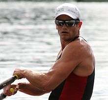
- Nathan Cohen – Olympic and two-time world champion rower
- Bill Crawford-Crompton – Silver Star, Air Vice Marshal and WW2 Commander and Ace
- Geoffrey Cox – Rhodes Scholar, Chief Intelligence Officer to General Freyberg in WWII, founded Britain's pioneering News at Ten on ITN.
- Marton Csokas – actor
- Dan Davin – author, editor
- Corey Flynn – Hooker for All Blacks
- Ernest Godward – inventor of the spiral hairpin and the petrol economiser
- Dene Halatau – Wests Tigers Utility in the NRL
- Joseph Hatch – businessman, oil factor
- Brigadier James Hargest; CBE, DSO & 2 bars, MC, ED, MP – New Zealand chief military officer for Southland and politician
- Rowena Jackson – Royal Ballet prima ballerina
- Jason Kerrison – Opshop singer/songwriter
- Chris Knox – musician, cartoonist, filmmaker
- Alex Lithgow – composer, musician, conductor
- Bill Manhire – inaugural NZ poet laureate
- Khan Manuel – Guitarist/Composer
- Herbert James "Burt" Munro – inventor, motorcycle enthusiast, racer and under-1000 cc land speed record holder
- Mils Muliaina – All Black
- Harry Norris – music director of the D'Oyly Carte Opera Company
- Anton Oliver – All Black
- Herbert Pither – aviation legend of Southland,
- Suzanne Prentice – musician
- Boyce Richardson – journalist, author, filmmaker
- Lesley Rumball – Former Silver Ferns Captain
- Tom Scully – cyclist, 2014 Commonwealth Gold Medallist
- Victor Spencer – last soldier to be executed in World War I, pardoned in 2005
- David Strang – inventor of Instant Coffee in 1890.
- Garfield Todd – Prime Minister of Rhodesia
- Jeremy Waldron – prominent legal and political philosopher
- Joseph Ward – Prime Minister of New Zealand
- Jeff Wilson – All Black and Black Cap ("Double All Black")
- Bob Yule – WWII fighter pilot
Suburbs
- Appleby
- Ascot
- Avenal
- Clifton
- Georgetown
- Gladstone
- Glengarry
- Grasmere
- Hawthorndale
- Heidelberg
- Kew
- Kildare
- Kingswell
- Newfield
- Otatara
- Prestonville
- Richmond
- Rosedale
- Strathern
- Thomson Park
- Waikiwi
- Waverley
- Windsor
- West Invercargill
- Woodend
Sister cities
See also
Notes
- ↑ "Subnational Population Estimates: At 30 June 2016 (provisional)". Statistics New Zealand. 21 October 2016. Retrieved 21 October 2016. For urban areas, "Subnational population estimates (UA, AU), by age and sex, at 30 June 1996, 2001, 2006-16 (2017 boundary)". Statistics New Zealand. 21 October 2016. Retrieved 21 October 2016.
- ↑ List of Place Names – Māori Language Resources – Te Taura Whiri i te Reo Māori – Māori Language Commission
- ↑ 2013 Census QuickStats about a place:Invercargill City
- ↑ Wright (2009), p. 61
- ↑ Wright (2009), p. 140
- ↑ King (2003), p. 170
- ↑ Wright (2009), p. 148
- ↑ Wright (2009), p. 224
- ↑ Fallow, Michael (23 November 2015). "Southern historian John Hall-Jones dies". Southland Times. Retrieved 15 December 2015.
- 1 2 Wright (2009), p. 237
- ↑ King (2003), p. 238
- ↑ November 2008 | Weather Watch
- ↑ Hotton, Mark; MacKay, Scot (20 September 2010). "Stadium ruined, more snow coming". Southland Times. Fairfax. Retrieved 5 October 2011.
- ↑ "Climate Data and Activities". NIWA Science. Retrieved 19 October 2013.
- ↑ "Your Council". Invercargill City Council. 31 August 2010. Retrieved 11 October 2010.
- ↑ "Mayor Tim Shadbolt". Invercargill City Council. Retrieved 11 November 2015.
- ↑ Russell Kirkpatrick (2005), plate 48
- ↑ Grant, David (2 March 2009). "Southland region – Government, education and health". Te Ara. Retrieved 2 November 2010.
- ↑ Grant, David (2 March 2009). "Southland region – Farming: 1950s to present day". Te Ara. Retrieved 2 November 2010.
- 1 2 Grant, David (2 March 2009). "Southland region – Transport, power and other advances". Te Ara. Retrieved 2 November 2010.
- 1 2 MacKay, Scot (18 September 2010). "Fear as roof collapses". Southland Times. Fairfax. Retrieved 5 October 2011.
- ↑ Hotton, Mark (18 September 2010). "Stadium roof collapses". Southland Times. Fairfax. Retrieved 5 October 2011.
- ↑ Flight Training in Aviation
- ↑ Forbes, Michael (5 November 2009). "New principal set for 'exciting and daunting' job". Southland Times. Fairfax. Retrieved 5 October 2011.
- ↑ Welcome to Verdon
- ↑ Westmount School
- ↑ "Sister City". Invercargill City Council.
References
- Reed, A.W. (2002) The Reed dictionary of New Zealand place names. Auckland: Reed Books. ISBN 0-790-00761-4.
- King, Michael (2003). The Penguin History of New Zealand. Auckland: Penguin Books (NZ) Ltd. pp. 170, 202, 238, 473. ISBN 0-14-301867-1.
- Wright, Matthew (2009). Old South: Life and Times in the Nineteenth-century Mainland. Auckland: Penguin Group (NZ) Ltd. pp. 236–37. ISBN 978-0-14-300651-0.
- A Complete Guide To Heraldry by A.C. Fox-Davies 1909.
External links
| Wikivoyage has a travel guide for Invercargill. |
| Wikimedia Commons has media related to Invercargill. |
Coordinates: 46°24′47″S 168°20′51″E / 46.41306°S 168.34750°E