Iowa Highway 110
| ||||
|---|---|---|---|---|
 | ||||
| Route information | ||||
| Maintained by Iowa DOT | ||||
| Length: | 14.789 mi[1] (23.801 km) | |||
| Existed: | 1934 – present | |||
| Major junctions | ||||
| South end: |
| |||
| North end: |
| |||
| Location | ||||
| Counties: | ||||
| Highway system | ||||
| ||||

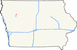
Iowa Highway 110 (Iowa 110) is a north–south state highway in northwestern Iowa. It is 15 miles (24 km) long. Iowa 110 begins at U.S. Route 20 (US 20) south of Schaller and ends in Storm Lake at Iowa Highway 7.
Route description
Iowa Highway 110 begins at U.S. Route 20 2 miles (3.2 km) south of Schaller. It heads north through Schaller and through northwest Sac County, crossing into Buena Vista County near mile marker 6.[1] Three miles into Buena Vista County, Iowa 110 turns to the east at Buena Vista County Road C65 (CR C65). For 2 1⁄2 miles (4.0 km), the route heads east, turning to the north again near the southwestern shore of Storm Lake. It continues north past the western shore for 2 miles (3.2 km) and negotiates an S-curve around the northwestern shore and into the city of Storm Lake. The highway ends at Iowa Highway 7 on the extreme western side of the city.[2]
History
Iowa Highway 110 was designated in 1934 on an old segment of Primary Road No. 4. Through the city of Storm Lake, the route followed the northern shore of Storm Lake; it ended at U.S. Route 71 in the downtown area. By 1952, only the segment from U.S. Route 20 to Schaller was paved.[3] By 1956, the entire route was paved.[4] By 1970, Iowa 110 was rerouted away from the downtown area to its current western end.[5]
Major intersections
| County | Location | mi[1] | km | Destinations | Notes |
|---|---|---|---|---|---|
| Sac | Eureka Township | 0.000 | 0.000 | ||
| Buena Vista | Storm Lake | 14.789 | 23.801 | ||
| 1.000 mi = 1.609 km; 1.000 km = 0.621 mi | |||||
References
- 1 2 3 "2009 Volume of Traffic on the Primary Road System of Iowa" (PDF). Iowa Department of Transportation. January 1, 2009. Retrieved July 31, 2010.
- ↑ Iowa Department of Transportation (2010). Iowa State Highway Map (PDF) (Map). Ames: Iowa Department of Transportation. Retrieved July 31, 2010.
- ↑ Iowa State Highway Commission (1952). Iowa State Highway Map (PDF) (Map). Ames: Iowa State Highway Commission. Retrieved July 31, 2010.
- ↑ Iowa State Highway Commission (1956). Iowa State Highway Map (PDF) (Map). Ames: Iowa State Highway Commission. Retrieved July 31, 2010.
- ↑ Iowa State Highway Commission (1970). Iowa State Highway Map (PDF) (Map). Ames: Iowa State Highway Commission. Retrieved July 31, 2010.
External links
- End of Iowa 110 at Iowa Highway Ends