Irewole
| Irewole | |
|---|---|
| LGA | |
 Irewole Location in Nigeria | |
| Coordinates: 7°25′N 4°13′E / 7.417°N 4.217°ECoordinates: 7°25′N 4°13′E / 7.417°N 4.217°E | |
| Country |
|
| State | Osun State |
| Government | |
| • Local Government Chairman and the Head of the Local Government Council | Olusola Ajayi |
| Area | |
| • Total | 271 km2 (105 sq mi) |
| Population (2006 census) | |
| • Total | 143,599 |
| Time zone | WAT (UTC+1) |
| 3-digit postal code prefix | 221 |
| ISO 3166 code | NG.OS.IR |
Irewole is a Local Government Area in Osun State, Nigeria. Its headquarters are in the town of Ikire in the south of the area at7°21′40″N 4°11′00″E / 7.36111°N 4.18333°E.
It has an area of 271 km² and a population of 143,599 at the 2006 census.
The postal code of the area is 221.[1]
References
- ↑ "Post Offices- with map of LGA". NIPOST. Retrieved 2009-10-20.
State capital: Osogbo | ||
| LGAs | 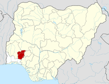 | |
This article is issued from Wikipedia - version of the 6/27/2015. The text is available under the Creative Commons Attribution/Share Alike but additional terms may apply for the media files.