Isentropic analysis
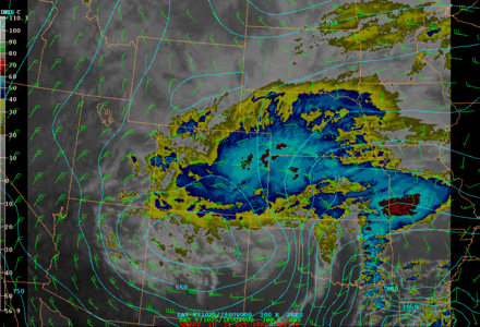
Isentropic analysis in meteorology is a technique to find the vertical and horizontal motion of airmasses during an adiabatic process above the planetary boundary layer. The change of state of air parcels following isentropic surfaces does not involve exchange of heat with the environment.[1] Such an analysis can also evaluate the airmass stability in the vertical dimension and whether an air parcel crossing such a surface will result in convective or stratiform clouds. It is based on the study of weather maps or vertical cross-sections of the potential temperature values in the troposphere.[2][3]
On a synoptic scale, isentropic analysis is associated with weather fronts: warm fronts are found where the wind crosses lines of a chosen potential temperature from lower heights to higher ones, while cold fronts are where the wind crosses descending heights. Synoptic clouds and precipitations can thus be better found with these areas of advection than with conventional isobaric maps. From a mesoscale point of view, an air parcel moving vertically will cross isolines of potential temperature and it will be unstable if the value of those lines decrease with altitude, or stable if they increase.[4]
References
- ↑ World Weather Organization. "Isentropic analysis". Meteorological glossary. Eumetcal. Retrieved July 22, 2014.
- ↑ World Weather Organization. "Isentropic surface". Meteorological glossary. Eumetcal. Retrieved July 22, 2014.
- ↑ Translation Bureau. "Analyse isentropique". Termium. Public Works and Government Services Canada. Retrieved July 22, 2014.
- ↑ "Isentropic Analysis". COMET. Retrieved July 22, 2014.
| Wikimedia Commons has media related to Isentropic analysis. |