Iso-Roine
| Iso-Roine | |
|---|---|
 | |
| Coordinates | 61°13′00″N 24°34′00″E / 61.2167°N 24.5667°ECoordinates: 61°13′00″N 24°34′00″E / 61.2167°N 24.5667°E |
| Basin countries | Finland |
| Surface area | 30.871 km2 (11.919 sq mi) |
| Average depth | 7.17 m (23.5 ft) |
| Max. depth | 73 m (240 ft) |
| Water volume | 0.221 km3 (179,000 acre·ft) |
| Shore length1 | 146.7 km (91.2 mi) |
| Surface elevation | 84.2 m (276 ft) |
| Frozen | December–April |
| Islands | Lammassaari, Huhtisaari, Papinsaari |
| Settlements | Hauho |
| References | [1] |
| 1 Shore length is not a well-defined measure. | |
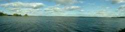
Iso-Roine (also Iso Roinevesi) is medium-sized lake in the Kokemäenjoki main catchment area in the Tavastia Proper region in Finland. The lake is located in the area of the city of Hämeenlinna. It is part of a chain of lakes that begins from the lakes Lummene and Vesijako at the drainage divide between the Kokemäenjoki and Kymijoki basins and flows westwards from there through the lakes Kuohijärvi and Kukkia into the Lake Iso-Roine, which in turn drains into lake Mallasvesi through the lakes Hauhonselkä and Ilmoilanselkä.[1]
This lake is one of the deepest lakes in Finland, depth is more than 70 meters.
See also
References
- 1 2 Iso-Roine in the Jarviwiki Web Service. Retrieved 2014-03-01. (English)
This article is issued from Wikipedia - version of the 9/4/2015. The text is available under the Creative Commons Attribution/Share Alike but additional terms may apply for the media files.