Iton
For the genus of grass skipper butterflies, see Iton (skipper).
| Iton | |
|---|---|
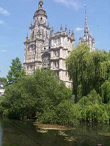 The Iton in Évreux | |
| Country | France |
| Basin | |
| Main source | Normandy |
| River mouth |
Eure River 49°10′29″N 1°11′11″E / 49.17472°N 1.18639°ECoordinates: 49°10′29″N 1°11′11″E / 49.17472°N 1.18639°E |
| Progression | Eure→ Seine→ English Channel |
| Basin size | 1,300 km2 (500 sq mi) |
| Physical characteristics | |
| Length | 132 km (82 mi) |
The Iton is a river in Normandy, France, left tributary of the river Eure. Its source is near Moulins-la-Marche. For about 10 km between Orvaux and Glisolles, it disappears and pursues a subterranean course.
The Iton flows through the following départements and towns:
Its length is 132 km and it flows into the Eure in Acquigny, south of Louviers.
Its basin (1,300 km2) covers 134 communes and is subject to a schéma d'aménagement et de gestion des eaux (water management scheme).
References
External links
| Wikimedia Commons has media related to Iton. |
- Avancement des SAGE du bassin Seine-Normandie SAGE on the Seine-Normandy basin (in French)
- Geoportail.fr
- The Iton at the Sandre database
This article is issued from Wikipedia - version of the 8/20/2016. The text is available under the Creative Commons Attribution/Share Alike but additional terms may apply for the media files.