Jacobs River, New Zealand
For the river situated north of the locality, see Jacobs River (New Zealand).
For other uses, see Jacobs River.
| Jacobs River | |
|---|---|
| Settlement | |
|
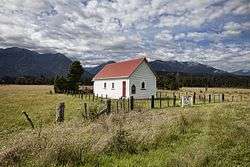
Our Lady of the River church, Jacobs River | |
 Jacobs River | |
| Coordinates: 43°34′18″S 169°40′47″E / 43.57167°S 169.67972°ECoordinates: 43°34′18″S 169°40′47″E / 43.57167°S 169.67972°E | |
| Country | New Zealand |
| Region | West Coast |
| District | Westland District |
| Electorates |
West Coast-Tasman Te Tai Tonga |
| Time zone | NZST (UTC+12) |
| • Summer (DST) | NZDT (UTC+13) |
| Area code(s) | 03 |
Jacobs River is a locality in the West Coast region of the South Island of New Zealand, situated just to the north of where State Highway 6 crosses the Jacobs River. Bruce Bay is about 7 kilometres (4 mi) to the south-west, and Fox Glacier is almost 40 kilometres (25 mi) to the north-east, by road.[1][2]
Education
The nearest school is in Fox Glacier, following the closure of Jacobs River School on 27 January 2013.[3]
References
- ↑ Peter Dowling (editor) (2004). Reed New Zealand Atlas. Reed Books. pp. map 76. ISBN 0-7900-0952-8.
- ↑ Roger Smith, GeographX (2005). The Geographic Atlas of New Zealand. Robbie Burton. pp. map 172. ISBN 1-877333-20-4.
- ↑ Mussen, Deidre (20 December 2012). "Class dismissed for last time at tiny school". The Press. Retrieved 14 March 2014.
External links
This article is issued from Wikipedia - version of the 9/5/2015. The text is available under the Creative Commons Attribution/Share Alike but additional terms may apply for the media files.