Jalgaon Jamod
| Jalgaon Jamod जळगाव जामोद | |
|---|---|
| Town | |
 Jalgaon Jamod Location in Maharashtra, India | |
| Coordinates: 21°02′55″N 76°32′04″E / 21.0486°N 76.5344°ECoordinates: 21°02′55″N 76°32′04″E / 21.0486°N 76.5344°E | |
| Country |
|
| State | Maharashtra |
| District | Buldhana |
| Elevation | 291 m (955 ft) |
| Population (2011) | |
| • Total | 28,276 |
| Languages | |
| • Official | Marathi |
| Time zone | IST (UTC+5:30) |
| Telephone code | 00-91-07266 |
| Vehicle registration | MH 28 |
| Lok Sabha constituency | Buldhana |
| Vidhan Sabha constituency | Jalgaon Jamod |
Jalgaon Jamod is a tehsil and a municipal council town situated in the north of Buldhana district in the Indian state of Maharashtra. It is located near Satpuda ranges and is on the border of Maharashtra and Madhya Pradesh.
Geography
The town is situated at the base of Satpura Range, about 10 km from Satpuda.
Borders
- In east there is Sangrampur tehsil.
- In west there is Muktainagar Tehsil in Jalgaon Khandesh District
- In north there is Burhanpur District State of Madhya Pradesh
- In south there is Nandura tehsil.
Natural
Purna is the largest river in the tehsil which is also largest in the District. There is the satpuda mountain ranges in the northern part of the tehsil. Rajura and Gorada are the famous dam at satpuda ranges. Both are natural dam. It is enriched with the green beauty of SATPUDA rows
Satpuda
The satpuda range extends from Jalgaon - Gatchiroli, the way consist of 3 famous points called as 1st mori, 2nd mori, and the last one 3rd mori.The Third mori is AAM- PAANEE,there we are having 2 Beauty full falls (origin of river) and one wall we called it is as " Satpudaa wall ". This town has a Dam called as GODADA dam, having beauty-full over flow called as Dudh ganga. in Satpuda range you can see Beauty full places for falls n scenes (nature) Naming Amba barwa, Mageri Mahadeo (cave), Jatashankar (fall), Umbardev (Amarnaath), Jamupaanee (fall), Badalkhora (medicine plants and fall),Devdhree (nature), Wari Hanumaan (Shree Hanumaanji Temple, Hanuman Sagar Dam ), Kakanwada (trymbak),Treeveni (sangam of three rivers), Mahilgad (mailgad),these are the places having their own identity and all comes within range of 40 km from "Satpudaa Nagree Jalaon Jamod ". Naturehelping in growing beauty of the town. one of the best Nature for photo shoot. For complete site seen we should have almost 4–5 days with us.
History
The name Jalgaon is combination of two Hindi words, Jal and Gaon that means village of water. This name came because of heavy water resources around the town. The name 'Jalgaon Jamod' developed because of a small village called 'Jamod' near to Jalgaon. The name 'Jamod' is given by Mughal emperors after 1630 AD, when Mughal emperor Shahjahan's wife Mumtaz Mahal was traveling with Shah Jahan's earlier military campaigns. She started facing Pregnancy complications in Jamod which led to death in Burhanpur city near to Jalgaon Jamod. After this incident Mughals started calling the village as Ja-e-Maut (place of Death). Ja-e-Maut was Persian word later called as Ja-maut, Ja-mod or Jamod by locals. In August 1905 it was part of then Akola District and was transferred to Buldhana district along with Khamgaon tehsil.[1] As per Ain-e-Akbari, it was a Pargana town in the Sarkar (then district) of Narnala of Berar Subah.[2]
Municipality at Jalgaon was established in 1931.[3]
Education
There are following schools and colleges in Jalgaon (Jamod):
- Satpuda Shikshan Sanstha is the leading education society in Buldana District. It includes many divisions like BSc Agri, Agricultural Polytech., Satpuda Convent Of scholars, B.Tech, KVK. (www.kvkbuldana.org)
- The New Era High School: Divisions up to Std XII Arts and Science. The New Era High School has developed its own website. www.newerajalgaon.org
- Dr. Babasaheb Ambedkar Vidyalay: Divisions up to Std XII
- Shripad Krina Kolhatkar Mahavidyalay: Divisions for BA and BCom
- Krishi Vigyan Kendra: Divisions for Bsc Agriculture
- divasi Ashram Shala: for adivasi student for them accommodation is provided there itself.
- Al-Farhan Urdu High School, Jalgaon Jamod
- Swami Vivekanand Rashtriya Dnyanpeeth is English medium school up to 10th standard and for 11th and 12th std English medium commerce is also available.
- Nitin Computer Typing Institute is the leading typewriting institute for english, marathi and hindi typewriting.
Pilgrimage
- "Shri Trimbkeshwar Sansthan, Kakanvada" is very old temple of Lord Mahadev which is 24 km from Jalgaon Jamod. It is copy of Trimbkeshwar.
- Dhanora is the religious place where is the famous temple of Mahasiddha Maharaj. Every year in month of February(magh Hindu calendar) fair is organised in dhanora which is one of the biggest festival.
- Palsi Supo is another religious place with the temple of Supo Maharaj. There is held a fair on each Sunday of Pausha month of Hindu calendar.
- The Raja Bartari Temple is one of the oldest temple in India. There are only two temples of this all over the country.
- Gajanan Maharaj Temple is built in jalgaon jamod which is holy place.
- Jalaram Mandir is built in jalgaon jamod which is holy place.
- Shri sant sakharam maharaj mandir of sakharampur(elora)
- There are also other temples such as Sakharam Maharaj Mandir.
- Kherda- The Temple of Kapil muni Maharaj located 6 km from Jalgaon
- In Sungaon there is a place at Satpuda ranges and a famous Temple of Lord Avajisiddha is here.
- Datta mandir is one of the oldest temple in the city which is situated near the river in the city.
- sulaj jagadamba mata maindir the oldest tempale
- adat mukt bajarpeth asalgaon.
Religion

Transport
There is no railway track in the tehsil. Nandura on Bhusawal - Badnera section of Bhusawal Division of Central Railway is a nearby railway Station.
The main means of travel are the roadways. State Highway no.194 connecting to Nandura and Jalgaon Jamod is the main road. Others are the road going to Burhanpur from Jalgaon Jamod and other is Khandvi - Muktainagar road going via Kurha. State Highway 195 connects Jalgagon Jamod to MH SH 24 via Sangrampur - Telhara.
Sungaon is village for Avajisidha Maharaj Yatra, which was organized at 3rd week of February. This is one of the oldest temples in Maharashtra. From Jalgaon Jamod Depot long-distance buses are available.
Political
- Sanjay Shriram Kute of BJP (3nd Term) is the Member of Vidhan Sabha. He is also district president for BJP. He has changed complete face of politics in this constituency
Important sights and places
- "Jama Masjid Jalgaon" is one of the oldest mosque in the area. It was built by "Hasan Bin Malik" in 1049 AH. The Inside structure of mosque is the example of Mughal architecture, a style that combines elements from Persian and Indian architectural styles.
- Asalgaon is the main market place in the tehsil where Tuesday is the weekly day of market.
- Pimpalgaon Kale is another market place situated on Khandvi-Kurha road.
- Manegaon is the Gateway to tehsil situated on state highway 194.
- Khandvi is a main junction from where one can go west to Jalgaon (Khandesh) and to Burhanpur (Madhya Pradesh).
- Kherda- The Temple of Kapil muni Maharaj located 6 km away from Jalgaon
- Sungaon- 7 km from Jalgaon jamod. A beautiful Place at Satpuda ranges.
- In the satpura rivers & natural seens are there.
References
- ↑ "Buldhana District Gazette 1976". Retrieved 4 February 2010.
- ↑ Imperial Gazetteer2 of India, Volume 14, page 27 - Imperial Gazetteer of India - Digital South Asia Library
- ↑ "Buldhana District Gazette 1976 - Places". Retrieved 4 February 2010.
- ↑ "Population by religion community - 2011". Census of India, 2011. The Registrar General & Census Commissioner, India. Archived from the original on 25 August 2015.
External links
 |
Burhanpur(Madhya Pradesh State) | Tunki, Hiwarkhed | | |
| |
Sangrampur | |||
| ||||
| | ||||
| Nandura |
| Subdivisions and tehsils | 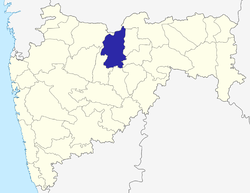 | |
|---|---|---|
| Cities, towns and villages | ||
| Railway stations |
| |
| Roads | ||
| Historical |
| |
| Geography | ||
| Lok Sabha constituencies | ||
| Vidhan Sabha constituencies |
| |
| Religious | ||
| People |
| |
| See Also |
| |