Jeremiah's Gutter
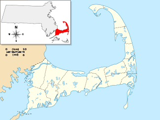
Jeremiah's Gutter was a canal located on the border of Orleans and Eastham, Massachusetts, the first canal to cut across the peninsula of Cape Cod. It connected Cape Cod Bay in the west to the Atlantic Ocean in the east. It was active for over 100 years, although it gradually fell out of use and was later replaced by the more widely known Cape Cod Canal.
History
Since the discovery of Cape Cod by Bartholomew Gosnold in 1602, the eastern side of the peninsula has been treacherous to shipping. Since sea levels rose to their present levels, and up until recent times, water has flowed over land in Orleans during times of high tide, allowing for boats to pass between them.[1][2] On 26 April 1717, the 1.5-mile (2.4 km) passage between Boat Meadow Creek on the side of Cape Cod Bay and Town Cove, to the east, was deepened by a massive Nor'easter that lasted for several days and wrecked the Whydah Gally and the Mary Anne (fleet ships of the pirate Samuel Bellamy); the canal became known as Jeremy's Drain and Jeremiah's Gutter, named after Jeremiah Smith. The canal was very shallow and allowed for a maximum of twenty ton boats when the tides were just right. The canal could cut up to a day off of the trip for ships, who instead of traveling around the arm of the Cape could pass right through it. In 1804, the canal was widened and improved, which allowed for use during the War of 1812. Eventually, proposals for a new canal began to take priority in the late 1800s (although the construction of the railroad around that time might have permanently blocked passage), and the canal began to fall into disrepair. In 1916, the opening of the Cape Cod Canal (between Bourne and Sandwich) created a permanent canal for the Cape.[3][4]
The only remains of the canal that are still visible are a river and cut through the marsh. These can be viewed from the Cape Cod Rail Trail about 0.3 miles north of the Rock Harbor Road parking. From that location on the trail, you can look north and west along the Boat Meadow Marsh inlet to the Cape Cod Bay, and can look southeast over the marsh toward the location of the Orleans rotary; Jeremiah's gutter most likely followed this path.[5] Any trace of the canal from the eastern end near Town Cove has been removed by the construction of the round-about and road now known as U.S. Route 6 and by the construction of homes.[3] There is a small sign about Jeremiah's Gutter, though, on Canal Road across from the Wendy's exit.
During his time on the Cape, Henry David Thoreau forded Jeremiah's Gutter.[6]
References
- ↑ Pratt, Enoch (1844). "A Comprehensive History, Ecclesiastical and Civil, of Eastham, Wellfleet and Orleans, County of Barnstable, Mass. from 1644 to 1844". Yarmouth, Massachusetts: W. S. Fisher and Co. Retrieved 13 August 2012.
- ↑ Freeman, Federick (1862). History of Cape Cod: Annals of Barnstable County, Volume 2. Nabu Press. ISBN 1143845501. Retrieved 13 August 2012.
- 1 2 "Jeremiah's Gutter" (PDF). American Canal Society Index. 4 January 2011. Retrieved 8 August 2012.
- ↑ Kelley, Shawnie M. (2006). It Happened on Cape Cod (1 ed.). Guilford: TwoDot. ISBN 0-7627-3824-3.
- ↑ Peace, William (April 2016). Cape Cod Visitor's Guide. William Peace. p. 54. ISBN 978-1530521401. Retrieved 18 May 2016.
- ↑ Mulloney, Stephen (1998). Traces of Thoreau : A Cape Cod Journey. Boston: Northeastern University Press. ISBN 1555533434.
Coordinates: 41°47′50.7″N 69°59′0.7″W / 41.797417°N 69.983528°W