Joinville Island group
 Satellite picture of the group | |
 Joinville Island group: | |
| Geography | |
|---|---|
| Location | Antarctica |
| Coordinates | 63°15′S 55°45′W / 63.250°S 55.750°WCoordinates: 63°15′S 55°45′W / 63.250°S 55.750°W |
| Archipelago | Joinville Island group |
| Administration | |
|
None | |
| Demographics | |
| Population | Uninhabited |
| Additional information | |
| Administered under the Antarctic Treaty System | |
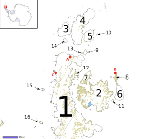
Joinville Island group is a group of antarctic islands, lying off the northeastern tip of the Antarctic Peninsula, from which Joinville Island group is separated by the Antarctic Sound. Joinville Island, located at 63°15′S 55°45′W / 63.250°S 55.750°W, is the largest island of the Joinville Island group. Immediately north of Joinville Island and separated by Larsen Channel lies D'Urville Island, Antarctica, the northernmost island of the Joinville Island group, being located at 63°05′S 56°20′W / 63.083°S 56.333°W.
The Joinville Island group was discovered in 1838 by a French expedition under Captain Jules Dumont d'Urville.
See also
- Composite Antarctic Gazetteer
- List of Antarctic and sub-Antarctic islands
- List of Antarctic islands south of 60° S
- SCAR
- Territorial claims in Antarctica
References
External links
This article is issued from Wikipedia - version of the 11/12/2016. The text is available under the Creative Commons Attribution/Share Alike but additional terms may apply for the media files.