José María Avilés Province
| Location in Bolivia | |
|---|---|
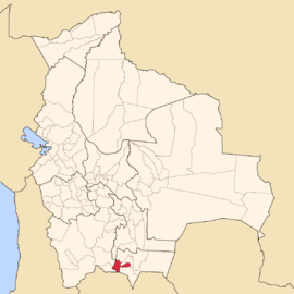 | |
| Main Data | |
| Capital | Uriondo |
| Area | 2,658 km² |
| Population | 17,504 (2001) |
| Density | 6.6 inhabitants/km² (2001) |
| ISO 3166-2 | BO.TR.AV |
José María Avilés (or: Avilez) is a province in the western parts of the Bolivian department Tarija.
Location
Avilés province is one of six provinces in the Tarija Department. It is located between 21° 28' and 22° 05' south and between 64° 29' and 65° 25' west.
The province borders Eustaquio Méndez Province in the north, Potosí Department in the west, Argentina in the south, Aniceto Arce Province in the south-east, and Cercado Province in the north-east.
The province extends over 85 km from north to south, and 115 km from east to west.
Population
Main idiom of the province is Spanish, spoken by 98.9%, while 2.4% of the population speak Quechua, and 0.2 speak Aymara.
The population increased from 16,210 inhabitants (1992 census) to 17,504 (2001 census), an increase of 8.0%. - 47.6% of the population are younger than 15 years old.
81.6% of the population have no access to electricity, 82.9% have no sanitary facilities (1992).
77.0% of the population are employed in agriculture, 0.1% in mining, 3.7% in industry, 19.2% in general services (2001).
93.9% of the population are Catholics, 4.6% are Protestants (1992).
Division
The province comprises two municipalities:
- Uriondo Municipality
- Yunchará Municipality
Places of interest
External links
Coordinates: 21°50′S 64°50′W / 21.833°S 64.833°W