Kakepuku
| Kakepuku | |
|---|---|
|
Kakepuku from the south as seen from the North Island Main Trunk Railway (Dec 2011) | |
| Highest point | |
| Elevation | 449 m (1,473 ft) [1] |
| Coordinates | 38° 3' 57.51"S, 175° 14' 59.6358"E |
| Naming | |
| Translation | swollen neck or swollen stomach of Kahu |
| Geography | |
| Location | North Island, New Zealand |
| Topo map | BE33 Pirongia http://www.topomap.co.nz/NZTopoMap/nz53324 |
| Geology | |
| Age of rock | Pliocene |
| Mountain type | Volcano (extinct) |
| Climbing | |
| Easiest route | from Kakepuku Rd |


Kakepuku (Kakipuku-o-kahurere) rises from the plain between the Waipa and Puniu rivers, 8 km (5 mi) SW of Te Awamutu in the Waikato region of New Zealand's North Island.
Geology
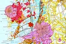
The 'Geology of the Waikato Area'[2] says, "The Alexandra Volcanic Group consists of several low-angle composite cones, including Karioi, Pirongia, Kakepuku, Te Kawa and Tokanui volcanoes, aligned southeast from Mount Karioi on the coast to Tokanui. They comprise about 55 km3 of mainly basaltic material erupted from at least 40 volcanic centres. The Alexandra Volcanic Group is the product of Late Pliocene to earliest Pleistocene back-arc volcanism, when both subduction-related basaltic magmas (Karioi, Pirongia, Kakepuku and Te Kawa) and intraplate alkalic basalts (Okete) were erupted. K-Ar ages range from 2.74 to 1.6 Ma, with the ages of the different magma series overlapping". It goes on to say Kakepuku is "composed mainly of basalt lava with minor tuff ". Kakepuku was formed about 2.5m years ago.[3] See also the geological map http://data.gns.cri.nz/geology/
History
Kakepuku was named by Rakataura, a Tainui tohunga. One version says it was in memory of the shape of his pregnant wife, Kahurere. In Maori legend, Kakepuku travelled north in search of his father, until he reached the Waipa plain and fell in love with Te Kawa, daughter of Pirongia and Taupiri Mountains. However, he had a rival in Karewa, who also stood nearby. The mountains fought, Karewa lost and, pursued by Kakepuku's rocks, fled into the Tasman Sea, now also known as Gannet Island. So Kakepuku remains guarding Te Kawa.
DOC says, "Tainui settlement in the Kakepuku area began about 1550AD, although there were probably earlier people's present - notably Ngati Kahupungapunga (see history of Tokoroa)." It is in the Ngāti Maniapoto area (see also http://www.teara.govt.nz/en/ngati-maniapoto/1). Four pa sites are hidden under forest or regenerating bush.[4]
Walking track


DOC says,[5] "From the car park there is a new walking track to the summit. This incorporates the mountain biking track for part of the way. This track is an old farm road and is of an even gradient. The bottom 3/4 of this track is also able to be used by mountain bikers. Once at the top continue along a ridge through a fine remnant of original forest in the ancient crater and finally onto the summit itself (449 m, marked with a trig)."
Conservation
Kakepuku Mountain Conservation Project covers 198 ha including Kakepuku Mountain Historic Reserve (administered by DOC), adjacent Waipa District Council reserve and private land. The project was established in 1995 out of concern for the health of native bush on Kakepuku Maunga. The aim has been to reduce possum, rat and goat populations to levels where minimal impact on forest and native birds would occur. 30 North Island robins were reintroduced in 1999 and later the New Zealand falcon, weedy portions on the fringe of the mountain were replanted with native plants and tui and kereru are also present. Plants in the reserve include tawa, rewarewa, kohekohe, mangeao and pukatea. [6]
References
- ↑ "Waitomotomo Stream, Waikato - NZ Topo Map". topomap.co.nz. Retrieved 2015-06-24.
- ↑ http://www.gns.cri.nz/content/download/3472/19502/file/waik_text_lowres.pdf
- ↑ New Zealand Journal of Geology and Geophysics. The Royal Society of New Zealand. p. 423. Retrieved 2015-06-24.
- ↑ "New Zealand historic heritage: Our work". doc.govt.nz. Retrieved 2015-06-24.
- ↑ "Kakepuku Track: Walking and tramping in Kakepuku Mountain Historic Reserve". doc.govt.nz. Retrieved 2015-06-24.
- ↑ "Volunteer: Getting involved". doc.govt.nz. Retrieved 2015-06-24.
Coordinates: 38°04′S 175°15′E / 38.067°S 175.250°E