Kampyli
| Kampyli | |
|---|---|
 Kampyli | |
| Coordinates: 35°18′05″N 33°06′25″E / 35.30139°N 33.10694°ECoordinates: 35°18′05″N 33°06′25″E / 35.30139°N 33.10694°E | |
| Country |
|
| • District | Kyrenia District |
| Country (controlled by) |
|
| • District | Girne District |
| Population (2011)[1] | |
| • Total | 194 |
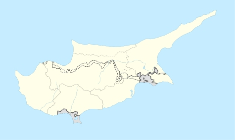
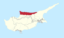
Kampyli (Greek: Καμπυλή; Turkish: Hisarköy “castle village”, previously Kambilli) is a small Turkish Cypriot village in Cyprus, located approximately 3 km (1.9 mi) east of Myrtou. It is under the de facto control of Northern Cyprus. In 1831, 30% of the village's inhabitants were Maronites. They all left by 1940, and, around that time, Muslim families from Larnakas tis Lapithou moved into Kampyli.[2] As of 2011, Kampyli had population of 194.
References
- ↑ "KKTC 2011 Nüfus ve Konut Sayımı" [TRNC 2011 Population and Housing Census] (PDF) (in Turkish). TRNC State Planning Organization. 6 August 2013.
- ↑ "KAMBYLI". Internal Displacement in Cyprus. PRIO Cyprus Centre. Retrieved 25 January 2015.
This article is issued from Wikipedia - version of the 5/6/2016. The text is available under the Creative Commons Attribution/Share Alike but additional terms may apply for the media files.