Kaneville Township, Kane County, Illinois
| Kaneville Township | |
|---|---|
| Township | |
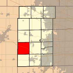 Location in Kane County | |
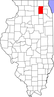 Kane County's location in Illinois | |
| Coordinates: 41°53′00″N 88°33′00″W / 41.88333°N 88.55000°WCoordinates: 41°53′00″N 88°33′00″W / 41.88333°N 88.55000°W | |
| Country |
|
| State |
|
| County | Kane |
| Established | November 6, 1849 |
| Area | |
| • Total | 35.13 sq mi (91.0 km2) |
| • Land | 35.11 sq mi (90.9 km2) |
| • Water | 0.02 sq mi (0.05 km2) 0.06% |
| Elevation | 850 ft (259 m) |
| Population (2010) | |
| • Total | 1,264 |
| • Density | 36/sq mi (14/km2) |
| Time zone | CST (UTC-6) |
| • Summer (DST) | CDT (UTC-5) |
| ZIP codes | 60119, 60151 |
| GNIS feature ID | 0422241 |
Kaneville Township is one of sixteen townships in Kane County, Illinois, USA. As of the 2010 census, its population was 1,264 and it contained 508 housing units.[1]
Geography
According to the 2010 census, the township has a total area of 35.13 square miles (91.0 km2), of which 35.11 square miles (90.9 km2) (or 99.94%) is land and 0.02 square miles (0.052 km2) (or 0.06%) is water.[1] The township is divided roughly into northern and southern halves by Interstate 88.
Cities, towns, villages
Unincorporated towns
- Kaneland Estates at 41°52′42″N 88°33′11″W / 41.8783614°N 88.5531364°W
- Pine View at 41°52′56″N 88°33′05″W / 41.8822503°N 88.5514697°W
- Troxel at 41°50′03″N 88°35′47″W / 41.8341955°N 88.5964695°W
(This list is based on USGS data and may include former settlements.)
Cemeteries
The township contains these three cemeteries: Gardner, Kaneville and Old Saint Mary's.
School districts
- Kaneland Community Unit School District 302
Political districts
- Illinois's 14th congressional district
- State House District 50
- State Senate District 25
References
- "Kaneville Township, Kane County, Illinois". Geographic Names Information System. United States Geological Survey. Retrieved 2010-06-26.
- United States Census Bureau 2009 TIGER/Line Shapefiles
- United States National Atlas
- 1 2 "Population, Housing Units, Area, and Density: 2010 - County -- County Subdivision and Place -- 2010 Census Summary File 1". United States Census. Retrieved 2013-05-28.
External links
 |
Cortland Township, DeKalb County | Virgil Township | | |
| Pierce Township, DeKalb County | |
Blackberry Township | ||
| ||||
| | ||||
| Squaw Grove Township, DeKalb County | Big Rock Township | Sugar Grove Township |
Municipalities and communities of Kane County, Illinois, United States | ||
|---|---|---|
| Cities | ||
| Villages | ||
| Townships |
| |
| CDP | ||
| Other unincorporated communities |
| |
| Footnotes | ‡This populated place also has portions in an adjacent county or counties | |
This article is issued from Wikipedia - version of the 11/29/2013. The text is available under the Creative Commons Attribution/Share Alike but additional terms may apply for the media files.