Kankan
| Kankan | |
|---|---|
| Sub-prefecture and town | |
|
Kankan Kabada health center | |
 Kankan | |
| Coordinates: 10°23′N 9°18′W / 10.383°N 9.300°W | |
| Country |
|
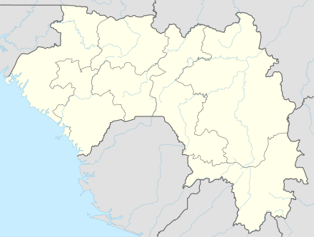
| Region | Kankan Region |
| Prefecture | Kankan Prefecture |
| Population (2014) | |
| • Total | 193,830 |

Kankan (Mandingo: Kánkàn) is the largest city in Guinea in land area, and the third largest in population, with a population of 193,830 people as of 2014.[1] The city is located on the Milo River in eastern Guinea and lying about 345 miles east of Conakry.
The population of the city is largely from the Mande ethnic group. Kankan serves as the capital and largest city of Kankan Prefecture and Kankan Region.
History
Kankan was founded by the Mandingo people in the 17th century after which it became an important trading centre, particularly for kola nuts, and the capital of the Baté Empire. The population of the city is predominantly from the Mandinka ethnic group and their language is widely spoken throughout the city.
The French explorer René Caillié spent a month in Kankan in 1827 on his journey from Boké, in present-day Guinea, to Djenné and Timbuktu in Mali. He arrived with a caravan transporting kola nuts. He described the visit in his book Travels through Central Africa to Timbuctoo. The town had a population of 6,000 inhabitants and was an important commercial centre with a market held three times a week. Instead of having a surrounding mud wall, the town was defended by a quickset hedge. The chief of the town refused Caillié permission to travel along the river to the north as the town of Kankan was fighting for control of the Bouré gold producing area around Siguiri and the Tinkisso River. Instead Caillié left the town heading east in the direction of Minignan in the Ivory Coast.[2][3]
The town was conquered by Samory Touré in 1881 and occupied by the French in 1891.
Climate
| Climate data for Kankan | |||||||||||||
|---|---|---|---|---|---|---|---|---|---|---|---|---|---|
| Month | Jan | Feb | Mar | Apr | May | Jun | Jul | Aug | Sep | Oct | Nov | Dec | Year |
| Average high °C (°F) | 36.5 (97.7) |
38.1 (100.6) |
38.9 (102) |
38.8 (101.8) |
37.1 (98.8) |
33.2 (91.8) |
32.2 (90) |
31.7 (89.1) |
32.7 (90.9) |
33.9 (93) |
34.7 (94.5) |
35.2 (95.4) |
35.3 (95.5) |
| Daily mean °C (°F) | 24.3 (75.7) |
26.3 (79.3) |
29.6 (85.3) |
30.1 (86.2) |
28.3 (82.9) |
26.4 (79.5) |
25.3 (77.5) |
25.1 (77.2) |
25.5 (77.9) |
26.4 (79.5) |
27.0 (80.6) |
23.8 (74.8) |
26.5 (79.7) |
| Average low °C (°F) | 10.8 (51.4) |
13.3 (55.9) |
17.0 (62.6) |
20.2 (68.4) |
19.6 (67.3) |
18.8 (65.8) |
18.9 (66) |
18.8 (65.8) |
18.9 (66) |
19.0 (66.2) |
13.9 (57) |
11.0 (51.8) |
16.7 (62.1) |
| Average precipitation mm (inches) | 2 (0.08) |
1 (0.04) |
24 (0.94) |
67 (2.64) |
134 (5.28) |
204 (8.03) |
262 (10.31) |
322 (12.68) |
304 (11.97) |
131 (5.16) |
20 (0.79) |
1.2 (0.047) |
1,472.2 (57.961) |
| Average precipitation days (≥ 1.0 mm) | 1 | 1 | 3 | 6 | 11 | 15 | 19 | 22 | 21 | 13 | 3 | 1 | 116 |
| Average relative humidity (%) | 38 | 35 | 38 | 49 | 63 | 73 | 77 | 79 | 77 | 75 | 57 | 46 | 59 |
| Mean monthly sunshine hours | 262 | 236 | 249 | 220 | 234 | 216 | 169 | 159 | 191 | 221 | 241 | 260 | 2,658 |
| Source: NOAA[4] | |||||||||||||
Features
The town is known for its university (Université de Kankan), for its religious scholars and its mango trees. It is home to the Kankan Airport. It is between a fourteen- and eighteen-hour drive from Conakry, due to the poor condition of the road. It also has one of the oldest mosques in West Africa. The Mandingo cultural site Gberedou/Hamana is located about 40 km to the northeast.
Transport
Kankan is the terminus of the lightduty narrow gauge railway from Conakry (traffic suspende since 1993). The N1 highway connects the city with Nzerekore in the south. In addition, the town is served by Kankan Airport.
References
- ↑ "Guinea". Institut National de la Statistique, Guinea, accessed via Geohive. Retrieved 12 September 2014.
- ↑ Caillié, René (1830). Travels through Central Africa to Timbuctoo; and across the Great Desert, to Morocco, performed in the years 1824-1828 (Volume 1). London: Colburn & Bentley. pp. 254–286.
- ↑ Quella-Villéger, Alain (2012). René Caillié, l'Africain : une vie d'explorateur, 1799-1838 (in French). Anglet, France: Aubéron. pp. 71–75. ISBN 978-2-84498-137-0.
- ↑ "Kankan Climate Normals 1961–1990". National Oceanic and Atmospheric Administration. Retrieved July 6, 2015.
Coordinates: 10°23′N 9°18′W / 10.383°N 9.300°W
Capital: Kankan | ||
| Sub-prefectures | 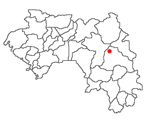 | |