Kansas City, Missouri
| Kansas City, Missouri | |||
|---|---|---|---|
| City | |||
| City of Kansas City | |||
|
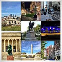
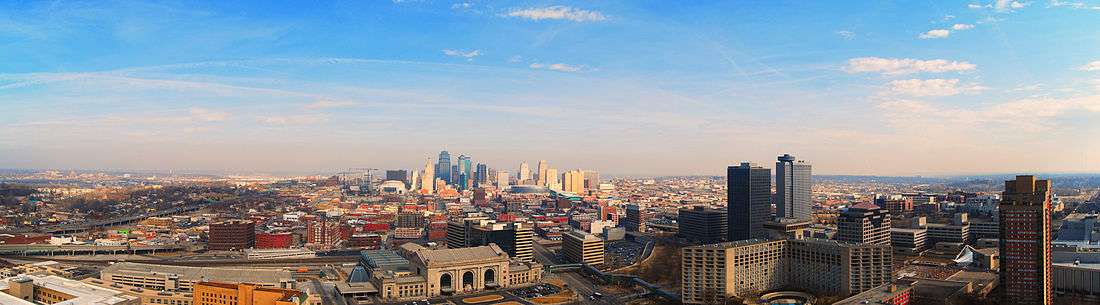
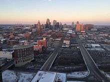
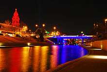
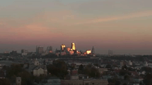
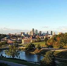
From top left: Downtown Kansas City from Liberty Memorial, Crown Center at Christmas, KC Streetcar, Washington Square Park, Union Station lit blue for the World Series, the Thinker at the Nelson Atkins Museum of Art, Liberty Memorial, and the Library area of Downtown. | |||
| |||
| Nickname(s): "KC", "KCMO", the "City of Fountains", or the "Heart of America" | |||
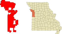 Location in Jackson, Clay, Platte, and Cass counties in the state of Missouri. | |||
 Kansas City, Missouri Location in the United States | |||
| Coordinates: 39°05′59″N 94°34′42″W / 39.09972°N 94.57833°WCoordinates: 39°05′59″N 94°34′42″W / 39.09972°N 94.57833°W | |||
| Country | United States | ||
| State | Missouri | ||
| Counties | Jackson, Clay, Platte, Cass | ||
| Incorporated | June 1, 1850 (as the Town of Kansas); March 28, 1853 (as the City of Kansas) | ||
| Government | |||
| • Mayor | Sly James | ||
| Area[1] | |||
| • City | 319.03 sq mi (826.28 km2) | ||
| • Land | 314.95 sq mi (815.72 km2) | ||
| • Water | 4.08 sq mi (10.57 km2) | ||
| • Urban | 584.4 sq mi (1,513.59 km2) | ||
| • Metro | 7,952 sq mi (20,596 km2) | ||
| Elevation | 910 ft (277 m) | ||
| Population (2010) | |||
| • City | 459,787 | ||
| • Estimate (2015)[2] | 475,378 | ||
| • Rank |
US: 36th MO: 1st | ||
| • Density | 1,474.2/sq mi (569.2/km2) | ||
| • Urban | 1,519,417 (US: 31st) | ||
| • Metro | 2,159,159 (US: 29th) | ||
| • CSA | 2,428,362 (US: 24th) | ||
| Demonym(s) | Kansas Citian | ||
| Time zone | CST (UTC−6) | ||
| • Summer (DST) | CDT (UTC−5) | ||
| ZIP Codes | 64101-64102, 64105-64106, 64108-64114, 64116-64121, 64123-64134, 64136-64139, 64141, 64144-64149, 64151-64158, 64161, 64163-64168, 64170-64172, 64179-64180, 64183-64184, 64187-64188, 64190-64193, 64195-64199, 64999[3] | ||
| Area code(s) | 816, 975 (planned) | ||
| FIPS code | 29000-38000[4] | ||
| GNIS feature ID | 0748198[5] | ||
| Website | KCMO.org | ||

Kansas City is the largest city in the U.S. state of Missouri and the sixth largest city in the Midwest. According to the U.S. Census Bureau, the city had an estimated population of 475,378 in 2015,[6] making it the 36th largest city by population in the United States. It is the anchor city of the Kansas City metropolitan area, which straddles the Kansas–Missouri border. Kansas City was founded in the 1830s as a Missouri River port at its confluence with the Kansas River coming in from the west. On June 1, 1850 the town of Kansas was incorporated; shortly after came the establishment of the Kansas Territory. Confusion between the two ensued and the name Kansas City was assigned to distinguish them soon thereafter.
Sitting on Missouri's western border, with Downtown near the confluence of the Kansas and Missouri rivers, the modern city encompasses some 319.03 square miles (826.3 km2), making it the 23rd largest city by total area in the United States. Most of the city lies within Jackson County, but portions spill into Clay, Cass, and Platte counties. Along with Independence, it serves as one of the two county seats for Jackson County. Major suburbs include the Missouri cities of Independence and Lee's Summit and the Kansas cities of Overland Park, Olathe, and Kansas City.
The city is composed of several neighborhoods, including the River Market District in the north, the 18th and Vine District in the east, and the Country Club Plaza in the south. Kansas City is also known for its cuisine (including its distinctive style of barbecue), its craft breweries and its major league sports teams.
History
Kansas City, Missouri was officially incorporated as a town on June 1, 1850, and as a city on March 28, 1853. The territory straddling the border between Missouri and Kansas at the confluence of the Kansas and Missouri rivers was considered a good place to build settlements.
The Antioch Christian Church, Dr. James Compton House, and Woodneath are listed on the National Register of Historic Places.[7]
Exploration and settlement
The first documented European visitor to Kansas City was Étienne de Veniard, Sieur de Bourgmont, who was also the first European to explore the lower Missouri River. Criticized for his response to the Native American attack on Fort Détroit, he had deserted his post as fort commander and was avoiding French authorities. Bourgmont lived with a Native American wife in a village about 90 miles (140 km) east near Brunswick, Missouri, where he illegally traded furs.
To clear his name, he wrote Exact Description of Louisiana, of Its Harbors, Lands and Rivers, and Names of the Indian Tribes That Occupy It, and the Commerce and Advantages to Be Derived Therefrom for the Establishment of a Colony in 1713 followed in 1714 by The Route to Be Taken to Ascend the Missouri River. In the documents, he describes the junction of the "Grande Riv[ière] des Cansez" and Missouri River, making him the first to adopt those names. French cartographer Guillaume Delisle used the descriptions to make the area's first reasonably accurate map.
The Spanish took over the region in the Treaty of Paris in 1763, but were not to play a major role other than taxing and licensing Missouri River ship traffic. The French continued their fur trade under Spanish license. The Chouteau family operated under Spanish license at St. Louis in the lower Missouri Valley as early as 1765 and in 1821 the Chouteaus reached Kansas City, where François Chouteau established Chouteau's Landing.
After the 1804 Louisiana Purchase, Lewis and Clark visited the confluence of the Kansas and Missouri rivers, noting it was a good place to build a fort. In 1831, a group of Mormons from New York settled in what would become the city. They built the first school within Kansas City's current boundaries, but were forced out by mob violence in 1833 and their settlement remained vacant.[8]
In 1833 John McCoy established West Port along the Santa Fe Trail, 3-mile (4.8-kilometre) away from the river. In 1834 McCoy established Westport Landing on a bend in the Missouri to serve as a landing point for West Port. Soon after, the Kansas Town Company, a group of investors, began to settle the area, taking their name from an English spelling of "Cansez." In 1850, the landing area was incorporated as the Town of Kansas.[9]
By that time, the Town of Kansas, Westport and nearby Independence, had become critical points in America's westward expansion. Three major trails – the Santa Fe, California, and Oregon – all passed through Jackson County.
On February 22, 1853, the City of Kansas was created with a newly elected mayor. It had an area of 0.70 square miles (1.8 km2) and a population of 2,500. The boundary lines at that time extended from the middle of the Missouri River south to what is now Ninth Street, and from Bluff Street on the west to a point between Holmes Road and Charlotte Street on the east.[10]
American Civil War
The Kansas City area was rife with animosity just prior to the U.S. Civil War. Kansas successfully petitioned the U.S. to enter the Union as a free state that did not allow slavery under the new doctrine of popular sovereignty. Missouri had many slaves. Slavery sympathizers crossed into Kansas to sway the state towards allowing slavery, at first by ballot box and then by bloodshed.
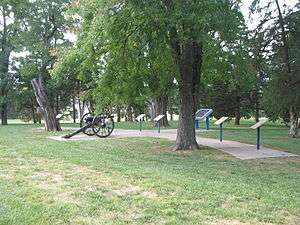
During the Civil War, the city and its immediate surroundings were the focus of intense military activity. Although the First Battle of Independence in August 1862 resulted in a Confederate victory, the Confederates were unable to leverage their win in any significant fashion, as Kansas City was occupied by Union troops and proved too heavily fortified to assault. The Second Battle of Independence, which occurred on October 21–22, 1864 as part of Sterling Price's Missouri expedition of 1864, also resulted in a Confederate triumph. Once again their victory proved hollow, as Price was decisively defeated in the pivotal Battle of Westport the next day, effectively ending Confederate efforts to regain Missouri.
General Thomas Ewing, in response to a successful raid on nearby Lawrence, Kansas, led by William Quantrill, issued General Order No. 11, forcing the eviction of residents in four western Missouri counties – including Jackson – except those living in the city and nearby communities and those whose allegiance to the Union was certified by Ewing.
Post-Civil War
After the Civil War, Kansas City grew rapidly. The selection of the city over Leavenworth, Kansas, for the Hannibal & St. Joseph Railroad bridge over the Missouri River brought about significant growth. The population exploded after 1869, when the Hannibal Bridge, designed by Octave Chanute, opened. The boom prompted a name change to Kansas City in 1889 and the city limits to extend south and east. Westport became part of Kansas City on December 2, 1897. In 1900, Kansas City was the 22nd largest city in the country, with a population of 163,752 residents.[11]
.tiff.jpg)
Kansas City, guided by architect George Kessler, became a forefront example of the City Beautiful movement, offering a network of boulevards and parks.[12]
The relocation of Union Station to its current location in 1914 and the opening of the Liberty Memorial in 1923 provided two of the city's most identifiable landmarks. Robert A. Long, president of the Liberty Memorial Association, was a driving force in the funding for construction. Long was a longtime resident and wealthy businessman. He built the R.A. Long Building for the Long-Bell Lumber Company, his home, Corinthian Hall (now the Kansas City Museum) and Longview Farm.
Further spurring Kansas City's growth was the opening of the innovative Country Club Plaza development by J.C. Nichols in 1925, as part of his Country Club District plan.
Pendergast era
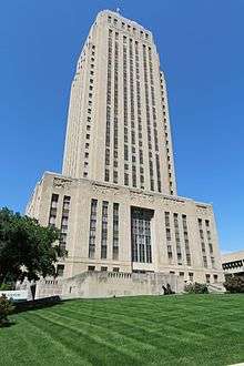
At the start of the 20th century, political machines gained clout in the city, with the one led by Tom Pendergast dominating the city by 1925. Several important buildings and structures were built during this time, including the Kansas City City Hall and the Jackson County Courthouse. The machine fell in 1939 when Pendergast, riddled with health problems, pleaded guilty to tax evasion after long federal investigations. His biographers have summed up Pendergast's uniqueness:
Pendergast may bear comparison to various big-city bosses, but his open alliance with hardened criminals, his cynical subversion of the democratic process, his monarchistic style of living, his increasingly insatiable gambling habit, his grasping for a business empire, and his promotion of Kansas City as a wide-open town with every kind of vice imaginable, combined with his professed compassion for the poor and very real role as city builder, made him bigger than life, difficult to characterize.[13]
Post–World War II
Kansas City's suburban development began with a streetcar system in the early decades of the 20th century. The city's first suburbs were in the neighborhoods of Pendleton Heights and Quality Hill. After World War II, many relatively affluent residents left for suburbs in Johnson County, Kansas, and eastern Jackson County, Missouri. Many also went north of the Missouri River, where Kansas City had incorporated areas between the 1940s and 1970s.
In 1950, African Americans represented 12.2% of Kansas City's population.[11] The sprawling characteristics of the city and its environs today mainly took shape after 1960s race riots. The assassination of Martin Luther King, Jr. was a catalyst for the 1968 Kansas City riot. At this time, slums were forming in the inner city, and many who could afford to do so, left for the suburbs and outer edges of the city. The post-World War II idea of suburbs and the "American Dream" also contributed to the sprawl of the area. The city's population continued to grow, but the inner city declined. The city's most populous ethnic group, non-Hispanic whites,[14] declined from 89.5% in 1930 to 54.9% in 2010.[11]
In 1940, the city had about 400,000 residents; by 2000, the same area was home to only about 180,000. From 1940 to 1960, the city more than doubled its physical size, while increasing its population by only about 75,000. By 1970, the city covered approximately 316 square miles (820 km2), more than five times its size in 1940.
The Hyatt Regency walkway collapse was a major disaster that occurred on July 17, 1981, killing 114 people and injuring more than 200 others during a tea dance. At the time, it was the deadliest structural collapse in US history.
21st century
Power & Light and the Sprint Center were constructed from 2005 to 2008, creating an entertainment district downtown. Both were built after a series of failed projects.
The Kansas City Streetcar was the first rail transit line in the region in almost 60 years, beginning operations on May 6, 2016. It was constructed after a series of ballot failures over the preceding decades. The project proceeded after a legal challenge that saw the project election validated by the state supreme court.[15]
Geography
The city has a total area of 319.03 square miles (826.28 km2), of which, 314.95 square miles (815.72 km2) is land and 4.08 square miles (10.57 km2) is water.[1] Bluffs overlook the rivers and river bottom areas. Kansas City proper is bowl-shaped and is surrounded to the north and south by glacier-carved limestone and bedrock cliffs. Kansas City is situated at the junction between the Dakota and Minnesota ice lobes during the maximum late Independence glaciation of the Pleistocene epoch. The Kansas and Missouri rivers cut wide valleys into the terrain when the glaciers melted and drained. A partially filled spillway valley crosses the central city. This valley is an eastward continuation of the Turkey Creek Valley. It is the closest major city to the geographic center of the contiguous United States, or "Lower 48".
Cityscape
Kansas City, Missouri, comprises more than 240[16] neighborhoods, some with histories as independent cities or as the sites of major events. Downtown is undergoing redevelopment with new condominiums, apartments, offices. The redeveloped Power & Light District offers indoor/outdoor shopping, dining and entertainment including bars, restaurants, a grocery store, a roof-top pool club called The Jones, a performing arts center and the Sprint Center. Downtown/midtown has become an attractive residential option. Nearby neighborhoods include historic Westport, Ivanhoe, Hyde Park, Squire Park, the Crossroads Arts District, 18th and Vine Historic District, Pendleton Heights, Quality Hill, the West Bottoms and the River Market. Two other "near" downtown neighborhoods that are very popular and have unique appeal are the Country Club Plaza (or simply the "Plaza"), south Plaza and nearby Brookside.
Architecture

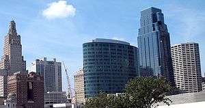
The Nelson-Atkins Museum opened its Euro-Style Bloch addition in 2007, and the Safdie-designed Kauffman Center for the Performing Arts opened in 2011. The Power and Light Building is influenced by the Art Deco style and sports a glowing sky beacon. The new world headquarters of H&R Block is a 20-story all-glass oval bathed in a soft green light. The four industrial artworks atop the support towers of the Kansas City Convention Center (Bartle Hall) were once the subject of ridicule, but now define the night skyline near the new Sprint Center along with One Kansas City Place (Missouri's tallest office tower), the KCTV-Tower (Missouri's tallest freestanding structure) and the Liberty Memorial, a World War I memorial and museum that flaunts simulated flames and smoke billowing into the night skyline. Kansas City is home to significant national and international architecture firms including ACI Boland, BNIM, 360 Architecture, HNTB, Populous. Frank Lloyd Wright designed two private residences and Community Christian Church there.
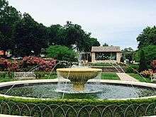
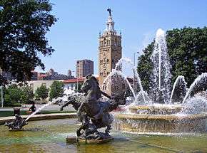
Kansas City hosts over 200 working fountains. Notable examples are located on the Country Club Plaza. Designs range from French-inspired traditional to modern. Highlights include the Black Marble H&R Block fountain in front of Union Station, which features synchronized water jets; the Nichols Bronze Horses at the corner of Main and J,C, Nichols Parkway at the entrance to the Plaza Shopping District; and the fountain at Hallmark Cards World Headquarters in Crown Center.
City Market
Since its inception in 1857, City Market has been one of the largest and most enduring public farmers' markets in the American Midwest, linking growers and small businesses to the community. More than 30 full-time merchants operate year-round and offer specialty foods, fresh meats and seafood, restaurants and cafes, floral, home accessories and more.[17] The City Market is also home to the Arabia Steamboat Museum, which houses artifacts from a steamboat that sank near Kansas City in 1856.[17]
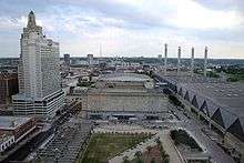
Downtown
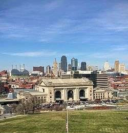
Downtown Kansas City is an area of 2.9 square miles (7.5 km2) bounded by the Missouri River to the north, 31st Street to the south, Troost Avenue to the East, and State Line Road to the west. Areas near Downtown Kansas City include the 39th Street District, which is known as Restaurant Row,[18] and features one of Kansas City's largest selections of independently owned restaurants and boutique shops. It is a center of literary and visual arts, and bohemian culture. Crown Center is the headquarters of Hallmark Cards and a major downtown shopping and entertainment complex. It is connected to Union Station by a series of covered walkways. The Country Club Plaza, or simply "the Plaza", is an upscale, outdoor shopping and entertainment district. It was the first suburban shopping district in the United States,[19] designed to accommodate shoppers arriving by automobile,[20] and is surrounded by apartments and condominiums, including a number of high rise buildings. The associated Country Club District to the south includes the Sunset Hill and Brookside neighborhoods, and is traversed by Ward Parkway, a landscaped boulevard known for its statuary, fountains and large, historic homes. Kansas City's Union Station is home to Science City, restaurants, shopping, theaters, and the city's Amtrak facility.
After years of neglect and seas of parking lots, Downtown Kansas City currently is undergoing a period of change with over $6 billion in development since 2000. Many residential properties recently have been or currently are under redevelopment in three surrounding warehouse loft districts and the Central Business District. The Power & Light District, a new, nine-block entertainment district comprising numerous restaurants, bars, and retail shops, was developed by the Cordish Company of Baltimore, Maryland. Its first tenant opened on November 9, 2007. It is anchored by the Sprint Center, a 19,000-seat complex that has become a top draw for sports and musical entertainment. Elton John was the first performer to play at the Sprint Center.
Climate
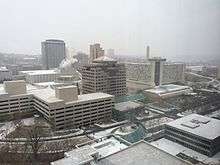
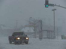

Kansas City lies in the Midwestern United States, as well as near the geographic center of the country, at the confluence of the longest river in the country, the Missouri River, and the Kansas River (also known as the Kaw River). The city lies in the northern periphery of the humid subtropical zone.[21] but is interchangeable with the humid continental climate due to roughly 104 air frosts on average per annum.[22] The city is part of USDA plant hardiness zones 5b and 6a.[23] Being located in the center of North America, far removed from a significant body of water, there is significant potential for extremes of hot and cold swings in temperature all year long. Unless otherwise stated, normal figures below are based on 1981–2010 data at Downtown Airport. The warmest month of the year is July, with a 24-hour average temperature of 81.0 °F (27.2 °C). The summer months are hot and unbearably humid, with moist air riding up from the Gulf of Mexico, and high temperatures surpass 100 °F (38 °C) on 5.6 days of the year, and 90 °F (32 °C) on 47 days.[24][25] The coldest month of the year is January, with an average temperature of 31.0 °F (−0.6 °C). Winters are cold, with 22 days where the high temperature is at or below 32.0 °F (0.0 °C) and 2.5 nights with a low at or below 0 °F (−18 °C).[24] The official record highest temperature is 113 °F (45 °C), set on August 14, 1936 at Downtown Airport, while the official record lowest is −23 °F (−31 °C), set on December 22 and 23, 1989.[24] Normal seasonal snowfall is 13.4 inches (34 cm) at Downtown Airport and 18.8 in (48 cm) at Kansas City International Airport. The average window for freezing temperatures is October 31 to April 4, while for measurable (0.1 in or 0.25 cm) snowfall, it is November 27 to March 16 as measured at Kansas City International Airport. Precipitation, both in frequency and total accumulation, shows a marked uptick in late spring and summer.
Kansas City is situated on the edge of the "Tornado Alley", a broad region where cold air from the Rocky Mountains in Canada collides with warm air from the Gulf of Mexico, leading to the formation of powerful storms, especially during the spring. A few areas of the Kansas City metropolitan area have had some severe outbreaks of tornadoes at different points in the past, including the Ruskin Heights tornado in 1957,[26] and the May 2003 tornado outbreak sequence. The region can also fall victim to the sporadic ice storm during the winter months, such as the 2002 ice storm during which hundreds of thousands of residents lost power for days and (in some cases) weeks.[27] Kansas City and its outlying areas are also subject to flooding, including the Great Floods of 1951 and 1993.
| Climate data for Kansas City, Missouri (Downtown Airport), 1981–2010 normals,[lower-alpha 1] extremes 1934–present) | |||||||||||||
|---|---|---|---|---|---|---|---|---|---|---|---|---|---|
| Month | Jan | Feb | Mar | Apr | May | Jun | Jul | Aug | Sep | Oct | Nov | Dec | Year |
| Record high °F (°C) | 76 (24) |
83 (28) |
89 (32) |
94 (34) |
103 (39) |
108 (42) |
112 (44) |
113 (45) |
109 (43) |
98 (37) |
83 (28) |
74 (23) |
113 (45) |
| Mean maximum °F (°C) | 61.5 (16.4) |
68.1 (20.1) |
78.1 (25.6) |
84.4 (29.1) |
89.3 (31.8) |
94.8 (34.9) |
100.1 (37.8) |
100.3 (37.9) |
93.3 (34.1) |
84.8 (29.3) |
73.5 (23.1) |
62.8 (17.1) |
102.1 (38.9) |
| Average high °F (°C) | 39.5 (4.2) |
44.6 (7) |
56.2 (13.4) |
66.7 (19.3) |
75.9 (24.4) |
85.0 (29.4) |
90.1 (32.3) |
88.6 (31.4) |
80.0 (26.7) |
67.8 (19.9) |
54.2 (12.3) |
41.8 (5.4) |
65.9 (18.8) |
| Average low °F (°C) | 22.4 (−5.3) |
26.3 (−3.2) |
35.8 (2.1) |
46.6 (8.1) |
57.1 (13.9) |
66.7 (19.3) |
72.0 (22.2) |
70.2 (21.2) |
60.5 (15.8) |
48.9 (9.4) |
36.6 (2.6) |
25.6 (−3.6) |
47.4 (8.6) |
| Mean minimum °F (°C) | 3.7 (−15.7) |
6.5 (−14.2) |
16.9 (−8.4) |
30.6 (−0.8) |
43.2 (6.2) |
54.6 (12.6) |
62.0 (16.7) |
59.4 (15.2) |
44.3 (6.8) |
32.8 (0.4) |
20.0 (−6.7) |
5.3 (−14.8) |
−2.7 (−19.3) |
| Record low °F (°C) | −14 (−26) |
−13 (−25) |
−3 (−19) |
16 (−9) |
32 (0) |
44 (7) |
52 (11) |
48 (9) |
34 (1) |
21 (−6) |
5 (−15) |
−19 (−28) |
−19 (−28) |
| Average precipitation inches (mm) | 1.14 (29) |
1.48 (37.6) |
2.15 (54.6) |
3.71 (94.2) |
5.13 (130.3) |
5.52 (140.2) |
3.97 (100.8) |
4.39 (111.5) |
4.16 (105.7) |
3.52 (89.4) |
2.14 (54.4) |
1.75 (44.4) |
39.06 (992.1) |
| Average snowfall inches (cm) | 4.1 (10.4) |
3.2 (8.1) |
0.9 (2.3) |
0.2 (0.5) |
0 (0) |
0 (0) |
0 (0) |
0 (0) |
0 (0) |
0.3 (0.8) |
0.3 (0.8) |
4.4 (11.2) |
13.4 (34) |
| Average precipitation days (≥ 0.01 in) | 4.8 | 5.3 | 7.6 | 9.4 | 11.0 | 10.2 | 7.9 | 7.5 | 8.1 | 7.5 | 6.1 | 5.4 | 90.8 |
| Average snowy days (≥ 0.1 in) | 2.5 | 2.1 | 0.6 | 0.1 | 0 | 0 | 0 | 0 | 0 | 0.1 | 0.4 | 2.5 | 8.3 |
| Source: NOAA[28][29][30] | |||||||||||||
| Climate data for Kansas City Int'l, Missouri (1981–2010 normals,[lower-alpha 1] extremes 1888–present)[lower-alpha 2] | |||||||||||||
|---|---|---|---|---|---|---|---|---|---|---|---|---|---|
| Month | Jan | Feb | Mar | Apr | May | Jun | Jul | Aug | Sep | Oct | Nov | Dec | Year |
| Record high °F (°C) | 75 (24) |
83 (28) |
91 (33) |
95 (35) |
103 (39) |
108 (42) |
112 (44) |
113 (45) |
109 (43) |
98 (37) |
83 (28) |
74 (23) |
113 (45) |
| Mean maximum °F (°C) | 60.6 (15.9) |
67.4 (19.7) |
78.4 (25.8) |
84.5 (29.2) |
88.2 (31.2) |
92.9 (33.8) |
98.1 (36.7) |
99.0 (37.2) |
92.6 (33.7) |
84.9 (29.4) |
72.5 (22.5) |
61.9 (16.6) |
100.5 (38.1) |
| Average high °F (°C) | 38.0 (3.3) |
43.3 (6.3) |
55.1 (12.8) |
65.7 (18.7) |
74.8 (23.8) |
83.5 (28.6) |
88.3 (31.3) |
87.4 (30.8) |
79.0 (26.1) |
66.9 (19.4) |
53.2 (11.8) |
40.3 (4.6) |
64.6 (18.1) |
| Average low °F (°C) | 19.6 (−6.9) |
23.8 (−4.6) |
33.4 (0.8) |
44.0 (6.7) |
54.2 (12.3) |
63.6 (17.6) |
68.4 (20.2) |
66.8 (19.3) |
57.3 (14.1) |
45.9 (7.7) |
34.1 (1.2) |
22.6 (−5.2) |
44.5 (6.9) |
| Mean minimum °F (°C) | −0.1 (−17.8) |
2.6 (−16.3) |
13.8 (−10.1) |
27.0 (−2.8) |
40.0 (4.4) |
50.3 (10.2) |
57.9 (14.4) |
55.1 (12.8) |
40.3 (4.6) |
28.6 (−1.9) |
16.7 (−8.5) |
1.7 (−16.8) |
−7 (−22) |
| Record low °F (°C) | −20 (−29) |
−22 (−30) |
−10 (−23) |
12 (−11) |
27 (−3) |
42 (6) |
51 (11) |
43 (6) |
31 (−1) |
17 (−8) |
1 (−17) |
−23 (−31) |
−23 (−31) |
| Average precipitation inches (mm) | 1.07 (27.2) |
1.46 (37.1) |
2.37 (60.2) |
3.70 (94) |
5.23 (132.8) |
5.23 (132.8) |
4.45 (113) |
3.89 (98.8) |
4.62 (117.3) |
3.16 (80.3) |
2.15 (54.6) |
1.53 (38.9) |
38.86 (987) |
| Average snowfall inches (cm) | 4.6 (11.7) |
5.4 (13.7) |
2.0 (5.1) |
0.6 (1.5) |
0 (0) |
0 (0) |
0 (0) |
0 (0) |
0 (0) |
0.2 (0.5) |
1.2 (3) |
4.8 (12.2) |
18.8 (47.8) |
| Average precipitation days (≥ 0.01 in) | 6.3 | 7.1 | 9.5 | 11.0 | 11.5 | 10.8 | 9.0 | 8.3 | 8.6 | 8.2 | 7.3 | 7.2 | 104.8 |
| Average snowy days (≥ 0.1 in) | 4.0 | 3.5 | 1.6 | 0.5 | 0 | 0 | 0 | 0 | 0 | 0.1 | 1.2 | 3.7 | 14.6 |
| Average relative humidity (%) | 68.8 | 69.6 | 66.7 | 62.9 | 68.0 | 69.2 | 67.4 | 70.0 | 70.4 | 67.1 | 69.7 | 71.0 | 68.4 |
| Mean monthly sunshine hours | 183.7 | 174.3 | 223.9 | 257.8 | 285.0 | 305.5 | 329.3 | 293.9 | 240.5 | 213.6 | 155.3 | 147.1 | 2,809.9 |
| Percent possible sunshine | 61 | 58 | 60 | 65 | 64 | 68 | 73 | 69 | 64 | 62 | 52 | 50 | 63 |
| Source: NOAA (relative humidity and sun 1961–1990)[28][31][32][33] | |||||||||||||
Demographics
| Historical population | |||
|---|---|---|---|
| Census | Pop. | %± | |
| 1860 | 4,418 | — | |
| 1870 | 32,260 | 630.2% | |
| 1880 | 55,785 | 72.9% | |
| 1890 | 132,716 | 137.9% | |
| 1900 | 163,752 | 23.4% | |
| 1910 | 248,381 | 51.7% | |
| 1920 | 324,410 | 30.6% | |
| 1930 | 399,746 | 23.2% | |
| 1940 | 399,178 | −0.1% | |
| 1950 | 456,622 | 14.4% | |
| 1960 | 473,539 | 3.7% | |
| 1970 | 507,330 | 7.1% | |
| 1980 | 448,028 | −11.7% | |
| 1990 | 435,146 | −2.9% | |
| 2000 | 441,545 | 1.5% | |
| 2010 | 459,787 | 4.1% | |
| Est. 2015 | 475,378 | [34] | 3.4% |
| Year | Population | ±% | Area[36] | Density |
|---|---|---|---|---|
| 1853 | 2,500 | - | 1.04 | 2,404 |
| 1860 | 4,418 | +76.7% | 3.89 | 1,136 |
| 1870 | 32,260 | +630.2% | 3.89 | 8,293 |
| 1880 | 55,785 | +72.9% | 5.17 | 10,790 |
| 1890 | 132,716 | +137.9% | 13.24 | 10,024 |
| 1900 | 163,752 | +23.4% | 26.67 | 6,140 |
| 1910 | 248,381 | +51.7% | 59.8 | 4,154 |
| 1920 | 324,410 | +30.6% | 59.8 | 5,425 |
| 1930 | 399,746 | +23.2% | 59.8 | 6,685 |
| 1940 | 400,178 | +0.1% | 59.8 | 6,692 |
| 1950 | 456,622 | +14.1% | 80.98 | 5,639 |
| 1960 | 475,539 | +4.1% | 128.4 | 3,704 |
| 1970 | 507,087 | +6.6% | 314.5 | 1,612 |
| 1980 | 448,159 | -11.6% | 314.5 | 1,425 |
| 1990 | 435,146 | -2.9% | 317.44 | 1,371 |
| 2000 | 441,545 | +1.5% | 317.46 | 1,391 |
| 2010 | 459,787 | +4.1% | 319.03 | 1,441 |
| 2015 Est. | 475,378 | +1% | 319.03 | 1,474 |
According to the 2010 census, the racial composition of Kansas City was as follows:
- White: 59.2% (non-Hispanic white: 54.9%)
- Black or African American: 29.9%
- Hispanic or Latino (of any race): 10.0%
- Some other race: 4.5% (primarily Latino)
- Two or more races: 3.2%
- Asian: 2.5%
- Native American: 0.5%
- Native Hawaiian and other Pacific Islander: 0.2%
Kansas City has the second largest Sudanese and Somali populations in the United States. The Latino/Hispanic population of Kansas City, which is heavily Mexican and Central American, is spread throughout the metropolitan area, with some concentration in the northeast part of the city and southwest of downtown. The Asian population, mostly Southeast Asian, is partly concentrated within the northeast side to the Columbus Park neighborhood in the Greater Downtown area, a historical Italian American neighborhood, the UMKC area and in River Market, in northern Kansas City.[37][38][39]
The Historic Kansas City boundary is roughly 58 square miles (150 km2) and has a population density of about 5,000 people per sq. mi. It runs from the Missouri River to the north, 79th Street to the south, the Blue River to the east, and State Line Road to the west. During the 1960s and 1970s, Kansas City annexed large amounts of land, which are largely undeveloped to this day.
Between the 2000 and 2010 Census counts, the urban core of Kansas City continued to drop significantly in population. The areas of Greater Downtown in the center city, and sections near I-435 and I-470 in the south, and Highway 152 in the north are the only areas of Kansas City, Missouri, to have seen an increase in population, with the Northland seeing the greatest population growth.[40]
| Racial composition | 2010[14] | 1990[11] | 1970[11] | 1940[11] |
|---|---|---|---|---|
| White | 59.2% | 66.8% | 77.2% | 89.5% |
| —Non-Hispanic white | 54.9% | 65.0% | 75.0%[41] | N/A |
| Black or African American | 29.9% | 29.6% | 22.1% | 10.4% |
| Hispanic or Latino (of any race) | 10.0% | 3.9% | 2.7%[41] | N/A |
Economy
The federal government is the largest employer in the Kansas City metro area. More than 146 federal agencies maintain a presence there. Kansas City is one of ten regional office cities for the US government.[42] The Internal Revenue Service maintains a large service center in Kansas City that occupies nearly 1,400,000 square feet (130,000 m2).[43] It is one of only two sites to process paper returns.[44] The IRS has approximately 2,700 full-time employees in Kansas City, growing to 4,000 during tax season. The General Services Administration has more than 800 employees. Most are located at the Bannister Federal Complex in South Kansas City. The Bannister Complex is also home to the Kansas City Plant, which is a National Nuclear Security Administration facility operated by Honeywell. Honeywell employs nearly 2,700 at the Kansas City Plant, which produces and assembles 85% of the non-nuclear components of the United States nuclear bomb arsenal.[45] The Social Security Administration has more than 1,700 employees in the Kansas City area, with more than 1,200 located at its downtown Mid-America Program Service Center (MAMPSC).[46] The United States Postal Service operates post offices in Kansas City. The Kansas City Main Post Office is located at 300 West Pershing Road.[47]
Ford Motor Company operates a large manufacturing facility in Claycomo at the Ford Kansas City Assembly Plant, which currently builds the Ford F-150. The General Motors Fairfax Assembly Plant is located in adjacent Kansas City, Kansas. Smith Electric Vehicles builds electric vehicles in the former TWA/American Airlines overhaul facility at Kansas City International Airport.
One of the largest US drug manufacturing plants is the Sanofi-Aventis plant located in south Kansas City on a campus developed by Ewing Kauffman's Marion Laboratories.[48] Of late, it has been developing academic and economic institutions related to animal health sciences, an effort most recently bolstered by the selection of Manhattan, Kansas, at one end of the[49] Kansas City Animal Health Corridor, as the site for the National Bio and Agro-Defense Facility, which researches animal diseases.
Numerous agriculture companies operate out of the city. Dairy Farmers of America, the largest dairy co-op in the United States is located here. Kansas City Board of Trade is the principal trading exchange for hard red winter wheat, the principal ingredient of bread. The National Association of Intercollegiate Athletics and The National Association of Basketball Coaches are based in Kansas City.
The business community is serviced by two major business magazines, the Kansas City Business Journal (published weekly) and Ingram's Magazine (published monthly), as well as other publications, including a local society journal, the Independent (published weekly).
The Kansas City Federal Reserve Bank built a new building that opened in 2008 near Union Station. Missouri is the only state to have two of the 12 Federal Reserve Bank headquarters (the second is in St. Louis). Kansas City's effort to get the bank was helped by former mayor James A. Reed, who as senator, broke a tie to pass the Federal Reserve Act.[50]
The national headquarters for the Veterans of Foreign Wars is headquartered just south of Downtown.
With a Gross Metropolitan Product of $41.68 billion in 2004, Kansas City's (Missouri side only) economy makes up 20.5% of Missouri's gross state product.[51] In 2014, Kansas City was ranked #6 for real estate investment.[52]
Three international law firms, Lathrop & Gage, Stinson Leonard Street, and Shook, Hardy & Bacon are based in the city.
Headquarters
The following notable companies are currently headquartered in Kansas City, Missouri:
- 360 Architecture
- American Century Investments
- AMC Theatres
- Andrews McMeel Universal
- Applebee's
- Assurant Employee Benefits
- Barkley Inc.
- Bernstein-Rein
- Black & Veatch's Global Water Business
- Blue Cross and Blue Shield of Kansas City
- BNIM
- Boulevard Brewing Company
- Cerner
- Children International
- Commerce Bancshares
- Copaken, White & Blitt
- Freightquote.com
- Great Plains Energy
- Hallmark Cards
- H&R Block
- HNTB
- Hostess Brands
- J.E. Dunn Construction Group
- Kansas City Southern Railway
- Lockton Companies
- Novastar Financial
- Populous
- Russell Stover Candies
- Smith Electric Vehicles
- UMB Financial Corporation
- Veterans of Foreign Wars
- Walton Construction
Top employers
According to the city's Fiscal Year 2014-15 Comprehensive Annual Financial Report,[53] the top ten principal employers are as follows:
| Rank | Employer | Employees | Percentage of Total Employment |
|---|---|---|---|
| 1. | Public School System | 30,172 | 2.92% |
| 2. | Federal Government | 30,000 | 2.91% |
| 3. | State/County/City Government | 24,616 | 2.39% |
| 4. | Cerner Corporation | 10,128 | 0.98% |
| 5. | HCA Midwest Health System | 9,753 | 0.94% |
| 6. | Saint Luke's Health System | 7,550 | 0.73% |
| 7. | Children's Mercy Hospitals and Clinics | 6,305 | 0.61% |
| 8. | Sprint Corporation | 6,300 | 0.61% |
| 9. | The University of Kansas Hospital | 6,030 | 0.58% |
| 10. | Hallmark Cards, Inc. | 4,600 | 0.45% |
Culture
Abbreviations and nicknames
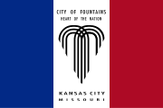
Kansas City is often abbreviated as KC (abbreviations often refer to the metropolitan area). It is officially nicknamed the "City of Fountains". The fountains at Kauffman Stadium, commissioned by original Kansas City Royals owner Ewing Kauffman, are the largest privately funded fountains in the world.[54] The city has more boulevards than any other city except Paris and has been called "Paris of the Plains". Soccer's popularity, at both professional and youth levels, as well as Children's Mercy Park's popularity as a home stadium for the U.S. Men's National Team has to the appellation as the " Soccer Capital of America". Residents are known as Kansas Citians. The city is sometimes referred to as the "Heart of America", as it is near both the population center of the United States and the geographic center of the 48 contiguous states.
Performing arts
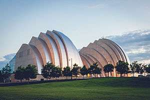
The Kansas City Repertory Theatre is the metropolitan area's top professional theatre company. The Starlight Theatre is an 8,105-seat outdoor theatre designed by Edward Delk. The Kansas City Symphony was founded by R. Crosby Kemper Jr. in 1982 to replace the defunct Kansas City Philharmonic, which was founded in 1933. The symphony performs at the Kauffman Center for the Performing Arts. The current music director and lead conductor of the symphony is Michael Stern. Lyric Opera of Kansas City, founded in 1958, performs at the Kauffman Center, offers one American contemporary opera production during its season, consisting of either four or five productions. The Civic Opera Theater of Kansas City performs at the downtown Folly Theater and at the UMKC Performing Arts Center. Every summer from mid-June to early July, The Heart of America Shakespeare Festival performs at Southmoreland Park near the Nelson-Atkins Museum; the festival was founded by Marilyn Strauss in 1993.
The Kansas City Ballet, founded in 1957 by Tatiana Dokoudovska, is a ballet troupe comprising 25 professional dancers and apprentices. Between 1986 and 2000, it combined with Dance St. Louis to form the State Ballet of Missouri, although it remained in Kansas City. From 1980 to 1995, the Ballet was run by dancer and choreographer Todd Bolender. Today, the Ballet offers an annual repertory split into three seasons, performing classical to contemporary ballets.[55] The Ballet also performs at the Kauffman Center. Kansas City is home to The Kansas City Chorale, a professional 24-voice chorus conducted by Charles Bruffy. The chorus performs an annual concert series and a concert in Phoenix each year with their sister choir, the Phoenix Chorale. The Chorale has made nine recordings (three with the Phoenix Chorale).[56]
Kansas City jazz in the 1930s marked the transition from big bands to the bebop influence of the 1940s. The 1979 documentary The Last of the Blue Devils portrays this era in interviews and performances by local jazz notables. In the 1970s, Kansas City attempted to resurrect the glory of the jazz era in a family-friendly atmosphere. In the 1970s, an effort to open jazz clubs in the River Quay area of City Market along the Missouri ended in a gang war. Three of the new clubs were blown up in what ultimately ended Kansas City mob influence in Las Vegas casinos. The annual "Kansas City Blues and Jazz Festival" attracts top jazz stars and large out-of-town audiences. It was rated Kansas City's "best festival." by Pitch.com.[57]
Live music venues are found throughout the city, with the highest concentration in the Westport entertainment district centered on Broadway and Westport Road near the Country Club Plaza, as well as the 18th & Vine area (jazz music). A variety of music genres can be heard and have originated there, including musicians Janelle Monáe, Puddle of Mudd, Isaac James, The Get Up Kids, Shiner, Flee The Seen, The Life and Times, Reggie and the Full Effect, Coalesce, The Casket Lottery, The Gadjits, The Rainmakers, Vedera, The Elders, Blackpool Lights, The Republic Tigers, Tech N9ne, Krizz Kaliko, Kutt Calhoun, Skatterman & Snug Brim, Mac Lethal, and Solè.
Irish culture
The large community of Irish-Americans numbers over 50,000.[58] The Irish were the first large immigrant group to settle in Kansas City and founded its first newspaper.[59] The Irish community includes bands, dancers, newspapers, Irish stores and the Irish Museum and Cultural Center. The first book that detailed the history of the Irish in Kansas City was Missouri Irish: Irish Settlers on the American Frontier, published in 1984.
Casinos
Missouri voters approved riverboat casino gaming on the Missouri and Mississippi Rivers by referendum with a 63% majority on November 3, 1992. The first casino facility in the state opened in September 1994 in North Kansas City by Harrah's Entertainment (now Caesar's Entertainment).[60] The combined revenues for four casinos exceeded $153 million per month in May 2008.[61] The metropolitan area is currently home to six casinos: Ameristar Kansas City, Argosy Kansas City, Harrah's North Kansas City, Isle of Capri Kansas City, the 7th Street Casino (which opened in Kansas City, Kansas, in 2008) and Hollywood Casino (which opened in February 2012 in Kansas City, Kansas).
Cuisine
Kansas City is most famous for its steak and barbecue. During the heyday of the Kansas City Stockyards, the city was known for its Kansas City steaks or Kansas City strip steaks. The most famous of its steakhouses is the Golden Ox in the Kansas City Live Stock Exchange in the West Bottoms stockyards. These stockyards were second only to those of Chicago in size, but they never recovered from the Great Flood of 1951 and eventually closed. Founded in 1938, Jess & Jim's Steakhouse in the Martin City neighborhood was also well known.
The Kansas City Strip cut of steak is similar to the New York Strip cut, and is sometimes referred to just as a strip steak. Along with Texas, Memphis, North and South Carolina, Kansas City is lauded as a "world capital of barbecue." More than 90 barbecue restaurants[62] operate in the metropolitan area. The American Royal each fall hosts what it claims is the world's biggest barbecue contest.
Classic Kansas City-style barbecue was an inner-city phenomenon that evolved from the pit of Henry Perry from Memphis in the early 20th century and blossomed in the 18th and Vine neighborhood. Arthur Bryant's took over the Perry restaurant and added molasses to sweeten the recipe. In 1946 one of Perry's cooks opened Gates and Sons Bar-B-Q.
.jpg)
The Gates recipe added even more molasses. Bryant's and Gates are the two definitive Kansas City barbecue restaurants. Both have only recently begun expanding outside of Kansas City. Fiorella's Jack Stack Barbecue is also well regarded. In 1977, Rich Davis, a psychiatrist, test-marketed his own concoction called K.C. Soul Style Barbecue Sauce. He renamed it KC Masterpiece, and in 1986, he sold the recipe to the Kingsford division of Clorox. Davis retained rights to operate restaurants using the name and sauce. In 2009, Kansas City appeared on Newsmax magazine's list of the "Top 25 Most Uniquely American Cities and Towns," a piece written by current CBS News travel editor Peter Greenberg. In determining his ranking, Greenberg cited the city's barbecue, among other factors.[63]
Kansas City has several James Beard Award-winning/nominated chefs and restaurants. Winning chefs include Michael Smith, Celina Tio, Colby Garrelts, Debbie Gold, Jonathan Justus and Martin Heuser. A majority of the Beard Award-winning restaurants are located in the Crossroads district, downtown and in Westport.
Points of interest
| Name | Description | Photo |
|---|---|---|
| Country Club Plaza District | A district developed in 1922 featuring Spanish-styled architecture and upscale shops and restaurants. Two universities have locations near the district (University of Missouri-Kansas City and the Kansas City Art Institute). The Kemper Museum of Contemporary Art and the Nelson-Atkins Museum of Art are located around the district as well. | 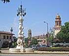 |
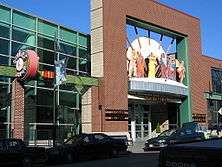
| 18th & Vine District | Cradle of distinctive Kansas City styled jazz. Home of the Negro Leagues Baseball Museum, American Jazz Museum, and the future home of the MLB Urban Youth Academy. The district contains several jazz clubs and venues, such as the Gem Theater and the Blue Room. There are currently talks of the city diverting $27 million to the district to connect the district to the rest of downtown.[64] | |
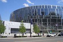
| Crossroads Arts District | Home to several restaurants, art galleries, and hotels. First Friday is a popular monthly event in the district. Pop-up galleries, food trucks, venue deals, and music events are planned for First Fridays. Union Station and the Kauffman Center are located within the district. Union Station also has exhibits that change frequently, as well as Science City within the building. | .jpg) |
| Westport District | Originally a separate town before being annexed by Kansas City, the district contains several restaurants, shops, and nightlife options. Along with the Power and Light District, it serves as one of the city's main entertainment areas. The University of Kansas Hospital is located very close to the district, just across State Line Road. | 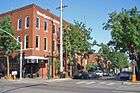 |
| Power and Light District | A new shopping and entertainment district within the Central Business District. It was developed by the Cordish Companies; several apartment towers are being constructed by the company as well. The Sprint Center is located within the district and is a major anchor development for the area. The Midland Theater, a popular concert venue, is also in the district. | 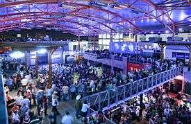 |
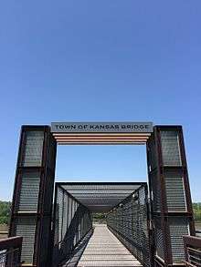
| River Market District/ Berkley Riverfront Park | Kansas City's original neighborhood, located right on the Missouri River. The district contains one of the country's largest and longest lasting public farmers' markets in the nation. There are several unique shops and restaurants throughout the area. Steamboat Arabia Museum is right next to the City Market. Residents and visitors traveling by foot or bike can take the Town of Kansas Bridge connection to get to the Riverfront Heritage Trail which leads to Berkley Riverfront Park, which is operated by Port KC. |  |
| Crown Center | A district developed by Hallmark. Within Crown Center, kids can enjoy an aquarium, Legoland, and Kaleidoscope. There are several mid to upscale stores, and visitors can stay at the Sheraton Crown Center or the Westin Crown Center. The district is a short walk from Liberty Memorial (which features a world-class World War One museum). Visitors can connect to Union Station and the rest of Crown Center via a skywalk called the Link. | 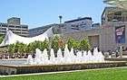 |
| The West Bottoms | The West Bottoms used to be used primarily as stockyards and for industrial uses, but today the district is slowly being revitalized through the development and redevelopment of apartments and shops. The district is home to the soon-to-be repurposed Kemper Arena, which regularly hosted the American Royal. The arena hosted the 1976 Republican National Convention. |  |
| Kansas City, North | The city north of the Missouri River has several attractions. There's Zona Rosa, a mixed-used development that has a large variety of shopping, dining, and events. Directly across the river is the Charles Wheeler Downtown Airport; it features the Aviation History Museum. The city's northern area also has an amusement park, Worlds of Fun, as well as a water park called Oceans of Fun; the two are operated under the same management and located right next to each other. | 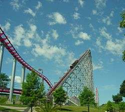 |
| Swope Park | Swope Park has an area of 1,805 acres, and it contains several attractions. The award winning Kansas City Zoo, encompassing some 200 acres, features over 1,000 animals from across the planet; it was ranked as one of the top 60 zoos in the United States. Starlight Theatre, the second largest outdoor musical theatre venue in the U.S., is also within the park.[65] | 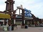 |
Religion
The proportion of Kansas City area residents with a known religious affiliation is 49.7%. The most common religious denominations in the area are:[66]
- None/No affiliation 50.3%
- Catholic 12.82%
- Other Christian 7.15%
- Baptist (African American denominations) 6.72%
- Baptist (Other) 6.46%
- Methodist 5.87%
- Pentecostal 2.60%
- Latter-day Saint 2.48%
- Lutheran 2.30%
Walt Disney in Kansas City
In 1911, Elias Disney moved his family from Marceline to Kansas City. They lived in a new home with a garage built by Elias Disney, which became the location for Walt's very first animation, at 3028 Bellefontaine.[67] In 1919, Walt Disney returned from France where he had served as a Red Cross Ambulance Driver in World War I. Walt started the first animation company Laugh-O-Gram Studio in Kansas City. Later, the company went bankrupt, Walt Disney moved to Hollywood, and started The Walt Disney Company on October 16, 1923.
Sports
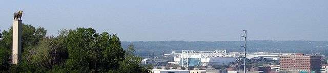
Professional sports teams in Kansas City include the Kansas City Chiefs in the National Football League (NFL), the Kansas City Royals in Major League Baseball (MLB), Sporting Kansas City in Major League Soccer (MLS), and FC Kansas City in the National Women's Soccer League.
Professional football
The Chiefs – now a member of the NFL's American Football Conference (AFC) – started play in 1960 as the Dallas Texans and they moved to Kansas City in 1963. The team lost Super Bowl I to the Green Bay Packers. They came back in 1969 to become the last ever AFL champions and win Super Bowl IV against NFL champions Minnesota Vikings with a score of 23-7.
Professional baseball
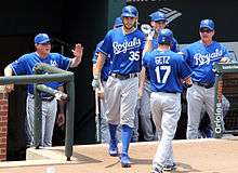
The Athletics baseball franchise played in the city from 1955, after moving from Philadelphia, to 1967, when the team relocated to Oakland, California. The city's current Major League Baseball franchise, the Royals, started play in 1969, and are the only major league sports franchise in Kansas City that has neither relocated nor changed its name. The Royals were the first American League expansion team to reach the playoffs, in 1976, to reach the World Series in 1980, and to win the World Series in 1985. The Royals returned to the World Series in 2014 and won in 2015.
Professional soccer
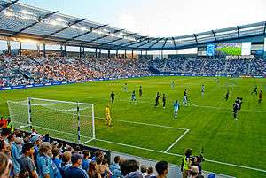
The Kansas City Wiz became a charter member of Major League Soccer in 1996. It was renamed the Wizards in 1997. In 2011, the team was renamed Sporting Kansas City and moved to its new stadium Children's Mercy Park in Kansas City, Kansas. Sporting's reserve team, Swope Park Rangers, plays at Swope Soccer Village in Swope Park. FC Kansas City began play in 2013 as an expansion team of the National Women's Soccer League; the team's home games are held at Swope Soccer Village as well.
College athletics
In college athletics, Kansas City has lately been the home of the Big 12 College Basketball Tournaments. The men's tournament has been played at Sprint Center since March 2008. The women's tournament is played at Municipal Auditorium.
In addition to serving as the Chiefs' home stadium, Arrowhead Stadium serves as the venue for various intercollegiate football games. It has hosted the Big 12 Championship Game five times. On the last weekend in October, the MIAA Fall Classic rivalry game between Northwest Missouri State University and Pittsburg State University took place at the stadium.
Professional rugby
Kansas City is represented on the rugby pitch by the Kansas City Blues RFC, a former member of the Rugby Super League and a current Division 1 club. The team works closely with Sporting Kansas City and splits home-games between Sporting's training pitch and Rockhurst University's stadium.
| Club | Sport | Founded | League | Venue |
|---|---|---|---|---|
| Kansas City Chiefs | Football | 1960 (as the Dallas Texans) 1963 (as Kansas City Chiefs) |
National Football League | Arrowhead Stadium |
| Kansas City Royals | Baseball | 1969 | Major League Baseball | Kauffman Stadium |
| Sporting Kansas City | Soccer | 1996 | Major League Soccer | Children's Mercy Park (Kansas City, Kansas) |
| Swope Park Rangers | Soccer | 2016 | United Soccer League | Swope Soccer Village |
| FC Kansas City | Women's Soccer | 2013 | National Women's Soccer League | Swope Soccer Village |
| Missouri Mavericks | Hockey | 2009 | ECHL (Div. 3) | Silverstein Eye Centers Arena (Independence) |
| Missouri Comets | Indoor Soccer | 2010 | Major Arena Soccer League | Silverstein Eye Centers Arena (Independence) |
| Kansas City Blues | Rugby Union | 1966 | USA Rugby Division 1 | Swope Park Training Complex |
| Kansas City Storm | Women's football | 2004 | WTFA | North Kansas City High School |
Parks and boulevards
Kansas City has 132 miles (212 km) of boulevards and parkways, 214 urban parks, 49 ornamental fountains, 152 ball diamonds, 10 community centers, 105 tennis courts, 5 golf courses, 5 museums and attractions, 30 pools, and 47 park shelters.[68][69] These amenities are found across the city. Much of the system, designed by George E. Kessler, was constructed from 1893 to 1915.
Cliff Drive, in Kessler Park on the North Bluffs, is a designated State Scenic Byway. It extends 4.27 miles (6.87 km) from The Paseo and Independence Avenue through Indian Mound on Gladstone Boulevard at Belmont Boulevard, with many historical points and architectural landmarks.
Ward Parkway, on the west side of the city near State Line Road, is lined by many of the city's largest and most elaborate homes.
The Paseo is a major north–south parkway that runs 19 miles (31 km) through the center of the city beginning at Cliff Drive. It was modeled on the Paseo de la Reforma, a fashionable Mexico City boulevard.
Swope Park is one of the nation's largest city parks, comprising 1,805 acres (730 ha), more than twice the size of New York City's Central Park.[70] It features a zoo, a woodland nature and wildlife rescue center, 2 golf courses, 2 lakes, an amphitheatre, a day-camp, and numerous picnic grounds. Hodge Park, in the Northland, covers 1,029 acres (416 ha) (1.61 sq. mi.). This park includes the 80-acre (320,000 m2) Shoal Creek Living History Museum, a village of more than 20 historical buildings dating from 1807 to 1885. Riverfront Park, 955 acres (3.86 km2) on the banks of the Missouri River on the north edge of downtown, holds annual Independence Day celebrations and other festivals.
A program went underway to replace many of the fast-growing sweetgum trees with hardwood varieties.[71]
Law and government
City government
Kansas City is home to the largest municipal government in the state of Missouri. The city has a council/manager form of government. The role of city manager has diminished over the years. The non-elective office of city manager was created following excesses during the Pendergast days. The mayor is the head of the Kansas City City Council, which has 12 members (one member for each district, plus one at large member per district). The mayor is the presiding member. Kansas City holds city elections in every fourth odd numbered year. The last citywide election was held in May 2015. The officials took office in August 2015 and will hold the position until 2019.
Pendergast was the most prominent leader during the machine politics days. The most nationally prominent Democrat associated with the machine was Harry S Truman, who became a Senator, Vice President and then President of the United States from 1945 to 1953. Kansas City is the seat of the United States District Court for the Western District of Missouri, one of two federal district courts in Missouri. The United States District Court for the Eastern District of Missouri is located in St. Louis. It also is the seat of the Western District of the Missouri Court of Appeals, one of three districts of that court (the Eastern District is in St. Louis and the Southern District is in Springfield).
The Mayor, City Council, and City Manager are listed below:
| Office | Officeholder |
|---|---|
| Mayor (presides over Council) | Sly James |
| Councilman, District 1 | Scott Wagner |
| Councilwoman, District 1 | Heather Hall |
| Councilwoman, District 2 | Teresa Loar |
| Councilman, District 2 | Dan Fowler |
| Councilman, District 3 | Quinton Lucas |
| Councilman, District 3 | Jermaine Reed |
| Councilwoman, District 4 | Katheryn Shields |
| Councilwoman, District 4 | Jolie Justus |
| Councilman, District 5 | Lee Barnes, Jr. |
| Councilwoman, District 5 | Alissia Canady |
| Councilman, District 6 | Scott Taylor |
| Councilman, District 6 | Kevin McManus |
| City Manager | Troy Schulte |
National political conventions
Kansas City hosted the 1900 Democratic National Convention, the 1928 Republican National Convention and the 1976 Republican National Convention. The urban core of Kansas City consistently votes Democratic in Presidential elections; however, on the state and local level Republicans often find success, especially in the Northland and other suburban areas of Kansas City.
Federal representation
Kansas City is represented by three members of the United States House of Representatives:
- Missouri's 4th congressional district – the southern portion of Kansas City in Cass County; currently represented by Vicky Hartzler (Republican)
- Missouri's 5th congressional district – most of Kansas City proper in Jackson County, plus Independence and portions of Cass County; currently represented by Emanuel Cleaver (Democrat)
- Missouri's 6th congressional district – all of Kansas City proper north of the Missouri River and plus suburbs in eastern Jackson County beyond Independence; currently represented by Sam Graves (Republican)
Crime
Some of the earliest organized violence in Kansas City erupted during the American Civil War. Shortly after the city's incorporation in 1850, so-called Bleeding Kansas erupted, affecting border ruffians and Jayhawkers. During the war, Union troops burned all occupied dwellings in Jackson County south of Brush Creek and east of Blue Creek to Independence in an attempt to halt raids into Kansas. After the war, the Kansas City Times turned outlaw Jesse James into a folk hero via its coverage. James was born in the Kansas City metro area at Kearney, Missouri, and notoriously robbed the Kansas City Fairgrounds at 12th Street and Campbell Avenue.
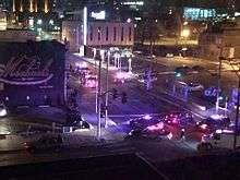
In the early 20th century under Pendergast, Kansas City became the country's "most wide open town". While this would give rise to Kansas City Jazz, it also led to the rise of the Kansas City mob (initially under Johnny Lazia), as well as the arrival of organized crime. In the 1970s, the Kansas City mob was involved in a gang war over control of the River Quay entertainment district, in which three buildings were bombed and several gangsters were killed. Police investigations gained after boss Nick Civella was recorded discussing gambling bets on Super Bowl IV (where the Kansas City Chiefs defeated the Minnesota Vikings). The war and investigation led to the end of mob control of the Stardust Casino, which was the basis for the film Casino (although the production minimizes the Kansas City connections).
As of November 2012, Kansas City ranked 18th on the Federal Bureau of Investigation (FBI)'s annual survey of crime rates for cities with populations over 100,000.[72] Much of the city's violent crimes occur on the city's lower income East Side. Revitalizing the downtown and midtown areas has been fairly successful and now these areas have below average violent crime compared to major downtowns.[73] According to a 2007 analysis by The Kansas City Star and the University of Missouri-Kansas City, downtown experienced the largest drop in crime of any neighborhood in the city during the 2000s.[74]
Education
Colleges and universities
Many universities, colleges, and seminaries are located in the Kansas City metropolitan area, including:
- University of Missouri–Kansas City − one of four schools in the University of Missouri system − serving more than 15,000 students
- Rockhurst University − Jesuit university founded in 1910
- Kansas City Art Institute − four-year college of fine arts and design founded in 1885
- Kansas City University of Medicine and Biosciences − medical and graduate school founded in 1916
- Avila University − Catholic university of the Sisters of St. Joseph of Carondelet
- Park University − private institution established in 1875; Park University Graduate School is located downtown
- Baker University − multiple branches of the School of Professional and Graduate Studies
- William Jewell College − private liberal arts institution founded in 1849
- Metropolitan Community College (Kansas City) − a two-year college with multiple campuses located in the suburban metropolitan area
- Midwestern Baptist Theological Seminary − Southern Baptist Convention
- Nazarene Theological Seminary − Church of the Nazarene
- Calvary Bible College and Theological Seminary
- Saint Paul School of Theology − Methodist
Primary and secondary schools
Kansas City is served by 16 school districts including 10 Public School Districts. There are also numerous private schools; Catholic schools in Kansas City are governed by the Diocese of Kansas City.
The following Public School Districts serve Kansas City:[75]
- Kansas City, MO School District
- North Kansas City School District
- Center School District
- Hickman Mills C-1 School District
- Grandview C-4 School District
- Liberty School District
- Park Hill School District
- Platte County R-3 School District
- Raytown C-2 School District
- Lees Summit R-7 School District
- Blue Springs R-4 School District
- Independence School District
- Fort Osage R-1 School District
Libraries and archives
- Linda Hall Library − internationally recognized independent library of science, engineering and technology, housing over one million volumes.
- Mid-Continent Public Library − largest public library system in Missouri, and among the largest collections in America.
- Kansas City Public Library − oldest library system in Kansas City.
- University of Missouri-Kansas City Libraries − four collections: Leon E. Bloch Law Library and Miller Nichols Library, both on Volker Campus; and Health Sciences Library and Dental Library, both on Hospital Hill in Kansas City.
- Rockhurst University Greenlease Library
- The Black Archives of Mid-America − research center of the African American experience in the central Midwest.
- National Archives and Records Administration (NARA), Central Plains Region − one of 18 national records facilities, holding millions of archival records and microfilms for Iowa, Kansas, Missouri, and Nebraska in a new facility adjacent to Union Station, which was opened to the general public in 2008.
Media
Print media
The Kansas City Star is the area's primary newspaper. William Rockhill Nelson and his partner, Samuel Morss, first published the evening paper on September 18, 1880. The Star competed heavily with the morning Kansas City Times before acquiring that publication in 1901. The "Times" name was discontinued in March 1990, when the morning paper was renamed the "Star."[76]
Weekly newspapers include The Call[77] (which is focused toward Kansas City's African-American community), the Kansas City Business Journal, The Pitch, Ink,[78] and the bilingual publications Dos Mundos and KC Hispanic News.
The city is served by two major faith-oriented newspapers: The Kansas City Metro Voice, serving the Christian community, and the Kansas City Jewish Chronicle, serving the Jewish community. It also the headquarters of the National Catholic Reporter, an independent Catholic newspaper.
Broadcast media
The Kansas City media market (ranked 32nd by Arbitron[79] and 31st by Nielsen[80]) includes 10 television stations, 30 FM and 21 AM radio stations. Kansas City broadcasting jobs have been a stepping stone for national television and radio personalities, notably Walter Cronkite and Mancow Muller.
WDAF radio (610 AM, now at 106.5 FM; AM frequency now occupied by KCSP) signed on in 1927 as an affiliate of the NBC Red Network, under the ownership of The Star. In 1949, the Star signed on WDAF-TV as an affiliate of the NBC television network. The Star sold off the WDAF stations in 1957, following an antitrust investigation by the United States government (reportedly launched at Truman's behest, following a long-standing feud with the Star) over the newspaper's ownership of television and radio stations. KCMO radio (originally at 810 AM, now at 710 AM) signed on KCMO-TV (now KCTV) in 1953. The respective owners of WHB (then at 710 AM, now at 810 AM) and KMBC radio (980 AM, now KMBZ), Cook Paint and Varnish Company and the Midland Broadcasting Company, signed on WHB-TV/KMBC-TV as a time-share arrangement on VHF channel 9 in 1953; KMBC-TV took over channel 9 full-time in June 1954, after Cook Paint and Varnish purchased Midland Broadcasting's stations.
The major broadcast television networks have affiliates in the Kansas City market (covering 32 counties in northwestern Missouri, with the exception of counties in the far northwestern part of the state that are within the adjacent Saint Joseph market, and northeastern Kansas); including WDAF-TV 4 (Fox), KCTV 5 (CBS), KMBC-TV 9 (ABC), KCPT 19 (PBS), KCWE 29 (The CW), KSHB-TV 41 (NBC) and KSMO-TV 62 (MyNetworkTV). Other television stations in the market include Saint Joseph-based KTAJ-TV 16 (TBN), Kansas City, Kansas-based TV25.tv (consisting of three locally owned stations throughout northeast Kansas, led by KCKS-LD 25, affiliated with several digital multicast networks), Lawrence, Kansas-based KMCI-TV 38 (independent), Spanish-language station KUKC-LP 48 (Univision), and KPXE-TV 50 (Ion Television).
Film community
Kansas City has been a locale for Hollywood film and television productions. Between 1931 and 1982 Kansas City was home to the Calvin Company, a large movie production company that specialized in promotional and sales short films and commercials for corporations, as well as educational films for schools and the government. Calvin was an important venue for Kansas City arts, training local filmmakers who went on to Hollywood careers, and also employing local actors, most of whom earned their main income in fields such as radio and television announcing. Kansas City native Robert Altman directed movies at the Calvin Company, which led him to his first feature film, The Delinquents, in Kansas City using many local players.
The 1983 television movie The Day After was filmed in Kansas City and Lawrence, Kansas. The 1990s film Truman, starring Gary Sinise, was filmed in the city. Other films shot in or around Kansas City include Article 99, Mr. & Mrs. Bridge, Kansas City, Paper Moon, In Cold Blood, Ninth Street, and Sometimes They Come Back (in and around nearby Liberty, Missouri). More recently, a scene in the controversial film Brüno was filmed in downtown Kansas City's historic Hotel Phillips.
Today, Kansas City is home to an active independent film community. The Independent Filmmaker's Coalition is an organization dedicated to expanding and improving independent filmmaking in Kansas City. The city launched the KC Film Office in October 2014 with the goal of better marketing the city for prospective television shows and movies to be filmed there. The City Council passed several film tax incentives in February 2016 to take effect in May 2016; the KC Film Office is currently coordinating its efforts with the State of Missouri to reinstate film incentives on a statewide level.[81]
Infrastructure
Originally, Kansas City was the launching point for travelers on the Santa Fe, Oregon and California trails. Later, with the construction of the Hannibal Bridge across the Missouri River, it became the junction of 11 trunk railroads. More rail tonnage passes through the city than any other U.S. city. Trans World Airlines (TWA) located its headquarters in the city, and had ambitious plans to turn the city into an air hub.
Highways
Missouri and Kansas were the first states to start building interstates with Interstate 70. Interstate 435, which encircles the entire city, is the second longest beltway in the nation. The Kansas City metro area has more limited access highway lane-miles per capita than any other large US metro area, over 27% more than the second-place Dallas–Fort Worth metroplex, over 50% more than the average American metropolitan area. The Sierra Club blames the extensive freeway network for excessive sprawl and the decline of central Kansas City.[82] On the other hand, the relatively uncongested road network contributes significantly to Kansas City's position as one of America's largest logistics hubs.[83]
Airports
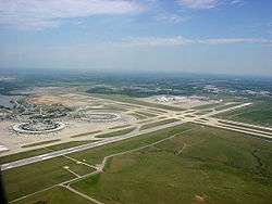
Kansas City International Airport was built to TWA's specifications to make a world hub. Its original passenger-friendly design placed each of its gates 100 feet (30 m) from the street. Following the September 11, 2001, attacks, it required a costly overhaul to conform to the tighter security protocols. Charles B. Wheeler Downtown Airport was TWA's original headquarters and houses the Airline History Museum. It is still used for general aviation and airshows.
Public transportation
Like most American cities, Kansas City's mass transit system was originally rail-based. From 1870 to 1957, Kansas City's streetcar system was among the top in the country, with over 300 miles (480 km) of track at its peak. The rapid sprawl in the following years led this private system to be shut down.
KCATA- RideKC
On December 28, 1965, the Kansas City Area Transportation Authority (KCATA) was formed via a bi-state compact created by the Missouri and Kansas legislatures. The compact gave the KCATA responsibility for planning, construction, owning and operating passenger transportation systems and facilities within the seven-county area.
RideKC Bus and MAX
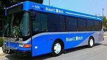
In July 2005, the KCATA launched Kansas City's first bus rapid transit line, the Metro Area Express (MAX). MAX links the River Market, Downtown, Union Station, Crown Center and the Country Club Plaza. This corridor employs over 150,000 workers.[84] MAX operates and is marketed more like a rail system than a local bus line. A unique identity was created for MAX, including 13 modern diesel buses and easily identifiable "stations". MAX features (real-time GPS tracking of buses, available at every station), and stoplights automatically change in their favor if buses are behind schedule. In 2010, a second MAX line was added on Troost Avenue.[85] The city is currently planning another MAX line down Prospect Avenue.[86]
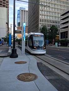
RideKC Streetcar
On December 12, 2012, a ballot initiative to construct a $102 million, 2-mile modern streetcar line in downtown Kansas City was approved by local voters.[87] The streetcar route runs along Main Street from the River Market to Union Station; it debuted on May 6, 2016.[88] A new non-profit corporation made up of private sector stakeholders and city appointees – the Kansas City Streetcar Authority – operates and maintains the system. Unlike many similar systems around the U.S., no fare is to be charged initially.[89] The city plans to add multiple extensions to the starter line.
RideKC Bridj
In 2015, the KCATA, Unified Government Transit, Johnson County Transit, and IndeBus (all separate metro services) began merging into one coordinated transit service for the Kansas City region, called RideKC. The buses and other transit options will be branded as: RideKC Bus, RideKC MAX, RideKC Streetcar, and RideKC Bridj. RideKC Bridj is a micro transit service partnership between Ford Bridj and KCATA that began on March 7, 2016. Users download the Bridj app and use the service much like a taxi service. The merger and full coordination is expected to be complete by 2019.[90]
Walkability
A 2015 study by Walk Score ranked Kansas City as the 42nd most walkable out of the 50 largest U.S. cities.[91] As a whole, the city has a score of 34 out of 100. However, several of the more densely populated neighborhoods have much higher scores: Westport has a score of 91; the Downtown Loop has a score of 85; the Crossroads scored 85; and the Plaza scored 83.[92] Those ratings range from "A Walker's Paradise" to "Very Walkable."
Sister cities
Kansas City has 14 sister cities:[93]
| City | Subdivision | Country | Date |
|---|---|---|---|
| Seville | |
|
1967 |
| Kurashiki | Okayama Prefecture | |
1972 |
| Morelia | |
|
1973 |
| Freetown | Western Area | |
1974 |
| Tainan | |
1978 | |
| Xi'an | Shaanxi | |
1989 |
| Guadalajara[94] | |
|
1991 |
| Hannover | |
|
1993 |
| Port Harcourt | Rivers State | |
1993 |
| Arusha | Arusha Region | |
1995 |
| San Nicolás de los Garza | |
|
1997 |
| Ramla | |
1998 | |
| Metz | |
|
2004 |
| Yan'an | Shaanxi | |
See also
- List of people from Kansas City, Missouri
- National Register of Historic Places listings in Jackson County, Missouri
- Sites of interest of Kansas City
Other articles connected with the culture of Kansas City:
Notes
- 1 2 Mean monthly maxima and minima (i.e. the expected highest and lowest temperature readings at any point during the year or given month) calculated based on data at said location from 1981 to 2010.
- ↑ Official records for Kansas City kept at downtown/Weather Bureau Office from July 1888 to December 1933; Downtown Airport from January 1934 to September 1972; and Kansas City Int'l since October 1972. For more information see ThreadEx.
References
- 1 2 "US Gazetteer files 2010". United States Census Bureau. Archived from the original on January 24, 2012. Retrieved July 8, 2012.
- ↑ "Population Estimates". United States Census Bureau. Retrieved May 20, 2016.
- ↑ "Zip Code Lookup". USPS. Retrieved November 27, 2014.
- ↑ "American FactFinder". United States Census Bureau. Archived from the original on September 11, 2013. Retrieved January 31, 2008.
- ↑ "US Board on Geographic Names". United States Geological Survey. October 25, 2007. Retrieved January 31, 2008.
- ↑ "Population, percent change - April 1, 2010 (estimates base) to July 1, 2015, (V2015)". www.census.gov. Retrieved 2016-05-11.
- ↑ National Park Service (2010-07-09). "National Register Information System". National Register of Historic Places. National Park Service.
- ↑ Wilkinson, Ernest L. (1976). Brigham Young University: The First 100 Years. Vol. 1. Provo: BYU Press. p. 7.
- ↑ "Why is Kansas City located in Missouri instead of Kansas?". Retrieved January 2, 2010.
- ↑ "Early City Limits". Archived from the original on September 27, 2007. Retrieved September 11, 2006.
- 1 2 3 4 5 6 "Missouri – Race and Hispanic Origin for Selected Cities and Other Places: Earliest Census to 1990". U.S. Census Bureau. Retrieved December 18, 2011.
- ↑ "Historic Sanborn Maps of Kansas City". University of Missouri Digital Library. Retrieved March 21, 2011.
- ↑ Lawrence H. Larsen and Nancy J. Hulston (2013). Pendergast!. University of Missouri Press. p. xi.
- 1 2 "Kansas City (city), Missouri". State & County QuickFacts. U.S. Census Bureau. Retrieved April 20, 2012.
- ↑ Morris, Mark (2013-12-24). "Missouri Supreme Court all but ends battle over KC streetcar financing". The Kansas City Star. Retrieved 2016-07-29.
- ↑ Archived March 25, 2009, at the Wayback Machine.
- 1 2 "Historic City Market :: City Market Kansas City". thecitymarket.org.
- ↑ "Kansas City – Restaurants – Restaurant Guide".
- ↑ "A walk through Kansas City history", Country Club Plaza website (online)
- ↑ Garvin, Alexander (2002). The American City: What Works, what doesn't. New York: McGraw-Hill Professional. pp. 119–125. ISBN 0-07-137367-5.
- ↑ "Kansas City Missouri Climate Summary". Weatherbase. Retrieved February 3, 2015.
- ↑ "Kansas City, Missouri, Temperature Averages". Weatherbase. Retrieved February 3, 2015.
- ↑ "Archived copy". Archived from the original on February 24, 2014. Retrieved 2013-06-28.
- 1 2 3 "NowData – NOAA Online Weather Data". National Oceanic and Atmospheric Administration. Retrieved 2011-12-17.
- ↑ "Interpretation Of Skew-T Indices". Theweatherprediction.com. Retrieved July 10, 2013.
- ↑ Kansas City Tornado Almanac, wdaftv4.com. Retrieved September 2006.
- ↑ KC powerless as icy barrage pummels the area, leaves behind disaster zone. Retrieved September 10, 2006.
- 1 2 "NowData – NOAA Online Weather Data". National Oceanic and Atmospheric Administration. Retrieved 2016-04-19.
- ↑ "Station Name: MO KANSAS CITY DOWNTOWN AP". National Oceanic and Atmospheric Administration. Retrieved 2014-03-13.
- ↑ "Kansas City Daily Climate Records/Normals". National Oceanic and Atmospheric Administration. Retrieved February 12, 2011.
- ↑ "Station Name: MO KANSAS CITY INTL AP". National Oceanic and Atmospheric Administration. Retrieved 2014-03-26.
- ↑ "Kansas City Daily Climate Records/Normals". National Oceanic and Atmospheric Administration. Retrieved February 12, 2011.
- ↑ "WMO Climate Normals for KANSAS CITY/INTL ARPT MO 1961–1990". National Oceanic and Atmospheric Administration. Retrieved 2014-03-11.
- ↑ "Annual Estimates of the Resident Population for Incorporated Places: April 1, 2010 to July 1, 2015". Retrieved July 2, 2016.
- ↑ "Census of Population and Housing". Census.gov. Archived from the original on May 11, 2015. Retrieved June 4, 2015.
- ↑ "Current and Past Estimates of the Land Area of Individual Annexations and of the Total Land Area of Kansas City, Missouri" (PDF). Planning and Zoning Department of Kansas City. Retrieved September 2, 2013.
- ↑ "Kansas City city, Missouri – ACS Demographic and Housing Estimates: 2006–2008". Factfinder.census.gov. Retrieved May 5, 2012.
- ↑ "Interactive: Mapping the census". The Washington Post. Retrieved May 7, 2012.
- ↑ "Immigrants, How They've Helped Shape Kansas City". FOX4KC. February 20, 2012. Retrieved May 7, 2012.
- ↑ "2000-2010 Population Change Map" (PDF). Mid-America Regional Council. Retrieved September 2, 2013.
- 1 2 From 15% sample
- ↑ The Federal Workforce by the Numbers – Kansas City. Greater Kansas City Federal Executive Board. 2011.
- ↑ "Archived copy". Archived from the original on May 20, 2012. Retrieved 2012-05-05.
- ↑ "2012 Instruction 1099-GENERAL" (PDF). Retrieved May 5, 2012.
- ↑ Kansas City Business Journal (July 19, 2006). "Bizjournals.com". Bizjournals.com. Retrieved May 5, 2012.
- ↑ "Facts About Our Region". SSA.gov. Retrieved May 5, 2012.
- ↑ "Post Office Location – Kansas City." United States Postal Service. Retrieved on May 5, 2009.
- ↑ "U.S. Manufacturing Sheet – sanofi-aventis.us – Retrieved August 25, 2008". Sanofi-aventis.us. Retrieved May 5, 2012.
- ↑ Kansas City Star – Kansas Tops List for Biodefense Lab Archived December 7, 2008, at the Wayback Machine.
- ↑ A Foregone Conclusion: The Founding of the Federal Reserve Bank of St. Louis by James Neal Primm – stlouisfed.org – Retrieved January 1, 2007.
- ↑ "The Role of Metro Areas in the U.S. Economy" (PDF). U.S. Conference of Mayors. March 2006. p. 119. Retrieved December 26, 2009.
- ↑ Roberts, Rob." KC ranks among best places to own rental property." Kansas City Business Journal. February 2, 2014.
- ↑ "Comprehensive annual Report" (PDF). Data.kcmo.org. Retrieved 2016-07-29.
- ↑ Pahigaian, Josh; Kevin O'Connell (2004). The Ultimate Baseball Road Trip. Guilford, Connecticut: Lyons Press. ISBN 1-59228-159-1.
- ↑ Deborah Jowitt, Kansas City Ballet: Happy Fiftieth!, The Village Voice, March 18, 2008
- ↑ "Kansas City Chorale : Homepage". KCchorale.org. Retrieved May 5, 2012.
- ↑ "The Pitch, ''Best of 2007'': "Best Festival" – Kansas City's Blues and Jazz Festival". Pitch.com. Retrieved May 5, 2012.
- ↑ "Kansas City, MO Population and Races". Usa.com. Retrieved 2016-07-29.
- ↑ O'Laughlin, Michael. Missouri Irish, The Original History of the Irish in Missouri, including St. Louis, Kansas City and Trails West. Retrieved November 21, 2014.
- ↑ "Missouri Gaming Commission: ''The History of Riverboat Gambling in Missouri''". Mgc.dps.mo.gov. July 1, 1994. Retrieved May 5, 2012.
- ↑ The Kansas City Star, June 13, 2008: Missouri riverboat casinos' revenue increases in May.
- ↑ "Experience Kansas City – Barbeque Kansas City Style". Experiencekc.com. Retrieved March 16, 2010.
- ↑ Greenberg, Peter. "Newsmax Magazine Rates the Top 25 Most Uniquely American Cities And Towns". Retrieved January 16, 2014.
- ↑ "KC Council to consider $27 million in public improvements for 18th and Vine". kansascity. Retrieved 2016-05-08.
- ↑ "Starlight Theatre Attractions - KCparks.org". kcparks.org. Retrieved 2016-05-08.
- ↑ "Religion in Kansas City Metro Area, Missouri". bestplaces.net.
- ↑ "Disney, Walt, House and Garage" (PDF). dnr.mo.gov.
- ↑ Parks & Recreation, 2008 Reference Book Archived March 25, 2009, at the Wayback Machine.
- ↑ Parks & Recreation, About Parks & Recreation Archived November 21, 2008, at the Wayback Machine.
- ↑ TimeLine 150 Archived November 20, 2008, at the Wayback Machine.
- ↑ Focus Kansas City, Tri-Blenheim Neighbors United, report date: April 29, 2000 Archived March 25, 2009, at the Wayback Machine.
- ↑ "FBI: Violent crime drops in Kansas City for first half of 2012 - Kansas City Business Journal". Bizjournals.com. February 1, 2013. Retrieved July 10, 2013.
- ↑ "Powered prohibited Mirror". thinkdowntownkc.com.
- ↑ Downtown News Archived April 12, 2008, at the Wayback Machine.
- ↑ "Gisweb.kcmo.org". Gisweb.kcmo.org. Retrieved May 5, 2012.
- ↑ Harry Haskell, Boss-Busters and Sin Hounds: Kansas City and Its "Star" (Columbia: University of Missouri Press, 2007) ISBN 978-0-8262-1769-1
- ↑ "The Call". Kccall.com. Retrieved May 5, 2012.
- ↑ "The Ink". Inkkc.com. Retrieved May 5, 2012.
- ↑ Arbitron, Inc., Spring '08 Blue Book, "2008 Market Survey Schedule: All Markets,", p. 4
- ↑ "TV by the Numbers, ''Nielsen People Meter Markets'', November 6, 2007: "Rank, Designated Market Area, Homes"". Tvbythenumbers.com. Retrieved May 5, 2012.
- ↑ Monreal, Jane (2016-04-02). "Tax breaks for films could bring cash to Kansas City". KSHB. Retrieved 2016-05-09.
- ↑ "1998 Sprawl Report- Sprawl – Sierra Club". Sierraclub.org. Retrieved May 5, 2012.
- ↑ Kcsmartport.com Archived March 25, 2009, at the Wayback Machine.
- ↑ "Maps and Schedules". KCATA. Retrieved March 16, 2010.
- ↑ "Light Rail and MAX". KCATA. Retrieved March 16, 2010.
- ↑ Authority, Kansas City Area Transportation. "Prospect Ave. MAX | Light Rail and MAX | KCATA". www.kcata.org. Retrieved 2016-05-09.
- ↑ "Kansas City voters approve streetcar plan". Kansas City Business Journal. Retrieved January 26, 2013.
- ↑ "Crowds jam streetcars in Kansas City return". kansascity. Retrieved 2016-05-07.
- ↑ "Kansas City streetcar rides will be free". Kansas City Business Journal. Retrieved January 26, 2013.
- ↑ Authority, Kansas City Area Transportation. "Ride KC: Bridj Begins Service March 7 | News | KCATA". www.kcata.org. Retrieved 2016-05-09.
- ↑ "2015 City and Neighborhood Rankings". Walk Score. 2015. Retrieved August 24, 2015.
- ↑ "Kansas City neighborhoods on Walk Score". Walk Score. Retrieved 2016-05-09.
- ↑ "Kansas City Sister Cities". kcsistercities.org. Sister City Association of Kansas City, MO. 2014. Retrieved November 17, 2014.
- ↑ "Sister Cities, Public Relations". Guadalajara municipal government. Archived from the original on March 2, 2012. Retrieved March 12, 2013.
Further reading
- Myers, James D., and Michael A. Sorrentino Jr. "Regional critical infrastructure assessment: Kansas City." International Journal of Critical Infrastructures 7.1 (2011): 58-72.
- Nusser, Sarah Parker, and Katrin B. Anacker. "What Sexuality is this Place? Building a Framework for Evaluating Sexualized Space: The Case of Kansas City, Missouri." Journal of Urban Affairs 35.2 (2013): 173-193.
- Rury, John L., and Sanae Akaba. " The Geo-Spatial Distribution of Educational Attainment: Cultural Capital and Uneven Development in Metropolitan Kansas City, 1960-1980." Histoire & mesure 29.1 (2014): 219-248.
- Shortridge, James R. Kansas City and How It Grew, 1822–2011 (University Press of Kansas; 2012) 248 pages; historical geography
- Sprinkle, Timothy. Screw the Valley: A Coast-to-Coast Tour of America's New Tech Startup Culture: New York, Boulder, Austin, Raleigh, Detroit, Las Vegas, Kansas City (BenBella Books, Inc., 2015)
- Torres, Theresa L. The Paradox of Latina Religious Leadership in the Catholic Church: Las Guadalupanas of Kansas City (Palgrave Macmillan, 2013)
- Wuthnow, Robert. Remaking the Heartland: Middle America since the 1950s (2010) Chapter 7
Online sources
- University of Missouri at Kansas City. Marr Sound Archives. Rags to Be-bop: the Sounds of Kansas City Music, 1890-1945. [Text by] Chuck Haddix. Kansas City, Mo.: University of Missouri at Kansas City, University Libraries, Marr Sound Archives, 1991. Without ISBN
External links
- Official City Website
- Official Travel and Tourism Site
- Kansas City Chamber of Commerce
- Historic maps of Kansas City in the Sanborn Maps of Missouri Collection at the University of Missouri
- The Black Archives of Mid-America on Google Cultural Institute
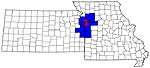
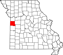
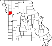
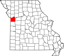
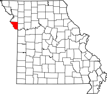