Kapoeta
| Kapoeta | |
|---|---|
| Town | |
|
Peace agreement dancers in Kapoeta | |
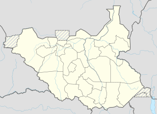 Kapoeta Location in South Sudan | |
| Coordinates: 04°46′30″N 33°35′24″E / 4.77500°N 33.59000°ECoordinates: 04°46′30″N 33°35′24″E / 4.77500°N 33.59000°E | |
| Country |
|
| State | Namorunyang State |
| County | Kapoeta South County |
| Town | 19 August 2013 |
| Elevation | 2,221 ft (677 m) |
| Population (2014 Estimate) | |
| • Total | 91,160 |
| Time zone | EAT (UTC+3) |

Kapoeta is a town in South Sudan. It is located in Kapoeta South County, in Namorunyang State,[1] in southeastern South Sudan.
Location
The town lies on the east bank of the Singaita River. The post at Kapoeta was established by Captain Knollys, who reached the river in January 1927.[2] This location lies approximately 275 kilometres (171 mi), by road, east of Juba, the capital of South Sudan, and the largest city in that country.[3] The town sits at an elevation of 677 metres (2,221 ft) above sea level.[4]
History
Kapoeta was upgraded to Town status administered by a town clerk on August 19, 2013.[5]
Transport
The main road from Lokichogio, Kenya to the capital city of Juba, South Sudan, runs through Kapoeta. The town is also served by Kapoeta Airport, which in 2011, was little more than a dirt strip.
Population
As of August 2008, the population of Kapoeta was estimated at about 7,000.
Culture
Kapoeta town sits in a land dominated by the Toposa ethnic group. The Didinga also live in the area, but they are farmers and tend to inhabit the fertile, wetter hills, whereas the cattle-centric Toposa people dominate the plains.
Points of interest
The following points of interest are found in or near Kapoeta:
- The offices of Kapoeta Town Council
- The headquarters of Kapoeta South County
- Kapoeta Airport - a civilian airport to the north of town
- Kapoeta Power Station - A 0.9MW high-speed diesel plant, commissioned in 2011[6]
- The Narus River - Seasonal river, prone to flooding[7]
See also
References
- ↑ Nakimangole, Peter Lokale (22 April 2016). "Additional Counties In Imatong And Namorunyang States Established". Gurtong. Retrieved 14 August 2016.
- ↑ Northeast African Studies, Volume 3. African Studies Center, Michigan State University. 1981. p. 84.
- ↑ Map Showing Kapoeta And Juba With Distance Marker
- ↑ Elevation of 2,220 Feet Above Sea Level
- ↑ Ijoo, Bosco (20 August 2013). "Eastern Equatoria to upgrade three towns to municipalities". Sudan Tribune. Retrieved 22 August 2013.
- ↑ Kapoeta Power Station Commissioned In 2011
- ↑ 2002 Geological Survey of Kapoeta County
| Counties |  | |
|---|---|---|
| Principal towns | ||
| Airports | ||
| Rivers | ||
| Mountains | ||
| Communities | ||