Kapp Wien
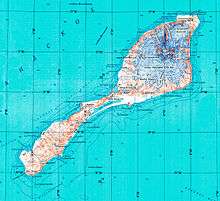
Topographic map of Jan Mayen
Kapp Wien is a headland at the southeastern side of the island of Jan Mayen, about halfway between Olonkinbyen and Sørkapp. It defines the northeastern extension of the bay Hornbækbukta.[1][2]
References
- ↑ "Kapp Wien (Jan Mayen)". Norwegian Polar Institute. Retrieved 24 July 2013.
- ↑ Arctic Pilot: Sailing directions Svalbard–Jan Mayen. 7. Stavanger: The Norwegian Hydrographic Service and The Norwegian Polar Institute. 1988. p. 403. ISBN 82-90653-06-9.
Coordinates: 70°51′58″N 8°48′25″W / 70.8660°N 8.8069°W
This article is issued from Wikipedia - version of the 10/31/2016. The text is available under the Creative Commons Attribution/Share Alike but additional terms may apply for the media files.