Karapınar Field
| Karapınar Field | |
|---|---|
 Cinder cone and Meke Gölü, a crater lake. | |
| Highest point | |
| Elevation | 1,302 m (4,272 ft) |
| Coordinates | 37°40′N 33°39′E / 37.67°N 33.65°E |
| Geography | |
| Location | Konya Province, Turkey |
| Geology | |
| Mountain type | Volcanic field / Cinder cones / Maars / Crater lake |
| Last eruption | Unknown |
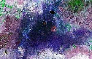
Karapınar Field seen from space (false color).
Karapınar Field is a volcanic field in central Anatolia, Asian Turkey.
Geography
The volcanic area is located near the city of Karapınar, in the Karapınar District of Konya Province.
Features
The basaltic Karapınar Volcanic Field consists of five cinder cones, two lava fields, and several explosion craters and maars.
Meke Dağı, at 300 metres (980 ft) in elevation, is one of the largest cinder cones in the Central Anatolia Region.
Meke Dağı is surrounded by Meke Gölü, a crater lake.
See also
| Wikimedia Commons has media related to Karapinar Volcanic Field. |
References
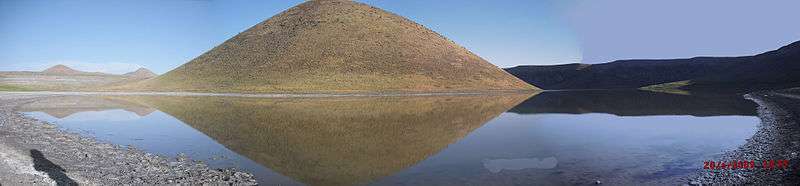
Karapınar Volcanic Field and Meke Gölü crater lake panorama
This article is issued from Wikipedia - version of the 1/3/2016. The text is available under the Creative Commons Attribution/Share Alike but additional terms may apply for the media files.