Kasare, Nandurbar
| Kasare कासारे | |
|---|---|
| village | |
 Kasare  Kasare Location in Maharashtra, India | |
| Coordinates: 21°17′04″N 73°59′07″E / 21.28444°N 73.98528°ECoordinates: 21°17′04″N 73°59′07″E / 21.28444°N 73.98528°E | |
| Country |
|
| State | Maharashtra |
| District | Nandurbar |
| Taluka | Navapur |
| Government | |
| • Body | Village panchayat |
| Languages | |
| • Official | Marathi |
| Time zone | IST (UTC+5:30) |
| Vehicle registration | MH |
| Lok Sabha constituency | Nandurbar |
| Vidhan Sabha constituency | Navapur |
| Website |
maharashtra |
Kasare (Marathi: कासारे), is a small village in Nandurbar District of Maharashtra, India.[1][2] Administratively, Kasare is under Shehi gram panchayat, Navapur Taluka of Nandurbar District in Maharashtra.[2] This village is located 2.5 km by road southeast of the village of Shehi, and State Highway 9.
Demographics
In the 2001 census, the village of Kasare had 206 inhabitants, with 96 males (46.6%) and 110 females (53.4%), for a gender ratio of 1146 females per thousand males.[3]
See also
References
- ↑ 2001 Census Village code for Kasare = 00087100, "2001 Census of India: List of Villages by Tehsil: Maharashtra" (PDF). Registrar General & Census Commissioner, India. p. 17. Archived (PDF) from the original on 13 November 2012.
- 1 2 2011 Census Village code for Kasare = 525869, "Reports of National Panchayat Directory: List of Census Villages mapped for: Shehi Gram Panchayat, Navapur, Nandurbar, Maharashtra". Ministry of Panchayati Raj, Government of India.
- ↑ "Census 2001 Population Finder: Maharashtra: Nandurbar: Nawapur: Kasare". Office of The Registrar General & Census Commissioner, Ministry of Home Affairs, Government of India. Archived from the original on 15 May 2013.
Nandurbar district topics | ||
|---|---|---|
| History | 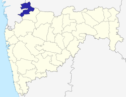 | |
| Geography | ||
| Cities and towns | ||
| Lok Sabha constituencies | ||
| Vidhan Sabha constituencies | ||
This article is issued from Wikipedia - version of the 9/26/2016. The text is available under the Creative Commons Attribution/Share Alike but additional terms may apply for the media files.