Katrenikona
| Katrenikona కాట్రేనికోన | |
|---|---|
| Village | |
|
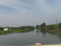
Godavari canal near Katrenikona | |
 Katrenikona  Katrenikona Location in Andhra Pradesh, India | |
| Coordinates: 16°34′55″N 82°09′14″E / 16.5818377°N 82.153793°ECoordinates: 16°34′55″N 82°09′14″E / 16.5818377°N 82.153793°E | |
| Country |
|
| State | Andhra Pradesh |
| District | East Godavari |
| Population (2001) | |
| • Total | 10,205 |
| Languages | |
| • Official | Telugu |
| Time zone | IST (UTC+5:30) |
| PIN | 533212 |
| Telephone code | 91- |
| Vehicle registration | AP |
| Climate | Aw (Köppen) |
| Precipitation | 603 millimetres (23.7 in) |
| Avg. annual temperature | 26.0 °C (78.8 °F) |
| Avg. summer temperature | 45.9 °C (114.6 °F) |
| Avg. winter temperature | 23.5 °C (74.3 °F) |
Katrenikona is a village and a Mandal in East Godavari district in the state of Andhra Pradesh in India.[1]
Geography
Katrenikona is a village and one of the major gram panchayats in Mummidivaram assembly constituency. Earlier it was the part of erstwhile Cheyyeru constituency and subsequently merged with Mummidivarm assembly constituency. Katrenikona is the mandal headquarters and has a total mandal population of 74,809 as per 2011 census.
References
- ↑ "Mandal wise list of villages in Srikakulam district" (PDF). Chief Commissioner of Land Administration. National Informatics Centre. Archived from the original (PDF) on 21 January 2015. Retrieved 7 March 2016.
This article is issued from Wikipedia - version of the 9/16/2016. The text is available under the Creative Commons Attribution/Share Alike but additional terms may apply for the media files.