Keevil
| Keevil | |
 St. Leonard's parish church |
|
 Keevil |
|
| Population | 441 (in 2011)[1] |
|---|---|
| OS grid reference | ST921580 |
| Civil parish | Keevil |
| Unitary authority | Wiltshire |
| Ceremonial county | Wiltshire |
| Region | South West |
| Country | England |
| Sovereign state | United Kingdom |
| Post town | Trowbridge |
| Postcode district | BA14 |
| Dialling code | 01380 |
| Police | Wiltshire |
| Fire | Dorset and Wiltshire |
| Ambulance | South Western |
| EU Parliament | South West England |
| UK Parliament | South West Wiltshire |
| Website | Keevil Village |
Coordinates: 51°19′16″N 2°06′54″W / 51.321°N 02.115°W
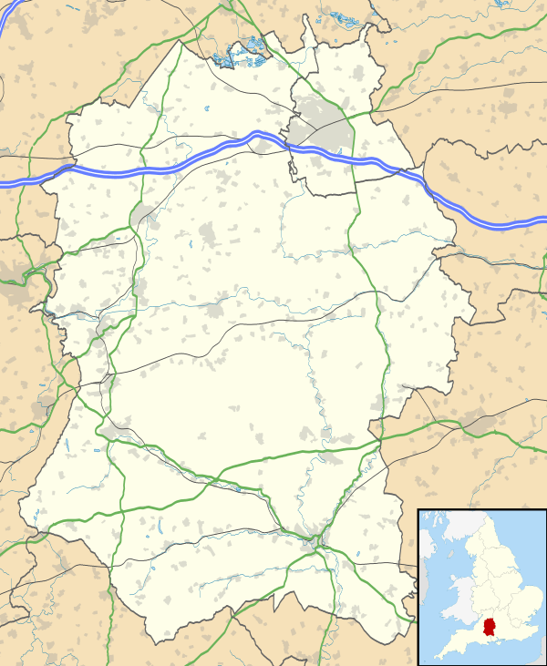
Keevil is a village and civil parish in Wiltshire, England, situated 5.1 miles (8.2 km) by road east of the centre of Trowbridge. It lies on a slope between Great Hinton and Bulkington.[2] Semington Brook flows north-westward from Bulkington in the east.[3]
Notable landmarks
After the Second World War the barracks of RAF Keevil were used as a temporary home for Polish refugees.[4] Today the small Ministry of Defence airfield at RAF Keevil is used for gliding at weekends, being the base of Bannerdown Gliding Club.[5]
The village has two Grade I listed buildings: Keevil Manor House c. 1580,[6] and a house known as Talboys, 14th century extended 1876.[7] In the western part of the village are several timber-framed houses including Little Talboys, a cruck-framed house with four bays.[3]
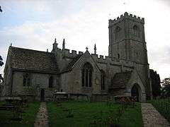
The Anglican Church of St Leonard is Grade II* listed.[8] In the later 20th century, new gargoyles costing £20,000 were installed, replacing the previous ones in poor condition. The vicarage, Field Head, today a private residence, was built in 1842 by Reverend Pooke and was enlarged in 1869. A new vicarage replaced it in 1954.[9]
The road to Bulkington had a turnpike house in the northern end in the latter part of the 18th century, which still existed in a derelict state in 1963. Along this road is a two-arched ashlar Baldham Bridge, which has existed since the 14th century, though the current structure dates to the 18th century.[3]
References
- ↑ "Wiltshire Community History - Census". Wiltshire Council. Retrieved 17 October 2014.
- ↑ Google (4 September 2016). "Keevil" (Map). Google Maps. Google. Retrieved 4 September 2016.
- 1 2 3 "Keevil". A History of the County of Wiltshire: Volume 8, Warminster, Westbury and Whorwellsdown Hundreds, Victoria County History, accessed via British History Online. Retrieved 4 September 2016.
- ↑ "KEEVIL POLISH CAMP in Wiltshire". Polishresettlementcampsintheuk.co.uk. Retrieved 4 September 2016.
- ↑ "Welcome to Bannerdown Gliding Club". Bannerdown Gliding Club. Retrieved 4 September 2016.
- ↑ Historic England. "Keevil Manor with attached stables (1251455)". National Heritage List for England. Retrieved 16 February 2015.
- ↑ Historic England. "Talboys, Keevil (1262752)". National Heritage List for England. Retrieved 16 February 2015.
- ↑ Historic England. "Church of St Leonard, Keevil (1262746)". National Heritage List for England. Retrieved 16 February 2015.
- ↑ "Church of St. Leonard, Keevil". Wiltshire Community History. Wiltshire Council. Retrieved 16 February 2015.
External links
| Wikimedia Commons has media related to Keevil. |
- Keevil Primary School, retrieved April 30, 2012
- Village web site