Kemptville Creek
| Kemptville Creek | |
| South Branch of the Rideau River | |
 Kemptville Creek in the town of Kemptville | |
| Country | Canada |
|---|---|
| Province | Ontario |
| Region | Eastern Ontario |
| County | United Counties of Leeds and Grenville |
| Municipalities | North Grenville, Augusta |
| Part of | Saint Lawrence River drainage basin |
| Source | North Augusta, Augusta |
| - elevation | 112 m (367 ft) |
| - coordinates | 44°45′57″N 75°45′00″W / 44.76583°N 75.75000°W |
| Mouth | Rideau River |
| - location | Kemptville, North Grenville |
| - elevation | 85 m (279 ft) |
| - coordinates | 45°03′21″N 75°39′15″W / 45.05583°N 75.65417°WCoordinates: 45°03′21″N 75°39′15″W / 45.05583°N 75.65417°W |
| Length | 69 km (43 mi) |
| Basin | 456 km2 (176 sq mi) |
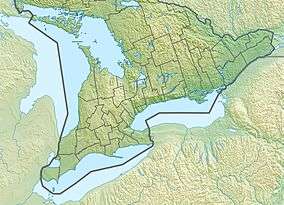 Location of the mouth of Kemptville Creek in southern Ontario | |
Kemptville Creek is a stream in the municipalities of North Grenville and Augusta, in the United Counties of Leeds and Grenville, in eastern Ontario, Canada.[1] It is in the Saint Lawrence River drainage basin, is a right tributary of the Rideau River, and is under the auspices of the Rideau Valley Conservation Authority.[2]
Kemptville Creek is 69 kilometres (43 mi) long and has a drainage basin of 456 square kilometres (176 sq mi).[2] Portions of the drainage basin extend into other municipalities of Leeds and Grenville, such as Athens, Elizabethtown-Kitley and Merrickville–Wolford. The creek was historically referred to by the name South Branch of the Rideau River, until its name was changed to Kemptville Creek in 1908. However, the former name is still in use as of 2015.[3]
Course
The main branch, also called the South Branch, beings northwest of the community of North Augusta in the municipality of Augusta, where it immediately takes in the right tributary Mud Creek. It travels north, passing into North Grenville near the community of Bishop's Mills.
The North Branch begins at Cranberry Lake in Merrickville–Wolford, and flows northeast, passes into North Grenville as it flows through the community of Bishop's Mills, before joining the main branch northeast of the community.
Combined, the creek continues north through the community of Oxford Mills, where it goes over Oxford Mills Dam, flows under the Canadian Pacific Railway main line, heads through Kemptville, where it takes in the right tributary Barnes Creek, and reaches its mouth at the Rideau River. The Rideau River flows to the Saint Lawrence River.
Recreation
The creek is navigable, for smaller watercraft, from the Rideau River to the town docks in Kemptville. In the summer it is also suitable for canoeing from Bishop's Mills to approximately 10 kilometres (6.2 mi) to the south of Oxford Mills (rough-launch near the railway bridge, or at the dam in town). In the spring it should be possible to canoe from Oxford Station Road (or further) to the Rideau River with one portage.
Tributaries
- Barnes Creek (right)
- North Branch Kemptville Creek (left)
- Muldoons Creek
- Mud Creek (right)
References
- ↑ "Kemptville Creek". Geographical Names Data Base. Natural Resources Canada. Retrieved 2015-07-14.
- 1 2 "Subwatershed Reporting — Kemptville Creek". Rideau Valley Conservation Authority. Retrieved 2015-07-14.
- ↑ "Environmental Assessment - Proposed Waterfront Trails and Pedestrian Bridge On the South Branch of the Rideau River" (PDF). Municipality of North Grenville. 2015-03-14. Retrieved 2015-08-10.
Other map sources:
- Map 11 (PDF) (Map). 1 : 700,000. Official road map of Ontario. Ministry of Transportation of Ontario. 2014. Retrieved 2015-07-14.
- Restructured municipalities - Ontario map #5 (Map). Restructuring Maps of Ontario. Ontario Ministry of Municipal Affairs and Housing. 2006. Retrieved 2015-07-14.
- Municipality of North Grenville (PDF) (Map). Municipality of North Grenville. Retrieved 2015-07-14.
External links
- Kemptville Creek Subwatershed Report 2013 from the Rideau Valley Conservation Authority
- Photos from Mudpuppy night on the Kemptville Creek
- The Kemptville Creek anthem