Kibergneset
| Kibergsneset | |
|---|---|
| Kibergneset | |
|
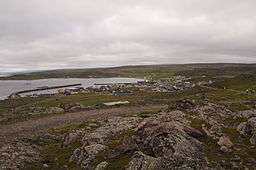
View of Kiberg village on the southern side of the peninsula | |
| Location | Finnmark, Norway |
| Coordinates | 70°17′19″N 31°03′46″E / 70.28861°N 31.06278°ECoordinates: 70°17′19″N 31°03′46″E / 70.28861°N 31.06278°E |
| Offshore water bodies | Barents Sea |
| Area | 4 km2 (1.5 sq mi) |

Some remains of the coastal fort of Kibergneset
Kibergneset or Kibergsneset is a peninsula in Vardø Municipality in Finnmark county, Norway. The small peninsula is located on the larger Varanger Peninsula along the Barents Sea. The village of Kiberg sits on the southwestern shore of the peninsula and the town of Vardø is located about 10 kilometres (6.2 mi) to the northeast.[1]
There is a coastal fortress on the southeastern part of the peninsula. It was built by the occupying Germans during World War II. Kibergneset is the easternmost point of mainland Norway.[2]
References
- ↑ Store norske leksikon. "Kibergneset" (in Norwegian). Retrieved 2013-03-01.
- ↑ Norwegian Mapping Authority. "Ytterpunkter for kongeriket Norge" (in Norwegian). Retrieved 7 February 2009.
This article is issued from Wikipedia - version of the 8/3/2016. The text is available under the Creative Commons Attribution/Share Alike but additional terms may apply for the media files.