Kimanis–Keningau Highway
| Kimanis–Keningau Highway | |
|---|---|
| Route information | |
| Length: | 53 km (33 mi) |
| Major junctions | |
| West end: | Kimanis |
|
Interior North-South Highway | |
| East end: | Keningau |
| Location | |
| Primary destinations: |
Crocker Range National Park Kota Kinabalu (From Keningau/Tenom) Keningau (Main Destination) Tenom (via Keningau) |
| Highway system | |
Kimanis–Keningau Highway is a state highway in Sabah, Malaysia, connecting the town of Kimanis to Keningau. It also acts as an alternative for Federal Route 500 from Kota Kinabalu to Tenom which is longer. The 53-kilometre (33 mi) highway began as a main logging road before being upgraded to a full two-lane highway.[1] The highway was opened to traffic in 2006.
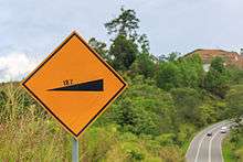
Even though the highway is relatively short and is in very good condition, it is notorious for its very steep gradients along the way, ranging from 10% to about 25%, making the Kimanis–Keningau Highway as the steepest highway in Malaysia.[2][3] As a result, climbing road lanes are provided at steep sections.
A gravity hill induced by optical illusion is located 11 kilometres (6.8 mi) from Keningau. It is reported that at the gravity hill, there is a slope which appears as a downhill slope, but is actually an uphill slope.[1]
List of interchanges
| Km | Exit | Interchange | To | Remarks | |
|---|---|---|---|---|---|
| Kimanis | North Kota Kinabalu Papar South Beaufort Sindumin | Roundabout | |||
| Keningau bound | |||||
| Bongawan Estate | North Papar South Bongawan | Roundabout | |||
| R&R complex Kimanis bound | |||||
| Keningau bound | |||||
| -- m above sea level | Kimanis bound, Engage lower gear | ||||
| West Coast Division Papar district border | |||||
| West Coast-Interior division border
| |||||
| Interior Division Keningau district border | |||||
| -- m above sea level | Keningau bound, Engage lower gear | ||||
| Crocker Range National Park -- m above sea level | |||||
| Jalan Masak Roundabout | South Jalan Patikang Ulu Tenom | Roundabout | |||
| Keningau | Interior North-South Highway
| Roundabout | |||
See also
References
- 1 2 "Titik Misteri, Bukit Graviti dan Bukit Magnetic" (in Malay). Retrieved 24 August 2011.
- ↑ "Kimanis-Keningau Road". Retrieved 24 August 2011.
- ↑ Zulnizam Shahrani (28 December 2011). "Ekspedisi solo Kuala Lumpur – Borneo penuh kepuasan" (in Malay). Berita Harian. Retrieved 15 December 2013.