King Fahad Dam
| King Fahad Dam | |
|---|---|
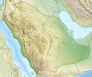 Location of King Fahad Dam in Saudi Arabia | |
| Country | Saudi Arabia |
| Location | Bisha, 'Asir Region |
| Coordinates | 19°41′46.80″N 42°29′14.46″E / 19.6963333°N 42.4873500°ECoordinates: 19°41′46.80″N 42°29′14.46″E / 19.6963333°N 42.4873500°E |
| Purpose | Flood control, municipal water, irrigation, groundwater recharge |
| Construction began | 1986 |
| Opening date | 1997 |
| Owner(s) | Ministry of Water and Electricity |
| Dam and spillways | |
| Type of dam | Gravity |
| Impounds | Wadi Bisha |
| Height (foundation) | 103 m (338 ft) |
| Height (thalweg) | 68 m (223 ft) |
| Length | 507 m (1,663 ft) |
| Width (crest) | 80 m (260 ft) |
| Width (base) | 8 m (26 ft) |
| Spillway type | Overflow |
| Spillway capacity | 5,338 m3/s (188,500 cu ft/s) |
| Reservoir | |
| Total capacity | 325,000,000 m3 (263,000 acre·ft) |
| Catchment area | 7,600 km2 (2,900 sq mi) |
| Max. length | 18 km (11 mi) |
The King Fahad Dam, previously known as Bisha Dam, is a gravity dam on Wadi Bisha about 35 km (22 mi) south of Bisha in the 'Asir Region of southwestern Saudi Arabia. The dam has many purposes to include flood control, municipal water supply, irrigation and groundwater recharge. A water treatment plant was built in conjunction with the dam and it can supply up to 40,000 m3 (1,400,000 cu ft) of water to the city of Bisha a day. The dam was constructed between 1986 and 1997. It is named after King Fahad and is managed by the Ministry of Water and Electricity. At 103 m (338 ft) in height, it was the tallest dam in the country until the 106 m (348 ft) Baysh Dam was completed in 2009. King Fahad's reservoir still has the largest storage capacity, at 325,000,000 m3 (263,000 acre·ft).[1]
References
- ↑ Alhamid, Abdulaziz A. (2004). "Achievements of the custodian of the two holy mosques in water sector, PSIPW" (PDF). King Saud University. Retrieved 27 March 2014.