Kingston Center Historic District
|
Kingston Center Historic District | |
|
First Congregational Parish | |
  | |
| Location | Kingston, Massachusetts |
|---|---|
| Coordinates | 41°59′42″N 70°44′0″W / 41.99500°N 70.73333°WCoordinates: 41°59′42″N 70°44′0″W / 41.99500°N 70.73333°W |
| Area | 30 acres (12 ha) |
| Built | 1802 |
| Architectural style | Federal, Greek Revival |
| NRHP Reference # | 02001085 [1] |
| Added to NRHP | October 4, 2002 |
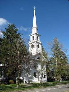
The Kingston Center Historic District is a historic district encompassing the center of Kingston, Massachusetts. The district is about 30 acres (12 ha) in size, and extends along Main Street (Massachusetts Route 106) between the First Parish Unitarian Church and the Mayflower Congregational Church, and for a short way along Green Street to the Evergreen Cemetery. At its center is the Training Green (established 1720) and Kingston Town Hall.[2]
The district was listed on the National Register of Historic Places in 2002.[1]
See also
References
- 1 2 National Park Service (2008-04-15). "National Register Information System". National Register of Historic Places. National Park Service.
- ↑ "NRHP nomination for Kingston Center Historic District". Commonwealth of Massachusetts. Retrieved 2014-05-25.
| Topics |  | ||||||||||||||||||||||||||||||
|---|---|---|---|---|---|---|---|---|---|---|---|---|---|---|---|---|---|---|---|---|---|---|---|---|---|---|---|---|---|---|---|
| Lists by county | |||||||||||||||||||||||||||||||
| Lists by city |
| ||||||||||||||||||||||||||||||
| Other lists | |||||||||||||||||||||||||||||||
| |||||||||||||||||||||||||||||||
This article is issued from Wikipedia - version of the 11/27/2016. The text is available under the Creative Commons Attribution/Share Alike but additional terms may apply for the media files.