Kondoa District
| Kondoa District | |
|---|---|
| District | |
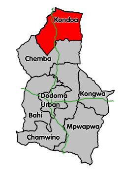 Kondoa District's location within Dodoma Region. | |
| Coordinates: 04°54′23″S 35°46′47″E / 4.90639°S 35.77972°ECoordinates: 04°54′23″S 35°46′47″E / 4.90639°S 35.77972°E | |
| Country | Tanzania |
| Region | Dodoma Region |
| Population (2012) | |
| • Total | 269,704 |
Kondoa District is one of the seven districts of the Dodoma Region of Tanzania. It is bordered to the north by Manyara Region, and to the south by Chemba District. Its district capital is the town of Kondoa.
According to the 2012 Tanzania National Census, the population of Kondoa District was 269,704.[1] While As of 2002, the population of the Kondoa District was 429,824.[2] The population of the district declined from 2002 to 2012, because Chemba District was split off.
The Kondoa Irangi Rock Paintings, which were inscribed as a UNESCO World Heritage Site in 2006, are found in this district.[3]
Transport
Trunk road T5 from Dodoma to Babati passes through the district.[4]
Administrative subdivisions
As of 2012, Kondoa District was administratively divided into 28 wards.[1]
Wards
References
- 1 2 "Census 2012". National Bureau of Statistics. Retrieved 21 July 2016.
- ↑ "2002 Population and Housing Census: General Report". Government of Tanzania. 2003. Archived from the original on 18 March 2004.
- ↑ "Kondoa Rock-Art Sites". UNESCO World Heritage. Retrieved 21 July 2016.
- ↑ "Dodoma Roads Network" (PDF). Tanroads. Retrieved 17 June 2016.
This article is issued from Wikipedia - version of the 9/11/2016. The text is available under the Creative Commons Attribution/Share Alike but additional terms may apply for the media files.