Kozyatağı
| Kozyatağı | |
|---|---|
| Kozyatağı Mahallesi | |
|
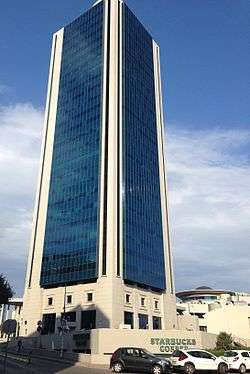
Nida Kule. One of the highest buildings in İstanbul. | |
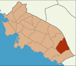 Location of Kozyatağı in Turkey | |
 Kozyatağı Location of Kozyatağı in Turkey | |
| Coordinates: 41°2′33.69″N 29°0′26.27″E / 41.0426917°N 29.0072972°ECoordinates: 41°2′33.69″N 29°0′26.27″E / 41.0426917°N 29.0072972°E | |
| Country | Turkey |
| Province | Istanbul Province |
Kozyatağı is a neighbourhood of Kadıköy one of the districts of Istanbul. It is to the East of Göztepe west of Bostancı south of Ataşehir and north of the coastal neighbourhoods.
Transport
The M4 and the planned M9 metro lines run through Kozyatağı, along with many bus and minibuses. It is also easily accessible by the D-100 highway. Kozyatağı is landlocked, but ferries in Kadıköy and Bostancı can be reached easily.
Surroundings
The area consists of mainly residential apartments along with many commercial towers and plazas. High rise building are not common in the Anatolian side except Kozyatağı, Ataşehir and a few more areas. There are also lots of parks and green areas along with a shopping mall.
This article is issued from Wikipedia - version of the 3/24/2016. The text is available under the Creative Commons Attribution/Share Alike but additional terms may apply for the media files.