Kurobe, Toyama
| Kurobe 黒部市 | ||
|---|---|---|
| City | ||
| ||
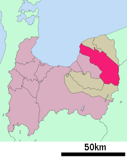 Location of Kurobe in Toyama Prefecture | ||
 Kurobe Location in Japan | ||
| Coordinates: 36°52′N 137°27′E / 36.867°N 137.450°ECoordinates: 36°52′N 137°27′E / 36.867°N 137.450°E | ||
| Country | Japan | |
| Region | Chūbu (Hokuriku) | |
| Prefecture | Toyama Prefecture | |
| Government | ||
| • Mayor | Yasuo Horiuchi | |
| Area | ||
| • Total | 427.96 km2 (165.24 sq mi) | |
| Population (January 31, 2012) | ||
| • Total | 42,613 | |
| • Density | 99.57/km2 (257.9/sq mi) | |
| Symbols | ||
| • Tree | Tsuga sieboldii, Juglans | |
| • Flower | Cherry blossom, Camellia | |
| Time zone | Japan Standard Time (UTC+9) | |
| City hall address |
725 Mikkaichi, Kurobe-shi, Toyama-ken 938-8555 | |
| Website |
kurobe | |


Kurobe (黒部市 Kurobe-shi) is a city located in Toyama Prefecture, Japan. The city was founded on April 1, 1954.
As of January 31, 2012, the city has an estimated population of 42,613, with 14,789 households and a population density of 99.57 persons per km². The total area is 427.96 km².
On March 31, 2006 the town of Unazuki (from Shimoniikawa District) was merged into Kurobe.
Shigotani dormitory disaster
On December 27, 1938, a bubble avalanche of heavy snow hit a five-story dormitory building, which was owned by the Sato Kogyo construction company. The company was responsible for the construction of Shigotani dam and hydroelectricity plant from 1936 to 1940. The construction site was geologically unstable, as it was over a hot rock mining zone. According to the Toyama Prefectureal official report, 84 people died due to the 1938 avalanche; a total number of 300 people lost their lives during five years' construction.
Economy
It is the world headquarters of the YKK.
Twin cities
- Macon, Georgia, United States
- Sneek, Friesland, Netherlands
See also
Ghidorah, the Three-Headed Monster
External links
| Wikimedia Commons has media related to Kurobe, Toyama. |
- Kurobe City official website (Japanese)