Kut Bak District
| Kut Bak กุดบาก | |
|---|---|
| Amphoe | |
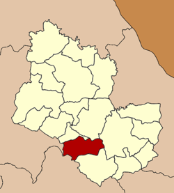 Amphoe location in Sakon Nakhon Province | |
| Coordinates: 17°5′14″N 103°49′21″E / 17.08722°N 103.82250°ECoordinates: 17°5′14″N 103°49′21″E / 17.08722°N 103.82250°E | |
| Country |
|
| Province | Sakon Nakhon |
| Seat | Kut Bak |
| Area | |
| • Total | 455.0 km2 (175.7 sq mi) |
| Population (2005) | |
| • Total | 31,833 |
| • Density | 70.0/km2 (181/sq mi) |
| Time zone | ICT (UTC+7) |
| Postal code | 47180 |
| Geocode | 4703 |
Kut Bak (Thai: กุดบาก) is a district (amphoe) of Sakon Nakhon Province, Thailand.
Geography
Neighboring districts are (from the north clockwise) Nikhom Nam Un, Phanna Nikhom, Mueang Sakon Nakhon, and Phu Phan of Sakon Nakhon Province, Kham Muang of Kalasin Province and Wang Sam Mo of Udon Thani Province.
History
The minor district (king amphoe) was created on 1 February 1964, when three tambons, Kut Bak, Khok Phu, and Na Mong were split from Mueang Sakon Nakhon District.[1] It was upgraded to a full district on 14 November 1967.[2]
Administration
The district is divided into three sub-districts (tambon), which are further subdivided into 38 villages (muban). Kut Bak is a township (thesaban tambon) which covers parts of tambon Kut Bak. There are a further three tambon administrative organizations (TAO).
| No. | Name | Thai name | Villages | Pop. | |
|---|---|---|---|---|---|
| 1. | Kut Bak | กุดบาก | 10 | 10,687 | |
| 3. | Na Mong | นาม่อง | 17 | 11,918 | |
| 5. | Kut Hai | กุดไห | 11 | 9,228 |
Missing numbers are tambon which now form Phu Phan District.
References
- ↑ ประกาศกระทรวงมหาดไทย เรื่อง แบ่งท้องที่การปกครองอำเภอเมืองสกลนครตั้งเป็นกิ่งอำเภอ (PDF). Royal Gazette (in Thai). 81 (14 ง): 250. February 4, 1964.
- ↑ พระราชกฤษฎีกาเปลี่ยนแปลงเขตอำเภอกุดบาก และอำเภอกุสุมาลย์ พ.ศ. ๒๕๑๐ (PDF). Royal Gazette (in Thai). 84 (111 ก): 917–919. November 14, 1967.