Kyotera
| Kyotera | |
|---|---|
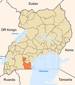
 Kyotera Location in Uganda | |
| Coordinates: 00°37′54″S 31°32′36″E / 0.63167°S 31.54333°E | |
| Country |
|
| Region | Central Uganda |
| District | Rakai District |
| Population (2011 Estimate) | |
| • Total | 9,000 |
Kyotera is a town in the southern part of the Central Region of Uganda.
Location
Kyotera is located approximately 44 kilometres (27 mi), by road, southwest of Masaka, the largest city in the sub-region.[1] This is approximately 29 kilometres (18 mi), by road, northeast of Rakai, where the district headquarters are located.[2] The coordinates of the town are 0°37'54.0"S, 31°32'36.0"E (Latitude:-0.631667; Longitude:31.543333).[3]
Population
During the 2002 Uganda National Census, Kyotera's population was enumerated at 7,590. In 2010, the Uganda Bureau of Statistics (UBOS) estimated the population at 8,800. In 2011, UBOS estimated the mid-year population of at 9,000.[4]
Points of interest
The following additional points of interest are located inside or near Kyotera:
- offices of Kyotera Town Council
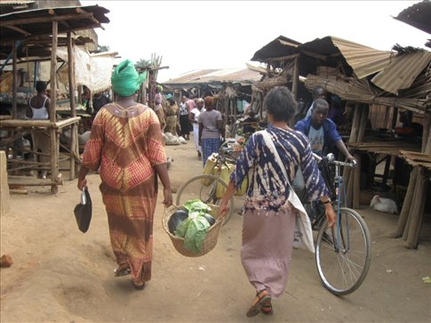
- Kyotera central market
- Masaka–Mutukula Road, passing through the town in a north/south configuration
- Offices of National Water & Sewerage Corporation, Kyotera Cluster.
Photos
See also
References
- ↑ GFC (14 July 2015). "Road Distance Between Masaka And Kyotera With Map". Globefeed.com (GFC). Retrieved 14 July 2015.
- ↑ GFC (14 July 2015). "Map Showing Rakai And Kyotera With Route Marker". Globefeed.com (GFC). Retrieved 14 July 2015.
- ↑ Google (14 July 2015). "Location of Kyotera At Google Maps" (Map). Google Maps. Google. Retrieved 14 July 2015.
- ↑ UBOS (2011). "Estimated Population of Kyotera In 2002, 2010 & 2011" (PDF). Uganda Bureau of Statistics (UBOS). Retrieved 14 July 2015.
External links
Capital: Rakai | ||
| Counties and sub-counties |
|  |
| Towns and villages | ||
| Economy | ||
| Health |
| |
| Transport | ||
| Notable landmarks | ||
| Notable people | ||
Coordinates: 00°37′54″S 31°32′36″E / 0.63167°S 31.54333°E