La Chapelle-Haute-Grue
| La Chapelle-Haute-Grue | |
|---|---|
|
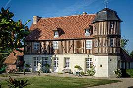
Manoir of Caudemone | |
 La Chapelle-Haute-Grue | |
|
Location within Normandy region  La Chapelle-Haute-Grue | |
| Coordinates: 48°58′03″N 0°08′54″E / 48.9675°N 0.1483°ECoordinates: 48°58′03″N 0°08′54″E / 48.9675°N 0.1483°E | |
| Country | France |
| Region | Normandy |
| Department | Calvados |
| Arrondissement | Lisieux |
| Canton | Livarot |
| Intercommunality | Pays de Livarot |
| Government | |
| • Mayor (2008–2014) | Antoine de Boever |
| Area1 | 2.92 km2 (1.13 sq mi) |
| Population (2008)2 | 45 |
| • Density | 15/km2 (40/sq mi) |
| Time zone | CET (UTC+1) |
| • Summer (DST) | CEST (UTC+2) |
| INSEE/Postal code | 14153 / 14140 |
| Elevation |
70–192 m (230–630 ft) (avg. 90 m or 300 ft) |
|
1 French Land Register data, which excludes lakes, ponds, glaciers > 1 km² (0.386 sq mi or 247 acres) and river estuaries. 2 Population without double counting: residents of multiple communes (e.g., students and military personnel) only counted once. | |
La Chapelle-Haute-Grue is a former commune in the Calvados department in the Normandy region in northwestern France. On 1 January 2016, it was merged into the new commune of Val-de-Vie.[1]
Population
| Historical population | ||
|---|---|---|
| Year | Pop. | ±% |
| 1962 | 80 | — |
| 1968 | 60 | −25.0% |
| 1975 | 40 | −33.3% |
| 1982 | 41 | +2.5% |
| 1990 | 38 | −7.3% |
| 1999 | 30 | −21.1% |
| 2008 | 45 | +50.0% |
See also
References
- ↑ Arrêté préfectoral 22 December 2015 (French)
| Wikimedia Commons has media related to La Chapelle-Haute-Grue. |
This article is issued from Wikipedia - version of the 3/21/2016. The text is available under the Creative Commons Attribution/Share Alike but additional terms may apply for the media files.