Lake Nosbonsing
| Lake Nosbonsing | |
|---|---|
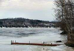 Astorville at the western end of the lake | |
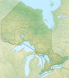 Lake Nosbonsing Location in Ontario | |
| Location | Nipissing District, Ontario |
| Coordinates | 46°12′09″N 79°12′31″W / 46.20250°N 79.20861°WCoordinates: 46°12′09″N 79°12′31″W / 46.20250°N 79.20861°W[1] |
| Type | Lake |
| Part of | Saint Lawrence River drainage basin |
| Primary inflows | Depot Creek |
| Primary outflows | Kaibuskong River |
| Basin countries | Canada |
| Max. length | 11 kilometres (6.8 mi) |
| Max. width | 5 kilometres (3.1 mi) |
| Surface elevation | 237 metres (778 ft)[2] |
| Islands | Perron Island |
| Settlements | Astorville, Bonfield, Nosbonsing |
Lake Nosbonsing (French: Lac Nosbonsing) is a lake in the municipalities of Bonfield, Chisholm, and East Ferris in Nipissing District in Northeastern Ontario, Canada.[1] It is near the City of North Bay, is the source of the Kaibuskong River, and is in the Saint Lawrence River drainage basin.
The primary inflow, at the south, is Depot Creek. The primary outflow, at the northeast, is the Kaibuskong River, which flows via the Mattawa River and the Ottawa River to the Saint Lawrence River.
The middle and west of the lake are in East Ferris;[3] the east of the lake is in Bonfield;[4] and a small portion of the very south centre of the lake is in Chisholm.[5] There are three named communities on the lake: Astorville, at the western tip, and Nosbonsing at the north, both in East Ferris; and Bonfield, at the northeast at the outflow of the Kaibuskong River, in Bonfield. The original Canadian Pacific Railway transcontinental main line runs along the northeast shore from the communities of Bonfield to Nosbonsing. There is one named island, Perron Island, in the west part of the lake; and two named points: Shields Point and McConnell Point, both on the north shore.
See also
References
- 1 2 "Lake Nosbonsing". Geographical Names Data Base. Natural Resources Canada. Retrieved 2014-08-31.
- ↑ Taken from Google Earth at geographic coordinates, accessed 2014-08-31.
- ↑ "Ferris" (PDF). Geology Ontario - Historic Claim Maps. Ontario Ministry of Northern Development, Mines and Forestry. Retrieved 2014-08-31.
- ↑ "Bonfield" (PDF). Geology Ontario - Historic Claim Maps. Ontario Ministry of Northern Development, Mines and Forestry. Retrieved 2014-08-31.
- ↑ "Chisholm" (PDF). Geology Ontario - Historic Claim Maps. Ontario Ministry of Northern Development, Mines and Forestry. Retrieved 2014-08-31.
Other map sources:
- Map 9 (PDF) (Map). 1 : 700,000. Official road map of Ontario. Ministry of Transportation of Ontario. 2014. Retrieved 2014-08-31.
- Restructured municipalities - Ontario map #4 (Map). Restructuring Maps of Ontario. Ontario Ministry of Municipal Affairs and Housing. 2006. Retrieved 2014-08-31.