Lake Solina
| Jezioro Solińskie Lake Solina | |
|---|---|
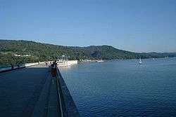 The lake seen from the dam. | |
| Location | Bieszczady |
| Coordinates | 49°22′27″N 22°27′8″E / 49.37417°N 22.45222°ECoordinates: 49°22′27″N 22°27′8″E / 49.37417°N 22.45222°E |
| Type | Artificial lake |
| Primary inflows | San River |
| Primary outflows | San River |
| Basin countries | Poland |
| Max. length | 21km |
| Surface area | 22 km2 (8.5 sq mi) |
| Average depth | 25 m (82 ft) |
| Max. depth | 60 m (200 ft) |
| Water volume | 472,000,000 m3 (617,000,000 cu yd; 383,000 acre·ft) |
| Shore length1 | 150 km (93 mi) |
| Islands | 3 |
| Settlements | Solina, Myczkowce, Polańczyk |
| 1 Shore length is not a well-defined measure. | |
Lake Solina (Polish: Jezioro Solińskie) is an artificial lake in the Bieszczady Mountains region, more precisely in Lesko County of the Subcarpathian Voivodship of Poland. Its coordinates are 49°22′27″N 22°27′8″E / 49.37417°N 22.45222°E.
The lake was created in 1968 by the construction of the Solina Dam on the San River. It has an area of 22 square kilometres (8 sq mi) and contains 472,000,000 cubic metres (617,000,000 cu yd; 383,000 acre·ft) of water, making it Poland's largest artificial lake.
It is the best known tourist attraction of the region, with waterside villages like Solina, Myczkowce and Polańczyk catering to watersports enthusiasts. The lake's great depth, water clarity, and mountainous scenery makes it a very popular destination for boaters. Because of these qualities the lake has been nicknamed the "Bieszczady Sea".
Starting in the 1970s the Wojewódzkie Przedsiębiorstwo Turystyczne (State Tourism Enterprise) "Bieszczady" purchased a number of vessels for the lake and established the lake's White Fleet. The fleet's main ships offer cruises on the lake.

External links
 Media related to Lake Solina at Wikimedia Commons
- The Solina municipality website (English) (German) (Polish)