Larochette
| Larochette Fiels | ||
|---|---|---|
| Commune | ||
|
Aerial view of Larochette and its castle | ||
| ||
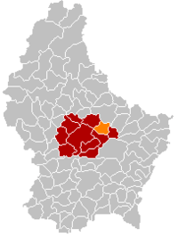 Map of Luxembourg with Larochette highlighted in orange, and the canton in dark red | ||
| Coordinates: 49°47′00″N 6°13′00″E / 49.7833°N 6.2167°ECoordinates: 49°47′00″N 6°13′00″E / 49.7833°N 6.2167°E | ||
| Country |
| |
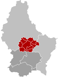
| Canton | Mersch | |
| Government | ||
| • Mayor | Pierre Wies | |
| Area | ||
| • Total | 15.4 km2 (5.9 sq mi) | |
| Area rank | 76 of 105 | |
| Highest elevation | 420 m (1,380 ft) | |
| • Rank | 36th of 105 | |
| Lowest elevation | 266 m (873 ft) | |
| • Rank | 73rd of 105 | |
| Population (2014) | ||
| • Total | 2,094 | |
| • Rank | 64th of 105 | |
| • Density | 140/km2 (350/sq mi) | |
| • Density rank | 50th of 105 | |
| Time zone | CET (UTC+1) | |
| • Summer (DST) | CEST (UTC+2) | |
| LAU 2 | LU00012006 | |
| Website | larochette.lu | |
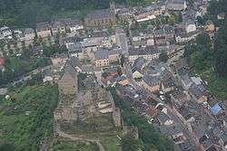

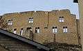
Larochette (Luxembourgish: Fiels, German: Fels) is a commune and town in central Luxembourg, in the canton of Mersch. It is situated on the White Ernz river. The town is dominated by the partly ruined Larochette Castle.
As of 2005, the town of Larochette, which lies in the north-east of the commune, has a population of 1,359. Other towns within the commune include Ernzen.
Meysembourg Castle, located some 2 kilometres (1 1⁄4 mi) south-west of Larochette, has a history dating back to the 12th century. Today's castle was built in 1880 in Neo-Renaissance style and is privately owned.[1]


References
- ↑ "Le Château de Meysembourg - Larochette", Larochette: Syndicat d'initiative et de tourisme (French) Retrieved 21 March 2011.
External links
| Wikivoyage has a travel guide for Larochette. |
-
 Media related to Larochette at Wikimedia Commons
 |
Vallée de l'Ernz (D) | | ||
| Nommern | |
Heffingen | ||
| ||||
| | ||||
| Fischbach |
 | ||
This article is issued from Wikipedia - version of the 12/1/2016. The text is available under the Creative Commons Attribution/Share Alike but additional terms may apply for the media files.