Lat Bua Luang District
| Lat Bua Luang ลาดบัวหลวง | |
|---|---|
| Amphoe | |
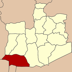 Amphoe location in Ayutthaya Province | |
| Coordinates: 14°9′57″N 100°18′27″E / 14.16583°N 100.30750°ECoordinates: 14°9′57″N 100°18′27″E / 14.16583°N 100.30750°E | |
| Country |
|
| Province | Ayutthaya |
| Seat | Lat Bua Luang |
| Tambon | 7 |
| Area | |
| • Total | 199.9 km2 (77.2 sq mi) |
| Population (2000) | |
| • Total | 36,186 |
| • Density | 181.0/km2 (469/sq mi) |
| Time zone | THA (UTC+7) |
| Postal code | 13230 |
| Geocode | 1410 |
Lat Bua Luang (Thai: ลาดบัวหลวง; IPA: [lâːt būa lǔaŋ]) is a district (amphoe) in the southern part of Ayutthaya Province, central Thailand.
History
Tambon Lat Bua Luang was separated from Amphoe Bang Sai and official upgraded to a district in 1947.
Geography
Neighboring districts are (from the north clockwise) Bang Sai (บางซ้าย), Sena and Bang Sai (บางไทร) of Ayutthaya Province, Sam Khok and Lat Lum Kaeo of Pathum Thani Province, Sai Noi of Nonthaburi Province, Bang Len of Nakhon Pathom Province, and Song Phi Nong of Suphanburi Province.
Administration
The district is subdivided into 7 communes (tambon). Lat Bua Luang is a township (thesaban tambon) covering parts of the tambon Lat Bua Luang.
| 1. | Lat Bua Luang | ลาดบัวหลวง | |
| 2. | Lakchai | หลักชัย | |
| 3. | Sam Mueang | สามเมือง | |
| 4. | Phraya Banlue | พระยาบันลือ | |
| 5. | Singhanat | สิงหนาท | |
| 6. | Khu Salot | คู้สลอด | |
| 7. | Khlong Phraya Banlue | คลองพระยาบันลือ |
This article is issued from Wikipedia - version of the 2/27/2013. The text is available under the Creative Commons Attribution/Share Alike but additional terms may apply for the media files.