Le Lorey
This article is about the commune in north-western France. For other uses, see Lorey (disambiguation).
Not to be confused with the commune Lorey in north-eastern France.
| Le Lorey | |
|---|---|
|
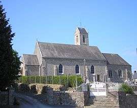
The church of Saint-Martin | |
 Le Lorey | |
|
Location within Normandy region  Le Lorey | |
| Coordinates: 49°05′41″N 1°18′19″W / 49.0947°N 1.3053°WCoordinates: 49°05′41″N 1°18′19″W / 49.0947°N 1.3053°W | |
| Country | France |
| Region | Normandy |
| Department | Manche |
| Arrondissement | Coutances |
| Canton | Saint-Sauveur-Lendelin |
| Intercommunality | Communauté de communes du canton de Marigny |
| Government | |
| • Mayor (2008–2014) | Michel Savary |
| Area1 | 14.57 km2 (5.63 sq mi) |
| Population (2006)2 | 587 |
| • Density | 40/km2 (100/sq mi) |
| Time zone | CET (UTC+1) |
| • Summer (DST) | CEST (UTC+2) |
| INSEE/Postal code | 50279 / 50570 |
| Elevation |
38–147 m (125–482 ft) (avg. 86 m or 282 ft) |
|
1 French Land Register data, which excludes lakes, ponds, glaciers > 1 km² (0.386 sq mi or 247 acres) and river estuaries. 2 Population without double counting: residents of multiple communes (e.g., students and military personnel) only counted once. | |
Le Lorey is a commune in the Manche department in Normandy in north-western France.
See also
| Wikimedia Commons has media related to Le Lorey. |
This article is issued from Wikipedia - version of the 3/1/2015. The text is available under the Creative Commons Attribution/Share Alike but additional terms may apply for the media files.