Le Mesnil-Ozenne
| Le Mesnil-Ozenne | |
|---|---|
|
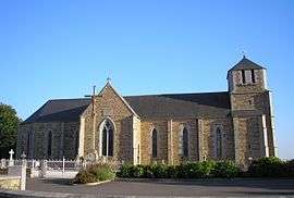
The church of Saint-Martin | |
 Le Mesnil-Ozenne | |
|
Location within Normandy region  Le Mesnil-Ozenne | |
| Coordinates: 48°40′04″N 1°13′46″W / 48.6678°N 1.2294°WCoordinates: 48°40′04″N 1°13′46″W / 48.6678°N 1.2294°W | |
| Country | France |
| Region | Normandy |
| Department | Manche |
| Arrondissement | Avranches |
| Canton | Pontorson |
| Intercommunality | Avranches - Mont-Saint-Michel |
| Government | |
| • Mayor (2008–2014) | Guy Trochon |
| Area1 | 4.59 km2 (1.77 sq mi) |
| Population (2006)2 | 213 |
| • Density | 46/km2 (120/sq mi) |
| Time zone | CET (UTC+1) |
| • Summer (DST) | CEST (UTC+2) |
| INSEE/Postal code | 50317 / 50220 |
| Elevation |
39–197 m (128–646 ft) (avg. 135 m or 443 ft) |
|
1 French Land Register data, which excludes lakes, ponds, glaciers > 1 km² (0.386 sq mi or 247 acres) and river estuaries. 2 Population without double counting: residents of multiple communes (e.g., students and military personnel) only counted once. | |
Le Mesnil-Ozenne is a commune in the Manche department in Normandy in north-western France.
See also
| Wikimedia Commons has media related to Le Mesnil-Ozenne. |
This article is issued from Wikipedia - version of the 3/31/2016. The text is available under the Creative Commons Attribution/Share Alike but additional terms may apply for the media files.