Lemaire Island
Lemaire Island (64°49′S 62°57′W / 64.817°S 62.950°WCoordinates: 64°49′S 62°57′W / 64.817°S 62.950°W) is an island 4.5 nautical miles (8 km) long and 1.5 nautical miles (3 km) wide, lying 1 nautical mile (2 km) west of Duthiers Point off the west coast of Graham Land, Antarctica. It was discovered by the Belgian Antarctic Expedition, 1897–99, under Adrien de Gerlache, who named it for Charles Antoine Lemaire.[1]
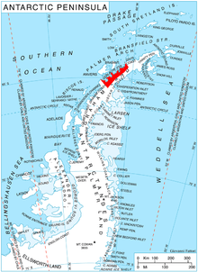
A map highlighting of the nearby Danco Coast on the Antarctic Peninsula
The island is bordered by the Aguirre Passage which separates it from the Danco Coast.[2]
See also
References
- ↑ "Lemaire Island". Geographic Names Information System. United States Geological Survey. Retrieved 2013-06-10.
- ↑
 This article incorporates public domain material from the United States Geological Survey document "Aguirre Passage" (content from the Geographic Names Information System).
![]() This article incorporates public domain material from the United States Geological Survey document "Lemaire Island" (content from the Geographic Names Information System).
This article incorporates public domain material from the United States Geological Survey document "Lemaire Island" (content from the Geographic Names Information System).
This article is issued from Wikipedia - version of the 7/12/2016. The text is available under the Creative Commons Attribution/Share Alike but additional terms may apply for the media files.