Lentiira
| Lentiira | |
|---|---|
 | |
| Location | Kuhmo |
| Coordinates | 64°26′N 029°47′E / 64.433°N 29.783°ECoordinates: 64°26′N 029°47′E / 64.433°N 29.783°E |
| Type | Lake |
| Primary inflows | Satulavirta |
| Basin countries | Finland |
| Surface area | 18.428 km2 (7.115 sq mi) |
| Average depth | 5.54 m (18.2 ft) |
| Max. depth | 27 m (89 ft) |
| Water volume | 0.102 km3 (83,000 acre·ft) |
| Shore length1 | 90.16 km (56.02 mi) |
| Surface elevation | 173.3 m (569 ft) |
| Frozen | November–April |
| References | [1] |
| 1 Shore length is not a well-defined measure. | |
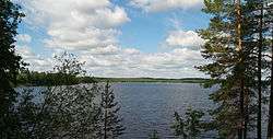
Lentiira is a medium-sized lake of Finland. It belongs to Oulujoki main catchment area and it is situated in Kuhmo municipality in the Kainuu region.[1] The lake is quite narrow and deep with long bays. It belongs to Lentiira–Iivantiira–Lentua kayaking route named The Tar Route.[2]
References
- 1 2 Lentiira in the Jarviwiki Web Service. Retrieved 2014-02-28. (English)
- ↑ Kuhmo Kayaking Routes. Erämatkailu Piirainen. Retrieved 2014-02-28. (English)
See also
This article is issued from Wikipedia - version of the 9/4/2015. The text is available under the Creative Commons Attribution/Share Alike but additional terms may apply for the media files.