Liberty, Missouri
| Liberty, Missouri | |
|---|---|
| City | |
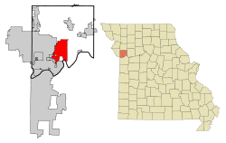 Location in the state of Missouri and in Clay County | |
| Coordinates: 39°14′27″N 94°25′35″W / 39.24083°N 94.42639°WCoordinates: 39°14′27″N 94°25′35″W / 39.24083°N 94.42639°W | |
| Country | United States |
| State | Missouri |
| County | Clay |
| Incorporated | 1829 (as a town),[1] 1851 (as a city)[2] |
| Government | |
| • Type | Mayor-Council-Administrator |
| • Mayor | Lyndell Brenton |
| Area[3] | |
| • Total | 29.15 sq mi (75.50 km2) |
| • Land | 29.03 sq mi (75.19 km2) |
| • Water | 0.12 sq mi (0.31 km2) |
| Elevation | 886 ft (270 m) |
| Population (2010)[4] | |
| • Total | 29,149 |
| • Estimate (2015) | 30,450 |
| • Density | 1,004.1/sq mi (387.7/km2) |
| [5] | |
| Time zone | CST (UTC-6) |
| • Summer (DST) | CDT (UTC-5) |
| ZIP codes | 64068, 64069 |
| Area code(s) | 816 |
| FIPS code | 29-42032 [6] |
| GNIS feature ID | 0730132 [7] |
| Website | City Website |
Liberty is a city in Clay County, Missouri and is a suburb of Kansas City, Missouri, located in the Kansas City Metropolitan Area. As of the 2010 United States Census[6] the population was 29,149. Liberty is the county seat of Clay County.[8] Liberty is home to William Jewell College.
History
Liberty was settled in 1822, and shortly later became the county seat of Clay County.[9] The city was named for the American concept of liberty.[10]
In 1830, David Rice Atchison established a law office in Liberty. He was joined three years later by colleague Alexander William Doniphan. The two argued cases defending the rights of Mormon settlers in Jackson County, served Northwest Missouri in Missouri's General Assembly, and labored for the addition of the Platte Purchase to Missouri's boundaries.
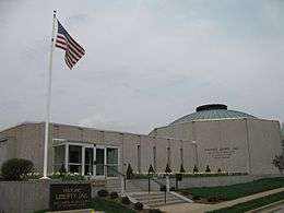
In October 1838, the two were ordered by Governor Lilburn Boggs to arrest Mormon prophet Joseph Smith Jr. at the Far West settlement in Caldwell County.[11] Immediately after the conclusion of the Mormon War, Smith and other Mormon leaders were incarcerated at the Liberty Jail for the winter as Doniphan labored for a quicker trial date. Although Doniphan led a force of Missouri volunteers ordered to capture the leaders, he defended Joseph Smith in trial and won him a change in venue. While en route to their new venue, Smith and his followers escaped and left Missouri for the new Mormon settlement in Nauvoo, Illinois.[11]
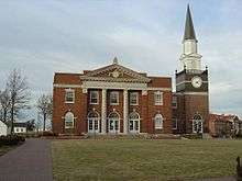
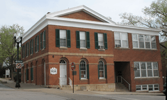
The Arthur-Leonard Historic District, Clay County Savings Association Building, Clinton House, Dougherty-Prospect Heights Historic District, Garrison School Historic District, Frank Hughes Memorial Library, IOOF Liberty Lodge No. 49, Jewell Hall, Jewell-Lightburne Historic District, Major Hotel, Miller Building, Mt. Memorial Cemetery, Nebo Hill Archeological Site, Odd Fellows Home District, South Liberty Courthouse Square Historic District, and West Liberty Courthouse Square Historic District are listed on the National Register of Historic Places.[12][13]
Geography
Liberty is located at 39°14′27″N 94°25′35″W / 39.24083°N 94.42639°W (39.240852, -94.426502).[14] According to the United States Census Bureau, the city has a total area of 29.15 square miles (75.50 km2), of which, 29.03 square miles (75.19 km2) is land and 0.12 square miles (0.31 km2) is water.[3]
Demographics
| Historical population | |||
|---|---|---|---|
| Census | Pop. | %± | |
| 1850 | 827 | — | |
| 1860 | 1,288 | 55.7% | |
| 1870 | 1,700 | 32.0% | |
| 1880 | 1,476 | −13.2% | |
| 1890 | 2,558 | 73.3% | |
| 1900 | 2,407 | −5.9% | |
| 1910 | 2,980 | 23.8% | |
| 1920 | 3,097 | 3.9% | |
| 1930 | 3,516 | 13.5% | |
| 1940 | 3,598 | 2.3% | |
| 1950 | 4,709 | 30.9% | |
| 1960 | 8,909 | 89.2% | |
| 1970 | 13,704 | 53.8% | |
| 1980 | 16,251 | 18.6% | |
| 1990 | 20,459 | 25.9% | |
| 2000 | 26,232 | 28.2% | |
| 2010 | 29,149 | 11.1% | |
| Est. 2015 | 30,450 | [15] | 4.5% |
2010 census
As of the census[4] of 2010, there were 29,149 people, 10,582 households, and 7,555 families residing in the city. The population density was 1,004.1 inhabitants per square mile (387.7/km2). There were 11,284 housing units at an average density of 388.7 per square mile (150.1/km2). The racial makeup of the city was 91.4% White, 3.6% African American, 0.5% Native American, 1.0% Asian, 0.1% Pacific Islander, 0.9% from other races, and 2.6% from two or more races. Hispanic or Latino of any race were 4.1% of the population.
There were 10,582 households of which 38.2% had children under the age of 18 living with them, 56.4% were married couples living together, 11.0% had a female householder with no husband present, 4.0% had a male householder with no wife present, and 28.6% were non-families. 23.4% of all households were made up of individuals and 8% had someone living alone who was 65 years of age or older. The average household size was 2.63 and the average family size was 3.11.
The median age in the city was 36.4 years. 26.6% of residents were under the age of 18; 9.8% were between the ages of 18 and 24; 26% were from 25 to 44; 26.5% were from 45 to 64; and 11.1% were 65 years of age or older. The gender makeup of the city was 48.7% male and 51.3% female.
2000 census
As of the census[6] of 2000, there were 26,232 people, 9,511 households, and 6,943 families residing in the city. The population density was 973.3 people per square mile (375.8/km²). There were 9,973 housing units at an average density of 370.0 per square mile (142.9/km²). The racial makeup of the city was 93.75% White, 2.59% African American, 0.40% Native American, 0.61% Asian, 0.06% Pacific Islander, 0.99% from other races, and 1.59% from two or more races. Hispanic or Latino of any race were 2.68% of the population.
There were 9,511 households out of which 38.9% had children under the age of 18 living with them, 59.2% were married couples living together, 10.9% had a female householder with no husband present, and 27.0% were non-families. 22.4% of all households were made up of individuals and 7.9% had someone living alone who was 65 years of age or older. The average household size was 2.62 and the average family size was 3.08.
In the city the population was spread out with 27.6% under the age of 18, 10.4% from 18 to 24, 30.2% from 25 to 44, 21.5% from 45 to 64, and 10.4% who were 65 years of age or older. The median age was 34 years. For every 100 females there were 91.9 males. For every 100 females age 18 and over, there were 89.6 males.
The median income for a household in the city was $52,745, and the median income for a family was $61,273. Males had a median income of $41,713 versus $28,516 for females. The per capita income for the city was $23,415. About 3.8% of families and 5.0% of the population were below the poverty line, including 5.1% of those under age 18 and 6.1% of those age 65 or over.
Economy
Major employers in Liberty include the Hallmark distribution warehouse. Liberty is also home to the operations headquarters for Ferrellgas, the largest retail provider of propane in the United States. The B&B Theatres corporate office is located in Liberty, the 17th largest theater chain in the U.S.
Education
The Liberty Public School District serves Liberty, Glenaire, along with portions of Kansas City, Kearney and unincorporated Clay County. It has 10 elementary, 4 middle, and 2 senior high schools. The Liberty Public School District is known for being a good school district, and draws many to the area each year. It is ranked as one of the best school districts in the state of Missouri.
Notable people
- David Allen, former American Football Running Back for the Jacksonville Jaguars, and St. Louis Rams.
- Ken Boyer, former third baseman and coach of the St. Louis Cardinals.
- James Dewees, keyboardist and back-up vocalist of The Get Up Kids, and started Reggie and the Full Effect.
- Alexander William Doniphan, Mexican-war general and preventer of the execution of the Mormon prophet Joseph Smith.
- Hubert Eaton, visionary and developer of the world-famous Forest Lawn cemeteries in California.
- Gatewood Lincoln, Governor of American Samoa.
- George Rice, football player
- Alex Saxon, actor (The Fosters, Finding Carter)[17]
- Craig Stevens, star of the 1950s television series Peter Gunn.
- Matt Wertz, soft rock singer/songwriter.
- Marcus Lucas, Football Player for the Carolina Panthers, Miami Dolphins, and Chicago Bears.
- Art Still, NFL Football Star
Cultural references
In The West Wing, Liberty is mentioned as the hometown of Acting President Glen Allen Walken.
The Liberty Jail is now an open museum and tourist site.
Twin towns
References
- ↑ http://libertymissouri.gov/2120/History-of-Liberty
- ↑ http://libertymissouri.gov/DocumentCenter/Home/View/2356
- 1 2 "US Gazetteer files 2010". United States Census Bureau. Archived from the original on January 24, 2012. Retrieved 2012-07-08.
- 1 2 "American FactFinder". United States Census Bureau. Retrieved 2012-07-08.
- ↑ "Population Estimates". United States Census Bureau. Retrieved 2016-06-08.
- 1 2 3 "American FactFinder". United States Census Bureau. Archived from the original on September 11, 2013. Retrieved 2008-01-31.
- ↑ "US Board on Geographic Names". United States Geological Survey. 2007-10-25. Retrieved 2008-01-31.
- ↑ "Find a County". National Association of Counties. Archived from the original on May 31, 2011. Retrieved 2011-06-07.
- ↑ Eaton, David Wolfe (1916). How Missouri Counties, Towns and Streams Were Named. The State Historical Society of Missouri. p. 277.
- ↑ "Clay County Place Names, 1928–1945 (archived)". The State Historical Society of Missouri. Retrieved 19 September 2016.
- 1 2 Muench, James F. (2006). Five Stars: Missouri's Most Famous Generals. Columbia, Missouri: University of Missouri Press. pp. 7–17. ISBN 978-0-8262-1656-4.
- ↑ National Park Service (2010-07-09). "National Register Information System". National Register of Historic Places. National Park Service.
- ↑ "National Register of Historic Places Listings". Weekly List of Actions Taken on Properties: 4/23/12 through 4/27/12. National Park Service. 2012-05-04.
- ↑ "US Gazetteer files: 2010, 2000, and 1990". United States Census Bureau. 2011-02-12. Retrieved 2011-04-23.
- ↑ "Annual Estimates of the Resident Population for Incorporated Places: April 1, 2010 to July 1, 2015". Retrieved July 2, 2016.
- ↑ "Census of Population and Housing". Census.gov. Archived from the original on May 11, 2015. Retrieved June 4, 2015.
- ↑ "Alex Saxon". IMDb. Retrieved 2014-08-09.
External links
| Wikimedia Commons has media related to Liberty, Missouri. |
- City of Liberty
- Liberty Public Schools
- Liberty Area Economic Development
- Historic maps of Liberty in the Sanborn Maps of Missouri Collection at the University of Missouri
Municipalities and communities of Clay County, Missouri, United States | ||
|---|---|---|
| Cities | 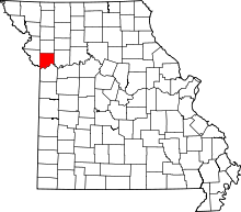 | |
| Villages | ||
| Townships |
| |
| Unincorporated communities | ||
| Footnotes | ‡This populated place also has portions in an adjacent county or counties | |
Kansas City metropolitan area's cities and counties | ||
|---|---|---|
| Central city |  | |
| Largest cities (over 100,000 in 2000) | ||
| Medium-sized cities (10,000 to 100,000 in 2000) | ||
| Smaller Cities (between 5,000 and 9,900 in 2010) | ||
| Counties | ||